
Alabama Hills
Following my defense last month, I felt an urgent need for a little getaway. An opportunity presented itself to make a little trip to Death Valley and despite the 110+ temps, I jumped at the chance. To make it even better, I added a 3rd flight leg to the trip so that I could visit with some friends in Colorado as well. This of course meant I could play on a few more 14ers. I could write a manuscript about this trip, but I think honestly it's easier just to highlight it through my photographs. The highpoints of Colorado were visiting Leadville again and climbing both Huron and San Luis peaks. As far as Death Valley, the highlights were many. I saw the racetrack playa, hiked through the ancient bristlecones, rock-climbed in the Alabama Hills, camped at Horseshoe Meadows, visited the Whitney Portal, climbed Telescope and Wildrose peaks, ran through forests of Joshua Trees, and even got chased down a mountain by lightning (quite literally).
Upon arriving in Colorado, I immediately decided that San Luis Peak would be my first 14er of the trip. When I thru-hiked the Colorado Trail back in 2008, I walked over the saddle of San Luis, only 1.2 miles from the summit, and yet still skipped it. I have always regretted that decision, especially considering that San Luis is one of the most remote 14ers to get to. After scoping out the West Willow Creek trailhead route (from Creede), I decided to finally go back and tag it properly. I knew that it was over 15 miles roundtrip and would take several hours, but I this was a good chance to finally knock it out. I was a little concerned about weather, but the rainy clouds seemed stable and not thunderstorm-y. I drove up to the Equity Mine, parked my rental car, and set out. More than anything I just wanted to be walking along the Colorado Trail again. After the madness of my dissertation defense, nothing seemed more pleasing than that. Here are a few pics.

San Luis as seen from the divide

The soothing CT....putting my soul at ease

Nearing the final saddle before the climb up to the summit

The Hoodoos near San Luis

At the Summit!

I look happy, but was ridiculously out-of-breath and out-of-shape

View from the top
After summiting, I went back to Leadville for a few days to relax and visit with folks. From there, I finally went out to hike up Huron. I had attempted Huron twice before but was turned around both times due to foul weather. Without fail, I was again accompanied by some very iffy weather. Along the climb, I experienced clear-sky sun, rain, sleet, wind, and even snow. Somehow though, I managed to make it to the summit in one piece.

Snowy wind from the summit of Huron

Another view from Huron Peak

At the summit!

Looking back up the trail on my way down

A beautiful tarn in the cirque below the summit

The trail-head road. It was some fun 4x4 action
I quickly made my way back to Denver, and headed out for my rendezvous in Southern California. Unfortunately, the basin-and-range area of the southwest was experiencing an even worse-than-normal heat wave. Upon arrival in Death Valley, we were greeted with temps nearing 120F. When I ran badwater back in 2012, the highest temp I recorded during the entire race was 121F...and that was in mid-July. Here it was early September, and nearly the same temp. It was rough, but still amazingly beautiful.


One of the places I wanted to see more than any other was the famous racetrack playa. Coincidentally, just a few weeks before the trip, a paper came out in the peer-reviewed science journal, "PLOS ONE" proving that the real reason behind the movement of the sailing stones was of course, ice! Isn't it always ice! The trip out to the playa was rough. Over 30 miles each way on backroad, high-clearance, 4x4 roads. It was totally worth it though...

Teakettle Junction

The playa

Racing a sailing stone (it won)

Panorama of the playa

Sailing stone!

Another sailing stone!
The following day, we zipped over to Bishop CA (having driven through Eureka Valley), and decided to drive up to the ancient bristlecone pines. I had been fascinated with the ancient bristlecones ever since I heard an NPR story about "Methuselah" the 4000+-year-old tree. This actual tree is located within a very small grove, but the park service will not publicly identify it for fear of vandalism. I'm fairly confident I found the actual tree (which may, or may not be shown in one of my photos below)...but truthfully, there's no way to be sure. Regardless, I most certainly saw many trees that are as old as the great pyramids of Giza.


This famous tree from the 1-mile scenic "discovery-walk", is often mistakenly identified as Methuselah. It IS a 4000-year-old bristlecone...but it is NOT Methuselah. (It's not even in the right grove. The Methuselah Tree and Grove is on the longer, 4.5-mile "Methuselah Trail")

Thousands of years seen in the tree rings
After playing in the Bristlecone forest, we spent an afternoon climbing in, on, and around the Alabama Hills at the base of Mt. Whitney. Here are some highlight pics...


Mt. Whitney in the background

the track of one of my many scrambles...(see pics below)

climbing up

View from the top of a scramble

At the top!

We also took a little drive up to the Whitney portal, where it was probably 30 degrees cooler....and definitely greener, and wetter!


Well...that's some wild ass isn't it?

We eventually ended up at the Wildrose campground within the Panamint Mountains. On one side of the range is Death Valley, and the other, Panamint Valley. The campground was at about 4000 feet, but was still over 100F during the day. On one evening, I climbed the 1200' low/unnamed peak above the campground.

View of the campground from part-way up the climb.


Panorama from top of climb (with Telescope and Wildrose labeled)
The next day I decided to climb Telescope Peak (11,043 feet). It is the highest point within Death Valley National Park with a fantastic climb to the summit. I drove up the 4 x 4 road to the to the trailhead at about 8000', and hiked the 15 mile round-trip excursion to the summit. Later that evening I made the quick hike up and down Wildrose Peak as well.

Telescope Peak from a few miles away

Some nice meta-sedimentary rocks

On the summit of Telescope Peak

Looking down on Panamint Valley (About 10,000 feet of relief)

Panorama from Telescope Summit...showing both Death and Panamint Valleys
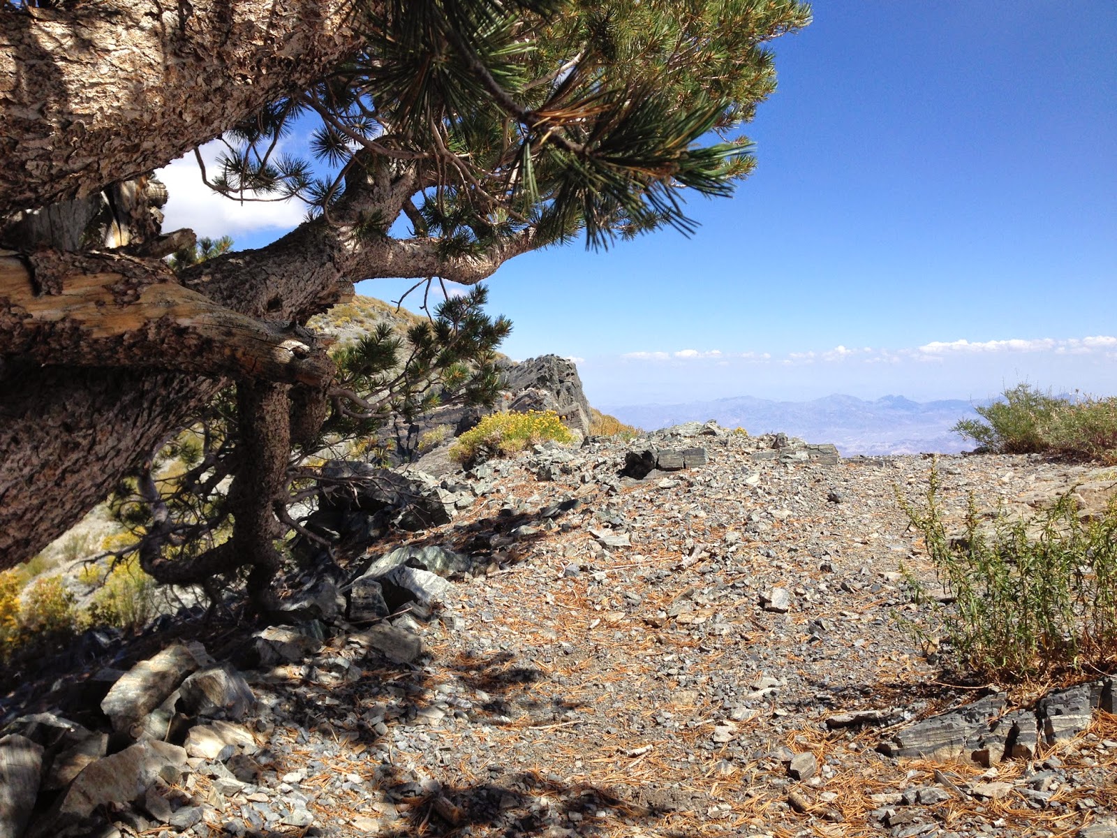
A nice shady rest-nook under a scrubby pine tree near the summit.

More lovely meta-seds

Benchmark from the summit of Wildrose Peak

View of Telescope Peak from the summit of Wildrose Peak
We moved back down into the valley and played a bit more around the ghost town of Balarat, The Ubehebe Crater, and even some Joshua Tree groves...

Balarat

The Actual Stovepipe Well

Ubehebe Crater

Joshua Trees
After a few more days, I took a trip up to hike Boundary Peak...Nevada's Highest Point. It was a several hour drive up through Lone Pine and on to Bishop. All morning I had been noticing heavy clouds building but just assumed they wouldn't be a problem. Boundary Peak is considered to be one of the driest of all the 50-state high points. It's also one of the most remote, so I knew this might be my only chance for a while to bag it. I decided on the Queen Mine Road approach as it seemed like a more fun trail.
I made it as high as the mine at 9200 before the road got too rough, and simply road-walked the last 1/2 mile to the saddle where the actual single-track trail started. The clouds had moved in by this point, but they seemed very stable, so I wasn't worried. I made it all the way to trail canyon saddle (about 1.5 miles and 2000' from summit) when the freezing rain began. I was still not too worried, although quite surprised by my bad luck. One of the driest high-points, and I hit it on the one rainy day! I climbed about 800 more feet up the steep pitch towards the high ridgeline when the first lightning hit. Just to be clear here...Boundary Peak is 100% exposed at these elevations. There is no cover, nowhere to hide. Needless to say I panicked. I looked off in the distance and what was coming looked infinitely worse. It was so absolutely frustrating to have to pull the plug on an ascent so close to the summit (I was probably only about 1 mile away, or less, from the summit at this point)...but I was honestly getting really worried.
The lightning strikes were becoming more frequent and closer, and I had to scramble down technical trail. I turned quickly and began scree-skiing as fast as I could down the ridgeline back to trail canyon saddle. With each strike, my panic level rose. At the saddle I debated just diving down the backside into the nearest drainage...which would have meant a very long afternoon climbing back up and around after the storm passed. I instead decided to run hard around the ridgeline back towards the trail-head thinking I could outrun the storm. I made it about another mile, and was nearing the last exposed portion when the big one hit. Rocks buzzed for a split second, I felt my fingers tingle and then a deafening crash. I have no idea how close it was, but I saw the light and heard the sound almost at the same time. I truly feared for my life at this point and dove off the side of the mountain as fast as I could down the closest side. It was wicked steep and I had no idea where it would take me, but it was down-slope, and gave me a little protection. A few more crashed, and then just as fast as it came, the storm was gone.
I had only scrambled down about 300 feet before the clouds cleared. I took a picture from under my little bristlecone hideout down the steep side of the random mountain face of what appears to be a beautiful blue sky. You'd never know I had just come feet away from a hot lightning strike. When I slogged back up to the ridgeline, I was briefly tempted to make another stab at the summit, but off in the distance I could see another line of storms coming...and they looked even worse. For that moment though, the sky was beautiful and blue. I took one last picture of Boundary Peak...and the summit I never made, so that I could remember it and so that I would have motivation to return some day (call it a little score to settle). I turned around, counted my blessings and made quick for my car. I had had enough excitement for the day.

The view looking up from my steep mountainside escape

One last look back at Boundary Peak, on what appears to be a beautiful day. You can just see off in the very far distance some clouds. They were moving ridiculously fast, and in my direction...
Turns out...the remnants of tropical storm/hurricane had come ashore from the Pacific and nailed the Sierras and White Mountains that day. Heck, it even rained in Death Valley. A more recent check of the weather report would have saved me a very long drive that day, but still, it made for quite an adventure for sure. I made it back to my car ok, but by the time I got out to the main road, the entire cluster of mountains was enveloped by a MASSIVE thunderstorm. I definitely made the right decision to turn around.

The view of Boundary Peak from the highway (The peak itself is in the center of the picture behind the main v-cut valley, but is completely obscured by the thunderstorm clouds) I took this picture only about 40 minutes after the sunny picture above.

Here's my garmin track for the day. The green arrow was where I parked my car. You can also see the labeled final summit and just how close I was when I turned around. I forgot to stop my garmin on my drive down, which is why the track continues down the road a bit.

And a little walk-through of day's events....
You can also watch a play-through of my GPS track here on my garmin page:

Stopped at the border to reflect on my little near-miss, and was not upset at all by my decision. I was actually quite proud of myself for knowing that I'm not so stubborn as to keep myself in serious danger for the sake of something essentially meaningless like peak-bagging. The mountain is not going anywhere soon...and now I have a reason to go back. Of all the thousands of thru-hiking miles I've done over the years, this was the closest I've ever gotten to an actual lightning strike. It was just as terrifying as you can imagine it would be.