
View from the South Rim
This past weekend, while I was flipping through my weather app, I noticed that Monday was forecast to be an unseasonably cool day for June in Arizona. Here in Flagstaff, there was actually a frost warning for the morning. The high in town was only going to be around 60.
An idea popped into my head....
'I wonder how how hot it'll be in the Canyon....'
Back in November, C and I took our first trip up to the Grand Canyon. It happened to be on a day where everything was covered in 6+ inches of snow. As we walked up to the Mather vista point, we both were utterly speechless. As magnificent as I imagined the Grand Canyon would be, let's just say that apparently my imagination had horrendously underperformed. We spent the next day snow-shoeing around the South Rim and taking in the sights. Upon leaving, I told myself that I definitely would be back to do a Rim to Rim to Rim hike or run at some point soon.
Some pics from our November trip are in my Year-end post here:

November trip to the Canyon
The problem with going for a R2R2R attempt, is that unless you go in late Fall or Early Spring, you are likely to have a really miserable/hot time down at the bottom (or a really cold and icy time during winter at the top). Typically, Phantom Ranch (down at the river) has daily highs over 100 degrees in Late Spring and Summer. Spring and Fall are tough for me with the semester being in session though. So when I looked up what the projected Monday high temperature for Phantom Ranch was, and that it was only going to get up to 80 degrees, I immediately made plans for an attempt. This epiphany was made even more exciting by the fact that I had just learned that the not only was Hardrock 100 canceled for the year, but that my entry was not going to be rolled over. I was in need of a wee little adventure.
So...I did what any ultrarunner/adventurer would do. I re-activated my Inreach, bought some supplies, dug out my National Parks yearly pass, and made plans to drive up to the South Rim at 3 am on Monday Morning.
Most R2R2R runners utilizes the South and North Kaibab Trails as they present the shortest total route. I debated whether or not to start at the Bright Angel trailhead as there is parking right at the start, but ultimately decided to stick to Kaibab. The downside was that I did have to hike 2 miles from my parked car, just to get to the trailhead, so it effectively wasn't any shorter overall.
After poring over the maps and info online, I learned that a full Rim to Rim to Rim, would entail 42 miles, with about 11,000 feet of gain (~46 miles if you include the walks to/from the trailhead). This was honestly not as bad as I thought. I began doing math in my head on what time I needed to start by to avoid hiking in the dark.
My goals were simple: I wanted to enjoy the day, and take in the sights as much as possible. I wanted to marvel at the different geologic formations, and not feel rushed. With that said, I still wanted to move with purpose, and try to average at least 3 mph. I really didn't want to 'run', and instead wanted to rely mostly on my fast hiking skills. My back-of-the-envelope calculations had me doing the full out and back in about 14 hours (15 if you include the ~4 miles to/from the trailhead). I figured if I started by 4:30 am, I could be back to the car by dark (or at the very least back to the trailhead), as long as I didn't run into any issues.
I spent Sunday night packing and prepping, and decided to go with my larger hiking pack (as opposed to a running-style vest). Again, my plan was to mostly hike, so I wasn't too worried about awkward running with a bigger pack on. With that said however, the pack I went with was my old FastPack 20, which I can run fairly proficiently in.
At 3:00 am on Monday morning, my alarm chirped and I was out of my bed in an instant. It was going to be a good day. I churned out some quick coffee, taped my feet, gathered my pre-packed gear, and was out the door by 3:20.
The drive to the South Rim went smoothly. It was the first time in a very long time that I had made a longer drive by myself in the car. It was somehow soothing listening to my music and drinking my coffee on a solo drive. It's weird to think that just a year ago, I was driving over 300 solo miles a week just going back and forth from Vermont to Boston...and now I barely drive at all. In the entire year we've lived in Flagstaff, we've only put a few thousand miles on the car.
I hit the main parking area at the South Rim about 4:35 am and then took about 10 minutes prepping my sunblock and gear before starting my hike over to the trailhead 2.25 miles away. I briskly walked along the paved rim trail and got some beautiful pre-dawn views. The sun was not up yet, but it was light enough out that I would not need a headlamp. At around 5:15 I hit the South Kaibab Trailhead. I took some pictures, activated my InReach, sent a 'At Trailhead' message to C, and officially started my Garmin watch. The R2R2R had begun at 5:18 am.

At the South Kaibab Trailhead (5:18 am)
(Note: AZ doesn't do Daylight Savings, so we get very early sunrises)

Obligatory start selfie
Within minutes I was already at the first vista point, the appropriately named, 'Ooh Aah Point'. It was right about then that the sun finally made an appearance. It made me feel slightly 'behind schedule' despite it still being before 6 am, so I did actually do a little jogging on the descent. I recall the first few miles going by extremely quickly. In what seemed like minutes, I had already dropped over 2000 feet in elevation.

1 mile down the trail at Ooh Aah Point

About 2.5 miles down trail

About 4 miles down, hiking through the 'Supergroup'
(These precambrian sedimentary rocks are only exposed in a few areas)
I passed a couple of people on the descent, including one park ranger who brushed me up on my Grand Canyon stratigraphy. About an hour in, I was already getting views of the river. The descent had not been nearly as steep as I was expecting, and there were a lot of forgiving switchbacks. I was constantly switching between hiking, and light jogging. Once I saw the foot bridge over the river, I knew I was getting close. I had remembered from the map that it was about 6 miles to to the crossing, and I had already gone past five miles in just a little over an hour. I was making great time.

View of the river from about half-way down.

First view of the bridge about 1200 feet down.
I made it to the river after just 90 minutes from leaving the trailhead. I was greeted by a rock tunnel just before the footbridge crossing. I hadn't realized just how high up and scary the bridge crossing would be. Needless to say, I stared at my feet to prevent getting vertigo. It was a little unsettling.

Last switchback before the tunnel and bridge

Tunnel just before river crossing
Tunnel Video

Suspension foot bridge....VERY high above the river.
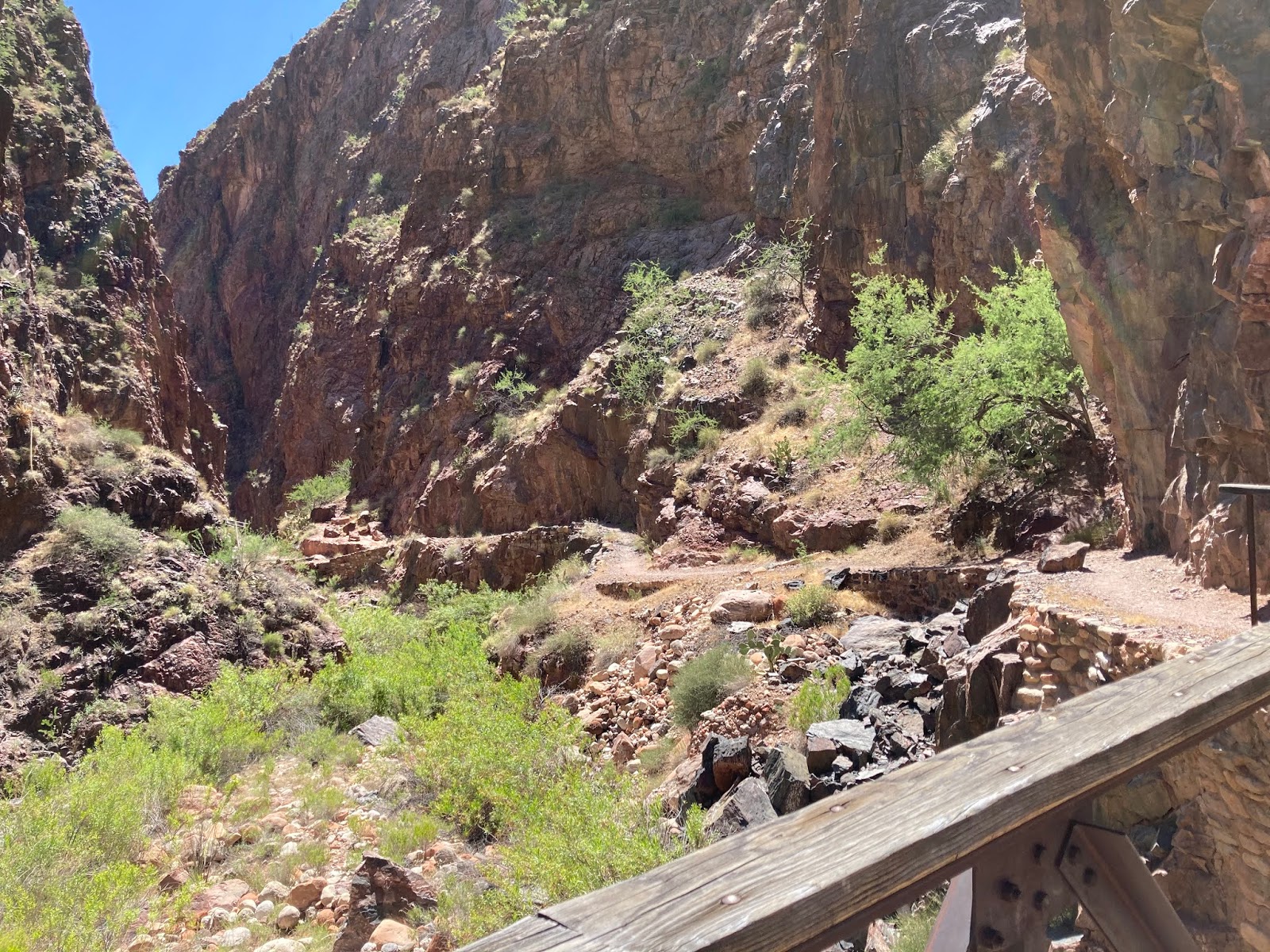
I took a short break on the other side, and then slowly began the long slog up the North Kaibab Trail. I hit 7 total miles and Phantom Ranch right at 7:00 am and it was still quite cool there. I knew on the way back many hours later it was likely to be much much warmer.
For the next 9 miles the trail wound its way around canyon walls without gaining much elevation. This section definitely dragged on a bit, but was at least gentle enough that I could still get in some intermittent jogging.
After about 3 hours, I finally made it to the Manzanita camp and the turn up the Roaring Springs canyon. This is when the trail finally starts to climb steeply up to the North Rim. I took a 10 minute break at a picnic table and refilled my water bottles (the taps were turned on thankfully). As I left to start the more difficult stretch of the North Kaibab trail, I also noticed it was beginning to get a bit warmer. The trail not only began to get steeper, but also a lot more precipitous. There were sections that were reminiscent of the Hardrock course where the trail was maybe 2 feet wide along a steep canyon wall, with at least a thousand foot drop just a step to the right. I found myself really 'hugging' the walls on those stretches.
Over the next five miles the trail wound steeply up the Roaring Springs Canyon, and over many switchbacks. I also noticed I was finally out of the basement rocks, and back in the sedimentary geology going through various recognizable formations. I crossed a foot bridge about 2 miles from the top that I had recognized from a video clip online, and so knew I was getting closer.

Starting up Roaring Springs Canyon towards the North Rim
The white limestone formation at the very top is where I was headed

View from the N. Kaibab Trail

More views from the climb
The last 2 miles were the toughest of the North Kaibab section. The trail got noticeably steeper, but thankfully it was also cooler due to the elevation. The North Rim trailhead is actually over 8200 feet elevation (1000 feet higher than the South Rim). I did some rough math and realized I might actually make the trailhead in under 6 hours if I pushed it a bit. It was an arbitrary number, but it still gave me a little extra motivation to get there without dawdling too much. I kept checking my altimeter and my mileage and it felt like it was taking forever to get to the top. Even though I knew it was 21 miles, somehow I felt like I'd get there sooner. My watch read 5:58 total time, so I figured I wasn't going to hit 6 hours.
But then I turned a slight corner and saw the steps leading up to the recognizable trailhead sign. I looked down....5:59...so I sprinted and made it to the top just before my watch flipped to 6:00 flat (or clock time 11:18 am). YES! I treated myself with a 15+ minute lunch break. I destroyed my PB&J sandwich, and downed a full liter of water. It felt nice to take a well-earned break. I think I put down a full packet of sugar gummies as well. Eventually I topped off all of my waters, and slowly packed up for my return.

North Rim Trailhead - halfway done

Definitely a bit spent, but happy the long climb is over.
I started back down the trail at trip time of 6:15 (or about 11:33 am). It was nice to know that I was already heading back for a 16+ mile downhill stretch, and it was still before noon. I felt pretty confident I'd be able to get back to the South Rim by dark (but definitely still had my headlamp packed should the need arise).

Along the descent with some clouds overhead
I made pretty quick work of the upper descent through the Roaring Springs Canyon. I was entirely hiking, but it was my goofy trademark trekking pole scampering that I do that averages over 3 mph. At one point on the descent, a mid-afternoon monsoon cloud formed over head and the temperature noticeably plummeted. I felt almost cold...but I wasn't complaining. For about 2 minutes I noticed very small specks floating through the air and thought, 'That's a strange type of pollen..."
Turns out it was actually small snow flakes. Yep...it was snowing in the Grand Canyon, in June. I laughed at the ridiculousness of it and plodded on. When I made it back to the Manzanita camp about 25 total miles in, I took another short break. I was starting to get a bit tired. I hydrated fully, and topped off my bottles again before continuing on. The next ~9 miles I knew would be long, hot, and mentally slow. I put my head down, and did my best to power hike as fast as I could. I still didn't feel like running.
Is that snow??!!
View from the winding lower canyon in the hot sun
When I did finally hit Phantom Ranch, I decided to push through to to the water pump 1 mile further down the trail right at the River junction. I had tested it in the morning and it was working. Well, When I made it there almost 20 minutes later, I learned that the pump had been shut off. So I had a decision to make.
I had 1 full liter of water in my pack and 6 miles (and 5000 feet) of gain ahead of me....during a hot part of the day. I wasn't a fan of treating Colorado River water, so made the rather stupid decision to just do the last 6 miles with my 1 liter. I figured I'd be fine...temps were ok, and there was bound to be potable water at one of the camps on the ascent.
I took a break at the bridge, ate the last of my food, swigged some water, and prepped for the 5000 foot climb. It was about 3:30 PM at this point. The first 2 miles of the ascent went quickly. The switchbacks were forgiving, and I was making great time. I only swigged a few gulps of water, and the trail was mostly shaded. I figured I'd have no trouble.
Turns out that I was a bit wrong. The last 3 miles of the climb are really tough, very exposed, and take a really long time. the 40 miles of the day had caught up to me and over the last two miles I struggled immensely. I found myself stopping several times to rest and actually had to ration my water. When I finally did hit Ooh Aah Point, I knew I had less than a mile and less than 800 feet of climb to go. Not long after I finished the last gulp of water, and I realized that I didn't remember a water tap at the South Rim trailhead. This would mean I'd have to not only finish out the last 1/2 mile of climb without water, but also hike the 2.25 miles back to the car dry as well. Yep...I should have refilled at Phantom Ranch. Lesson Learned: never pass by a water tap without topping off!
I hit the last set of switchbacks just 100 feet below the trailhead and slowed to a crawl pace. When I finally did top out, I lumbered down the short paved section back to the official trailhead sign a few meters away. I was utterly relieved to find a working water tap. I noted the time: 6:29 PM. It had taken me just under 7 hours on the return leg and 13hrs 10mins total time from trailhead to trailhead, including breaks. My average pace over the entire endeavor was about 3.2 mph, so I was quite thrilled.
I was not, however, looking forward to the 2+ mile slog back to the car. Thankfully it was all flat and with nice views out over the canyon. I noticed a very large smoke plume coming from the direction of the North Rim and wondered if was from near the trailhead. Apparently there was a wildfire burning in that area.
Along the walk back to the car with a smoke-filled sky in the distance
Forty short minutes later, at exactly 7:10 PM (about 14 hours and 20 minutes total time from car to car), I was back at my car, finally ready to head home. I had done it. With a proper smile on my face, I made the 90 minute drive back home, and pulled in right at 9:00 pm. In all of my many adventures and ultra endeavors, I can say without hesitation, that doing the R2R2R was definitely right up there as one of the most visually breathtaking. I consider myself extraordinarily lucky to now live so close to such a ridiculous place. I will gladly do this adventure again with any of my friends that want to come visit....so....just let me know if you're headed out this way ;-)
Some Stats:
In total, I covered 46.5 miles, including the walks to/from the trailhead.
Strava Track R2R2R: Rim 2 Rim 2 Rim
Strava Track To Trailhead: To Trailhead
Strava Track From Trailhead: From Trailhead
InReach Track: InReach Shared Map

Strava Track

InReach Track