Location: Chester, CA
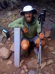
Half-way!!!!!!
What a great day. Woke up early, had a nice and easy 20 miler up and
around a 7600 ft peak and down to highway 36. Along the way, we
passed the midpoint marker. It was a great moment. I took some pics,
signed the register, and soaked it in. The snow, while still hanging
around in a few patches, is no longer a factor in the hike. We've
averaged over 28 miles per day for the past 5 days. We gotva quick
hitch into Chester, got a cheap room split three ways (bojangles, and
ed) and I took on the half-gallon challenge. 54 minutes later, I
stood triumphantly, with 64 oz of ice cream on my belly. Hellz yeah.
Tomorrow we enter Lassen national volcanic park, where the road was
just opened due to snow! Looking forward to northern Cali.
It's all down hill from here.....right?
Thursday, July 8, 2010

Day 76: Mile 1315.4 (26.1)
Location: Humboldt Summit
Another fantastic day. Today we caught up to two of the four guys
from the lead pack. Right now there are only two north bounders ahead
of us. Crazy. I also heard that it's 95 degrees back east. Crazy to
fathom when I'm still dealing with snow. Tomorrow is a huge day.
First, we'll hit the half way mark in the morning, then we'll hitch to
Chester and each attempt a half gallon challenge!! Woo hoo. Camping
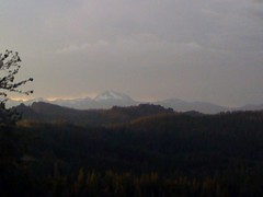
across from a beautiful and snowy mt lassen. Awesome sunset.
Another fantastic day. Today we caught up to two of the four guys
from the lead pack. Right now there are only two north bounders ahead
of us. Crazy. I also heard that it's 95 degrees back east. Crazy to
fathom when I'm still dealing with snow. Tomorrow is a huge day.
First, we'll hit the half way mark in the morning, then we'll hitch to
Chester and each attempt a half gallon challenge!! Woo hoo. Camping
across from a beautiful and snowy mt lassen. Awesome sunset.
Day 75: Mile 1289.3 (34.3)
Location: The Braatans (Belden, CA)
The snow is gone, the afterburners are on. Today was an epic day. We
hiked almost 35 today... That's right, 35! We made a lot of progress
and should now hit Chester by Thursday. The half way point is in 40
miles! Can't wait to celebrate with a half gallon of ice cream. Will
probably hit some snow tomorrow.
The snow is gone, the afterburners are on. Today was an epic day. We
hiked almost 35 today... That's right, 35! We made a lot of progress
and should now hit Chester by Thursday. The half way point is in 40
miles! Can't wait to celebrate with a half gallon of ice cream. Will
probably hit some snow tomorrow.
Day 74: Mile 1255 (30)
Location: Bear Creek
My first 30 plus day on the pct. The snow has let up, and the
afterburners are firing. We passed several flip floppers today...
People that flipped up to Ashland. They said snow was bad up near
Oregon border, but that was several weeks ago. It was very hot today,
and is supposed to be for a while. This is great news for whatever
snow might be hanging around. As far as today, we hiked 30, and only
touched snow twice. We never lost trail, and our feet were dry all
day! Now that is a good day. We are going to try a few big mile days
so that we can hit Chester on Thursday afternoon. Chester is at the
halfway point, so there will be ice cream involved. We are sleeping
tonight at 3500 feet. I can't remember the last time I was that low.
My first 30 plus day on the pct. The snow has let up, and the
afterburners are firing. We passed several flip floppers today...
People that flipped up to Ashland. They said snow was bad up near
Oregon border, but that was several weeks ago. It was very hot today,
and is supposed to be for a while. This is great news for whatever
snow might be hanging around. As far as today, we hiked 30, and only
touched snow twice. We never lost trail, and our feet were dry all
day! Now that is a good day. We are going to try a few big mile days
so that we can hit Chester on Thursday afternoon. Chester is at the
halfway point, so there will be ice cream involved. We are sleeping
tonight at 3500 feet. I can't remember the last time I was that low.
Day 73: Mile 1225 (27.4)
Location: Nelson Creek
Today was a fantastic day. The bad news is that the snow is not over
yet. We had north face snow down to 6200 today. The good news is
that we never got lost today. We did lose the trail several times,
but always knew where to go. Even with the navigating, and leaving
the wonderful town of Sierra city late after breakfast....we did
almost 28 miles. What little is left of the snow is melting super
fast, and I'm pretty confident that the snowy spots north that we
heard about will be gone by the time we are there.
It was nice to have my smaller pack and Brooks shoes back. All in all
my body was happy with me today. Tomorrow, we have a full day of
hiking under 6000 feet, and should end the day at a great swimming spot!
Happy 4th of July everyone!
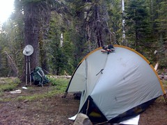
Today was a fantastic day. The bad news is that the snow is not over
yet. We had north face snow down to 6200 today. The good news is
that we never got lost today. We did lose the trail several times,
but always knew where to go. Even with the navigating, and leaving
the wonderful town of Sierra city late after breakfast....we did
almost 28 miles. What little is left of the snow is melting super
fast, and I'm pretty confident that the snowy spots north that we
heard about will be gone by the time we are there.
It was nice to have my smaller pack and Brooks shoes back. All in all
my body was happy with me today. Tomorrow, we have a full day of
hiking under 6000 feet, and should end the day at a great swimming spot!
Happy 4th of July everyone!
Sunday, July 4, 2010
Day 72: Mile 1197.6 (8.1)
Location: Sierra City
Well...we made it. We are in Sierra city and enjoying not dealing
with snow. We are all sharing a large apartment...bojangles,
furniture, ed, and a few others. We also met some southbound flippers
who gave us a northbound snow report. Looks like we still have some
more snow ahead. I'm not worried...I'm confident we'll get through
it. Our highest elevation in the next 200 miles is 7600 feet. Next
big town stop is Chester...the half way point. Weird to think about.
Happy fourth of july tomorrow everyone!

Well...we made it. We are in Sierra city and enjoying not dealing
with snow. We are all sharing a large apartment...bojangles,
furniture, ed, and a few others. We also met some southbound flippers
who gave us a northbound snow report. Looks like we still have some
more snow ahead. I'm not worried...I'm confident we'll get through
it. Our highest elevation in the next 200 miles is 7600 feet. Next
big town stop is Chester...the half way point. Weird to think about.
Happy fourth of july tomorrow everyone!
Saturday, July 3, 2010
Day 71: Mile 1189.5 (25.5)
Location: Campspot 8 miles before Sierra City
After 500 miles of postholing, sunburn, wet feet, map and compass,
getting lost, losing trail, falling on my ass, crossing insane river
fords.....the snow is finally over (I think). We started today
extraordinarily frustrated. We got off trail over snow and were lost
in dense forest for hours. We finally refound the trail, and had only
a few more potential snowy parts. As we crested a ridge at 8000 feet,
we started a descent that would take us below the 8000's for good.
Within a few hours, we were below 7000 feet with no sign of snow. As
quick as it started almost one month ago, it has hopefully ended.
After Sierra city tomorrow, we do go up to 7300 again, so there is a
small chance of hitting a little more...but as far as I'm concerned,
I've survived the worst. i was at my wits end with the snow. I can
see why many people quit the pct after tahoe. It really wears you
down on a level that I've not experienced before while hiking. Even
in 2008 when I thru-hiked the colorado trail early during a high snow
year, it was nothing like the past month out here.
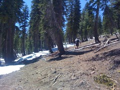
After 500 miles of postholing, sunburn, wet feet, map and compass,
getting lost, losing trail, falling on my ass, crossing insane river
fords.....the snow is finally over (I think). We started today
extraordinarily frustrated. We got off trail over snow and were lost
in dense forest for hours. We finally refound the trail, and had only
a few more potential snowy parts. As we crested a ridge at 8000 feet,
we started a descent that would take us below the 8000's for good.
Within a few hours, we were below 7000 feet with no sign of snow. As
quick as it started almost one month ago, it has hopefully ended.
After Sierra city tomorrow, we do go up to 7300 again, so there is a
small chance of hitting a little more...but as far as I'm concerned,
I've survived the worst. i was at my wits end with the snow. I can
see why many people quit the pct after tahoe. It really wears you
down on a level that I've not experienced before while hiking. Even
in 2008 when I thru-hiked the colorado trail early during a high snow
year, it was nothing like the past month out here.
Day 70: Mile 1164 (21.5)
Location: Near basin peak.
Well today had it's ups and downs. Started the day with some very
difficult and icy snow traverses. By mid morning, we were walking on
a beautiful exposed ridgeline section near Anderson peak. It was one
of my favorite pieces of trail yet. Just like Franconia. We got to
donner and we walked to the ski lodge for lunch. It turned out to be
closed on Thursdays so we ate our own lunches. While there, I lost my
ass....at donner pass. The small foam pad i was carrying since
kickoff that I used as my butt pad, blew away in some strong winds.
Doh! The the evening got worse. We headed across interstate 80
(which was weird as i80 is the same highway that goes by my apartment
back in PA), and the woods were completely snow covered. South
facing, at a low 7200 feet, and no trail for mlles. This was so
frustrating. It really feels like the snow will never end. Don't
know how much more I can take.
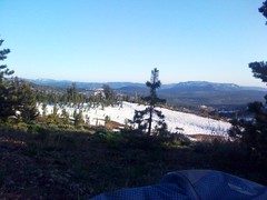
Well today had it's ups and downs. Started the day with some very
difficult and icy snow traverses. By mid morning, we were walking on
a beautiful exposed ridgeline section near Anderson peak. It was one
of my favorite pieces of trail yet. Just like Franconia. We got to
donner and we walked to the ski lodge for lunch. It turned out to be
closed on Thursdays so we ate our own lunches. While there, I lost my
ass....at donner pass. The small foam pad i was carrying since
kickoff that I used as my butt pad, blew away in some strong winds.
Doh! The the evening got worse. We headed across interstate 80
(which was weird as i80 is the same highway that goes by my apartment
back in PA), and the woods were completely snow covered. South
facing, at a low 7200 feet, and no trail for mlles. This was so
frustrating. It really feels like the snow will never end. Don't
know how much more I can take.
Thursday, July 1, 2010
Day 69: Mile 1142.5 (28)
Location: Just past American River
Today was a great day of hiking. Bojangles and i were hoping for big
miles, but not expecting it. We ended up having over 20 miles of
trail and only a handful with snow. After dealing with snow for so
long, having that much trail made for fast and easy walking. Most of
today we hovered around 8000 feet and only had to use compasses
twice. Tomorrow we hit 8700 feet and the don't go over 8100 again.
By this time Friday, we hope to be in Sierra city, celebrating the end
of snowy trail. One thing that has become worse, are the Mosquitos.
Today, we had to use a lot of deet. Part of the reason we managed 28
miles by 6 pm was because we never wanted to stop walking and let the
skeeters get us. From what I understand, they only get worse too.
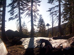
Today was a great day of hiking. Bojangles and i were hoping for big
miles, but not expecting it. We ended up having over 20 miles of
trail and only a handful with snow. After dealing with snow for so
long, having that much trail made for fast and easy walking. Most of
today we hovered around 8000 feet and only had to use compasses
twice. Tomorrow we hit 8700 feet and the don't go over 8100 again.
By this time Friday, we hope to be in Sierra city, celebrating the end
of snowy trail. One thing that has become worse, are the Mosquitos.
Today, we had to use a lot of deet. Part of the reason we managed 28
miles by 6 pm was because we never wanted to stop walking and let the
skeeters get us. From what I understand, they only get worse too.
Day 68: Mile 1114.5 (20)
Location: Phipps Creek
Started the day with a few hitches out of tahoe. Bojangles and I got
back to the trailhead at about nine and decided to hang together until
Sierra city. We did an easy 20, and said goodbye to 9000 feet as we
hikes over dicks pass. There was a lot of snow, even down to 7400
feet. Lake aloha was beautiful today. Only 80 more miles of
potential snow...although the Mosquitos are really starting to get bad
now.

Started the day with a few hitches out of tahoe. Bojangles and I got
back to the trailhead at about nine and decided to hang together until
Sierra city. We did an easy 20, and said goodbye to 9000 feet as we
hikes over dicks pass. There was a lot of snow, even down to 7400
feet. Lake aloha was beautiful today. Only 80 more miles of
potential snow...although the Mosquitos are really starting to get bad
now.
Subscribe to:
Posts (Atom)