Sunday, May 12, 2024

A Journey to the Center of Arizona

The Geographic Center of Arizona

All right my friends...it's time for another geographic geek-out; another quirky and seemingly bizarre trek to nowhere. Two weeks ago I set out from my home in Flagstaff Arizona with a single and simple goal: to set foot on the precise Geographic Center of Arizona. This is that story....

Now I have spoken exhaustively about geographic peculiarities on this site, and multiple times specifically about geographic centers. There's an entire chapter of my Treks to Nowhere written collection dedicated to geographic centers and my quest to reach as many of the marked "Centers" of the United States as possible. The story of these geographical pinpoints is long and complicated, but the short of it is that it is nearly impossible to identify the exact center locations of any bounded geographic area. This is because, well, the Earth is just not that simple. Land masses are bulgy, wobbly, and imprecise. Marked boundaries and borders aren't always perfect either and sometimes are either diffuse or dynamic. Rivers change, coastlines change, glaciers melt, and even the seemingly unchanging stone bedrock beneath us is at the constant mercy of the always irksome processes of erosion.

Still, we've gotten really good at minimizing the uncertainties, factoring in all of these difficult-to-quantify processes, and crunching the numbers. One geographer at the University of Buffalo, Peter Rogerson, published a scientific paper in 2015 where he presented a brand new method for calculating geographic centers that has since become the most precise method to date (superseding calculations previously made by the USGS). As such, if one were to seek out such a geographic center, these are ostensibly the best available estimates we have today.

What came of this study, were also the published coordinates for the geographic centers of each of the US states. A quick perusal of these coordinates reveals that many of these marked locations do fall within private property. Most points also fall relatively close to public roads and if private property weren't an issue, could likely be accessed via short hikes on foot. Even the geographic centers of large and relatively empty states like Wyoming or Nevada are not that far from 4x4 dirt roads. I will note that, yes, Alaska's center would be incredibly challenging to reach and is far from any accessible road (not surprisingly). Additionally, given the layout of the Hawaiian islands, its center is actually located in the open pacific ocean.

Here in Arizona however, things are a bit different. In simplest terms, our recently calculated and most current geographic center, is NOT easily accessible. Historically, our state's "proxy" center has been marked by the USGS as being located in the town of Camp Verde. There is even an established marker located there. I say that this marker is a "proxy", because even Camp Verde recognizes that the true marker is located miles away within the Mazatzal wilderness area near the confluence of the Verde and East Verde Rivers. On the Camp Verde marker, they note the location for the Geographic Center as 34°16'31.1"N, 111°39'36.8" W.
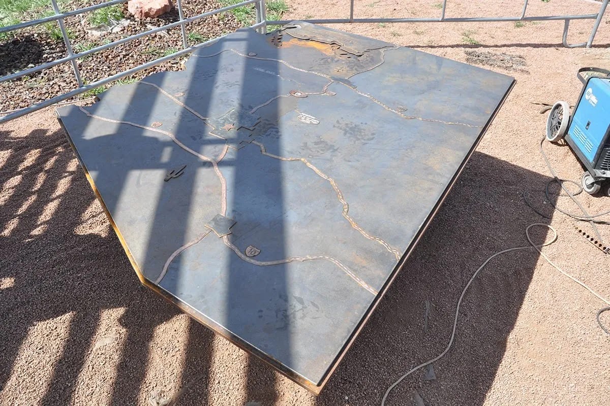
Geographic Center marker in Camp Verde

The published USGS coordinates for the Geographic Center in Camp Verde

If you spend some time digging into this "precise" geographic point, you soon realize that it is, in fact, NOT precise at all and depending on your source, has multiple coordinates. In addition, regardless of which coordinates you take as "gospel,", all come with their own inherent baked-in uncertainties. As I outlined in great detail in my Treks to Nowhere written collection, the historical method for calculating a geographic center (and the one employed by the USGS) involves using "the center of gravity of the surface, or that point on which the surface of the area would balance if it were a plane of uniform thickness." Rogerson updates this method using a new definition which is equivalent to the state's "centroid" (34.2740°N, 111.6582°W). It is derived by minimizing the sum of squared great circle distances from all points of land in a state (including islands, but not coastal waters, following the earlier practice of the USGS). In addition, since Rogerson's 2015 paper, the numbers have again been slightly updated (34.2744°N 111.6602°W) and are now publicly available via the following Wikipedia page:


Arizona's Geographic Center

Distance from Camp Verde (~26 miles)
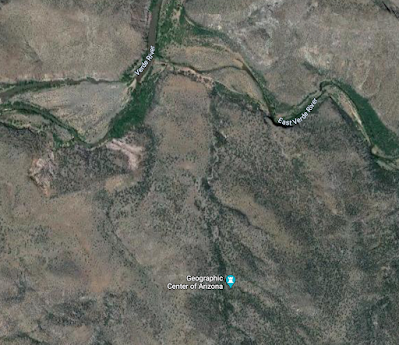
Location near the Verde and East Verde River confluence

The multiple Geographic Centers of AZ

Given the rigor of Rogerson's new calculation method, I have come to recognize his calculations as the most precise for geographic centers. Therefore, when looking into my new home state's center point (AZ), I have opted to acknowledge the most current and updated decimal calculation as the most accurate:

34.2744°N 111.6602°W


SEEKING THE CENTER...
Sometime late last year (2023), an idea began to brew in my head. I wanted to see if I could set out and reach this elusive point in Arizona in a single day. Given the remoteness of this point, and its inaccessibility, I knew this would require some clever route development. I also knew that it would likely require multiple modes of transportation, some difficult off-trail bushwhacking, and at least one river ford. What I didn't realize was just how big of an undertaking this trek would all be, and that it would ultimately take me four attempts to find success.

ATTEMPT #1 (Bloody Basin Rd / Cordes Lakes / Verde River):
I initially plotted out several possible approaches to this point and quickly settled on an approach from the West. This route would involve very difficult and unmaintained forest roads, and therefore the use of my dual-sport motorcycle. The start of this road however, was also located over 60 miles from my home in Flagstaff so would require either a long highway ride first, or for me to load my bike onto a trailer and first drive it down. All of this would take significant time. Once at the approach forest road near the town of Cordes Lakes, I would then have to ride in over 40 miles of rough and rocky trails just to reach the area where I could then start my hike over to the point. This hike would require nearly 2000 feet of descent down to the Verde River, and then fording the river to reach its eastern side. From there, the route would entail a difficult off-trail climb up to the point located in a small drainage on a desert hill side (likely covered with various cactus and cheatgrasses). The roundtrip hike would total around 8 miles (which doesn't sound like a lot, but would be mostly off-trail). This approach, while perhaps "logical" on paper, was ridiculously bold, and I hadn't appreciated just how long it would take to carry out. Still, I went into it rather recklessly and overconfident.

I left my home in Flagstaff entirely too late in the morning for the attempt to ever be successful, but didn't fully realize it at the time. And not only did I leave too late for an honest attempt, but I decided to take the "scenic" route down to Cordes Lakes. I chose to do this as I would be riding my smaller displacement dual-sport bike that didn't do well on the 75+ mph Interstate highway. I also just falsely assumed I'd be able to quickly get through the rough roads and bang out a fast hike over to the center point. The hubris was definitely oozing through on this attempt. The fortunate side-effect of this attempt, while it was ultimately unsuccessful, was that it resulted in a fantastic day of riding my dual-sport bike all over some of the most incredible places in Arizona. My bike was still relatively new at the time, and this attempt allowed me to truly explore some wild and wonderful nooks and crannies of Northern AZ.

My route down to Cordes Lakes took me first down Oak Creek and into Sedona. This is always one of my favorite rides to do on my motorcycles. I made great time down to the Cottonwood area, but rather than hop out onto the Interstate for a short stint, I opted to go up and over the mountains through the ghost town of Cherry. This is a fantastic ride on some killer dirt roads, but takes a fair amount of time to get through. The scenery was spectacular, but I lost at least another hour on this stretch.

Once I made it out the other side on US Route 169, I finally opted to use the Interstate for the final stretch to Cordes Lakes. I finally made it to the Bloody Basin Rd to begin the 40+ mile stretch out to the Verde River at about 11 am (again, way too late for an honest attempt). Just a few miles into the rough roads, I made a wrong turn and ended up on a private ranch (again costing me precious time).

I backtracked to the primary road and pushed on towards the Verde River....but quickly realized just how slow going the ride would be. After about 20 miles of slow and stressful riding, I began to do some quick math. I calculated that I wouldn't even reach the end of the road until almost 3 pm. Adding in an 8-mile hike over difficult terrain would likely add 3-4 more hours. Putting me back to the bike around 7 pm. By the time I were to ride the 40+ miles back to my bike (mostly in the dark) I would reach the highway until 9 or 10 pm. Then I'd be riding home on the highways, and likely not getting back until well after midnight. 
I aborted my attempt to reach the center and instead opted to turn my day into a fun day of exploration on my motorcycle instead. I rode back through the mountain town of Jerome and then worked my way back up to the Colorado Plateau through the small ghost town of Perkinsville and eventually up through the town of Williams. I rode my bike up to teh top of Bill Williams peak before finally heading home to Flagstaff. I didn't get back to the house until well after dark, but was thrilled with how the day played out. Despite not reaching the center, I had a fantastic day exploring northern Arizona on my new motorcycle and the entire trip allowed me to get more comfortable on the bike, and really get a good feel for how it performed off road. It truly was a brilliant day.
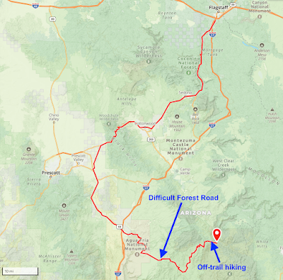
The planned route...

40+ miles of technical riding...and then difficult hiking...

Heading down to Oak Creek Canyon

The road to Cherry, AZ

Wrong turn onto a private ranch

Heading down Bloody Basin Rd.

The turnaround point

Heading to Perkinsville, AZ

The ride up Bill Williams Peak

ATTEMPT #2 (Deadman Mesa / Strawberry / East Verde River):
For my second attempt, I knew that I needed to get more serious and budget a lot more time. For this attempt, I chose to attack the center from the Northeast by way of the town of Strawberry, AZ. I would plan to ride my Honda again, but this time I would head down the long road out to a feature known as Deadman Mesa. From this approach I could get to within about 7 miles of the of the center, requiring a 15-mile roundtrip hike. This hike would also be on the labeled Deadman Mesa Trail (although there was no way of knowing how maintained it would be). I planned to cover about 2 miles per hour so the hike would potentially take me 8 hours (meaning I'd have to start by 9 am at the latest).

Full route for attempt #2

The route from Strawberry, AZ

Zoomed-in hiking portion of the route

The morning of my attempt I left my house early before sunrise. I planned to get to the trailhead before 9:00 am in order to give myself plenty of time for the hike. The ride down the paved Lake Mary Rd to Strawberry was quick and I was starting up the backgrounds out to Deadman Mesa around 8:00 am. Very soon into the off-road riding the quality of the road degraded to that of a barely discernible trail. It also quickly ramped up in difficulty to the very extreme end of my comfort level for riding. I was dodging large rocks and navigating steep descents. The riding was slow and treacherous and I was losing a lot of time. On a steep section out on the Mesa, my bike rolled on a loose rock and I dropped it hard onto some jagged rocks. Thankfully, I didn't incur any major damage, but it was enough for me to admit that I was now on roads beyond my capabilities. I found a place to stash my bike behind some trees, and chose to hike the rest of the way. This plan would add at least 3 miles to my hike, but I figured I could move quicker on foot.

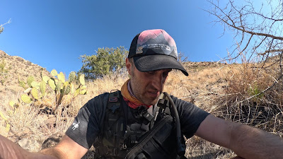
I began hiking down the road as it continued to get rougher. I was happy I chose to park the bike but it was already past 9:00 am and I knew I was going to be tight on time. It took me almost 5 miles of hiking before I finally reached the end of the Mesa to begin my descent down to the river, and as I progressed down the descent, the trail effectively disappeared. From this point on I was essentially route finding through open terrain. I was constantly getting snagged on briars and cactus, and the descent down was steep and unstable. I was falling a lot and beginning to get worried about my odds of actually making the center point.

About 2 miles down the descent, I began to do the math and once again realized that making the center was not going to be possible in the daylight. In addition, my water supplies were getting low and there was no place to resupply other than the river itself. I made the command decision to abort and head back to the bike. After several hours of hiking, I finally made it back at dusk, and had to then ride out the 10+ miles of very difficult roads in the fading light. By the time I made it back to pavement, it was well after dark I didn't make it home until late evening. I was frustrated by the day, but learned a valuable lesson with respect to Arizona Trails: many "marked" trails are actually unmaintained and present very difficult conditions. Given this, I knew any attempt on such "trails" had to include additional time for slow navigation.
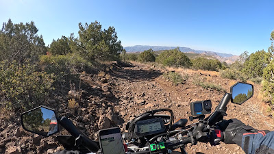
Riding out on Deadman Mesa

Taking a spill...

Recovering...

Off-trail route finding

Starting the descent to the Verde River

Along the steep ridge line descent (and no "trail")
The turnaround point...

Riding back out in the late afternoon

Still on the back roads at sunset

ATTEMPT #3 (Bloody Basin Rd / Cordes Lakes / Verde River):
For attempt #3, I decided to return to the location of my first attempt as I wanted to minimize the amount of time I'd have to traverse on foot. I figured if I could make it in the 40+ miles on Bloody Basin Rd, I could make much quicker work of the ~7 mile round-trip hike to the center from there. Of course the big question mark for this approach is the Verde River crossing. At times the Verde River can have flow rates in the thousands of cubic feet per second...making it impossible to ford safely. I had been watching the public stream gauge data online, and determined that the levels were looking decent for an attempt.

I also decided that for this attempt, rather than lose so much time riding to the approach road, I would instead load my bike onto a trailer, and drive it down to the Bloody Basin road in the wee hours of the morning. This way, I could be starting up the 40 mile road right at sunrise giving me plenty of time for the hike.

I loaded the bike the night before and prepped all of my supplies for a pre-dawn departure. I left the next morning well before sunrise and drove down the 70 miles on the Interstate to the Bloody Basin road exit. I had the bike offloaded quickly and was starting down the road just after sunrise.

The riding out to the far end took hours but was absolutely stunning. Just past the point that I had turned around on my first attempt, the road became much more scenic and thrilling. I descended down a twisty mountain section and then along an expansive and desolate desert stretch. Before long, I was deep into the wilderness without a single soul nearby. As I progressed farther and farther, I couldn't help but feel like I was a million miles from civilization. 

When I finally reached the last descent down towards the river I opted to ride the bike as far as I was comfortably able. In the end, I nearly made it to the end of the road, parking just 1/4-mile from its end point.

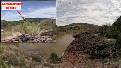
The hike down to the river was again supposed to be on a "trail", but I quickly discovered that like Deadman Mesa, these trails are mostly overgrown and abandoned. It took me over an hour to traverse the 3 miles down to the river and when I arrived, I was hit with a very sobering realization. The Verde River had swollen over the previous 24 hours and was now a raging torrent. It was well over 5 foot deep moving with flow rates well beyond any safe crossing. I was absolutely crestfallen, but knew there was nothing I could do. The Geographic Center was in view less than 1.5 miles away, yet there was no way I would be able to reach it.

I begrudgingly turned around making the hike back to the bike and then the very long ride back to the car and trailer. I had hours to think about this silly quest of mine on the riding, and had decided that my goal to reach to the center was likely over. I just didn't think I had any more attempts left in me. In the end I decided to give myself a few weeks to mull it over, and maybe see if there was any other way to approach the center that could be doable in a day. I also considered if it was just worth doing as a multi-day overnight with camping.

Loading up the bike

About 25 miles out on Bloody Basin Rd

An abandoned car near the end of the road

A swollen Verde River

How close I was to the center (1.4 Miles)
Location of Center from Verde River

Riding back out

Passing a single 4x4 deep into the ride

Back at the car (around sunset)


ATTEMPT #4 (Twin Buttes / East Verde River):
A few weeks after my 3rd attempt, I did come to discover one additional route that might work as an approach to the geographic center of AZ. The issue with this route was twofold: First, it would require a 24-mile round trip hike, and second, that hike was likely on another unmaintained AZ trail. Of course this meant that my hiking would be slow and inefficient. And while I'ver certainly covered well over 24 miles in a single day on trails before, these would likely be very slow miles. In addition, this route would still require some off-road riding to reach the "trail head". So, despite my earlier conviction to not try this adventure again, I did eventually decided to go after one final attempt...

Route #4

This approach would be similar to my 2nd attempt. I would make way down to the town of Strawberry, AZ, but instead of heading out towards Deadman Mesa, I would instead ride only about 6 miles out to the Twin Buttes trailhead. In my research I did learn that this is an established trailhead and that the trail (Verde River Trail #11) is at least moderately maintained and follow-able. 

I left my house in the pre-dawn hours and rode the 75 miles down into Strawberry just after sunrise. I then rode the 6 miles out to the twin buttes trail head on a relatively moderate forest road. The last mile did get a bit more technical, but I got through it without issue, and was at the trailhead not long after.

The hiking over the first 7 miles was easy and was along a once-established jeep road of sorts. The trail was old and overgrown, but easy to discern. Around the eighth mile, the trail changed to a single track and it became much more overgrown. In addition there were numerous cacti and tall grasses that kept snagging my shoes. As I progressed down to the river, I was accruing hundreds of barbed grass seeds in my socks.

I made it down to the river by noon, and from this approach, I only had to ford the smaller East Verde River (which was flowing at a meager 14 cubic feet per second). The crossing was only ankle deep and I was quickly on the other side. The final mile hike up to the center point was brutal and entirely off-trail (despite the marked trail showing it continued in this stretch). I fell into numerous cactus plants (picking up a collection of spines), and had thousands of annoying seeds poking me through my socks.

Despite these setbacks, at approximately 1:30 PM, I finally arrived at the small juniper tree at the precise lat/long coordinates marking the geographic center. I spent about 10 minutes there snapping photos and recording video clips before turning around and heading back to the river.

The 10 mile climb up from the river back to the motorcycle was excruciatingly slow and exhausting. I had recently had a bout with covid and I could tell my lungs weren't entirely back to full functionality yet. The return hike also featured over 3000 feet of elevation gain during the hottest part of the day.

I did eventually make it back to the bike just after sunset (and after 24 total miles of hiking) and was able to ride out to paved roads before dark. The long 70 miles of highway riding back home was all in the dark (and cold)...but I did eventually make it back to my house by about 9:00 pm.  

In the end, this quest ultimately took me four attempts, but I did finally find success reaching the geographic center. I can't imagine anyone else has ever sat under that specific juniper to celebrate Arizona's center (especially given that the newly calculated coordinates are only a few years old).

I spent hours reflecting on this long odyssey I had been on to reach this elusive point, and I decided that I was indeed glad that I chose to give the adventure one last attempt.

The final mile before the trailhead

Starting down the trail (mile 2)

Blooming barrel cactus

On the overgrown single track trail

The East Verde River Crossing

Cooling off in the river

The Geographic Center of AZ!

Grass seeds hitching rides on my socks/shoes


Hiking back up to the bike

Riding out in the dark

Wednesday, April 10, 2024

Another Lost Earth (2024 Eclipse)

2024 Eclipse Totality (As seen from near Oden, Arkansas)

For the second time in seven years, I have come away from a celestial event that was so profound...so stupefying...that I find it again difficult to verbalize my thoughts. Back in August of 2017, I traveled with my partner to rural Kentucky in order to place myself squarely on the centerline of a total solar eclipse. Since first learning of these rare events, and then witnessing an annular eclipse during my senior year of high school, I made a promise to myself to one day witness a true total eclipse (under clear skies). On that day in 2017, we stood in a small cornfield on the outskirts of Hopkinsville, Kentucky, just 500 meters from the totality centerline and very near the longest duration point along the path. We had driven several hundred miles to hunt for high atmospheric pressure...in order to give us the best odds for clear skies. Getting there also involved a missed flight connection out of Boston, and a several-hour unplanned drive from Chicago down to St. Louis. I wrote about this entire ordeal and experience here in a post titled, "A Lost Earth". I also featured this write-up as a full chapter in my recently published collection titled, "Treks to Nowhere".

I came away from this entire experience, profoundly moved. It is truly impossible to explain to someone just how overwhelming, surreal, and....well, cosmic, a total solar eclipse is. For the two minutes and forty seconds of totality, I stood, mouth agape in absolute awe. I took only one picture, and instead just wanted to "be in the experience." I wanted to absorb every millisecond, and every sensation of the moment. I knew it would all be fleeting, and possibly the only time I'd ever have this experience. During totality, I have described my feeling as though the universe at large, somehow divided by zero. A certainty so established as the sun shining, became....uncertain, and it was eerily unsettling, but yet awe inspiring. I uttered only four words during totality, and they were, "...we are so small."

When it was over, I realized immediately that I would never be the same. I was permanently affected and changed forever. For the many hours (and days) that it took us to get back home, I couldn't get the overwhelming thoughts and feelings out of my mind. Never has a natural event had such a profound impact on me...and I've experienced earthquakes, volcanic eruptions, tropical storms, the northern lights, comet viewings, meteor showers, Antarctic storms....none have come close. I suppose a significant meteor impact, nearby supernova, or alien visitation might have the same sort of effect.

During the 2017 Total Eclipse

Totality Photo during 2017 Eclipse

Path of the 2017 Eclipse

...Many years have past since this experience, and my thoughts and feelings of it have not diminished.

This past October (2023), an annular solar eclipse transited the US just up the road from where I live in Arizona. We drove up to Navajo Nation, parked along the side of the road and experienced the event over a several hour period. For this eclipse, it felt more like a curious oddity, or science experiment. It was apparent that the ambient light diminished, and there was an overall dulled eeriness in the air, but without a true totality, it just didn't have the same metaphysical and mystifying impact. It was incredible to see the "ring of fire" during the peak, and it brought up fond memories of my high school annular eclipse that were buried deep in my mind...but it just didn't invoke that resounding cosmic awe that the 2017 had. I was glad to have experienced it (and with clear skies), but it made me long for that fleeting feeling of true totality. I had become an addict.

Our set up near Dennehotso, Navajo Nation, AZ

Watching the 2023 Annular Eclipse

My doggo getting a view of the eclipse

Approaching Annular "Totality"

Annular Totality w/ "Ring of Fire"

Path of 2023 Annular Eclipse (centered right over Four Corners)

I had obviously known of the 2024 total eclipse from the moment I left Kentucky in 2017. My partner and I had decided within moments of starting our long drive back to St. Louis, that we needed to experience the feeling of totality again. Sure enough, the US would once again be host to a total solar eclipse in just seven short years in 2024. Of course to us at the time, seven years seemed like an eternity to have to wait in order to experience totality again, but we were at the mercy of those pesky celestial laws of motion. Curse you Kepler! 

Incidentally, one of the things that I immediately noticed about the 2024 eclipse is that the path of totality would actually be crossing directly over my childhood home town in upstate New York. Of course given the location along the Great Lakes, the odds of overcast would be exceedingly high. So, in the few days following the 2017 eclipse we collectively decided that we'd likely instead try to find our way to southern Texas where the clear sky odds would be more in our favor. We effectively "Saved the Date," and then went on with our lives. I can say that once you experience a total eclipse, waiting for the next...is worse than waiting for Christmas as a child. It feels as though it may never come. In addition, nothing about it is certain. The entire path may be cursed with bad weather, or travel may simply become unworkable. It's entirely possible that you make complex plans, spend thousands of dollars, and then have no way to reach clear skies during the short window of time leading up to the eclipse. The nice thing about have a long transit path across the continental US, is that the odds of being able to drive to sunny skies are greatly increased. There are eclipses that cross only a sliver of land, and if that area is under overcast skies, it's just not possible to relocate. What this all means is that while we penciled in southern Texas for our likely viewing location, we knew that this plan was very likely to change. Like with 2017, we would plan fly to a large city along the totality path, and then venture out from there by car, never deviating too far from that path of totality.

2024 Eclipse Path

In the years following the 2017 event, our lives changed dramatically. In 2019, we completely picked up our lives in New England and headed to Flagstaff Arizona to start a new life chapter, and new jobs. Today, that seems like a lifetime ago. We survived the bumpiness of integrating into a new University and our new academic roles. We survived a global pandemic and all of the ridiculousness that came with that. I picked up entirely new hobbies (adventure motorcycling), and ran several dozen ultramarathons (including the Hardrock 100 and Western States 100 ....twice!). Needless to say, much has happened in the past seven years. I had just turned 40 years old for the 2017 eclipse...and now my fifties are creeping up on the horizon. 

Following the October 2023 annular eclipse, my excitement level began to increase markedly for the 2024 total eclipse. Immediately following the winter holidays, we began our making plans in earnest. We determined that flying to Dallas would be the best bet as it would give us many options for follow-up travel. We would have access to a large airport (minimizing risk of flight problems), and we could fly direct from Phoenix. We'd also have access to a large rental car fleet. In January, we booked flights, hotel rooms, and rental cars without any issue, and then simply waited. At the time of this planning, we had continued to assume our plan would be to drive south and west away from Dallas towards the more arid parts of Texas (and closer to Mexico). Little did we know that we'd ultimately be doing the exact opposite when the eclipse weekend finally approached.

April 2024

The week before the eclipse, we got our first bit of bad news. The long-range forecasts were not looking favorable at all. Not only were all models forecasting overcast skies near Dallas, but nearly all of Texas was projected to be covered. There was actually a moment where we even debated whether or not to go. Looking back now, I can't believe I even considered this. I would have never forgiven myself for not even trying.  We had had a really busy few weeks leading up to the eclipse, and were both quite burned out. It was hard to get motivated and excited. Two nights before our flights were scheduled to leave, we both agreed that we needed to try. There wasn't going to be another US total eclipse crossing the lower 48 until 2045....in 21 years. Were we willing to wait that long? No...we were not. We tried to stay hopeful, but he forecasts looked miserable.

But then we got a glimmer of good news and hope. As we boarded our flights for Dallas, the forecast improved slightly. Texas still looked miserable, but if we chose to drive up towards Arkansas, the cloud forecast was showing places with only 20% coverage. This would mean driving over 250 miles on the morning of the eclipse...which to me was really only a mild inconvenience. What's a few hours in a car, after waiting 7 years?

We landed in Dallas late on Saturday night and checked into our hotel after midnight. The following morning I picked up our rental car and we spent the day relaxing under perfectly clear skies. It was mildly frustrating that we had such gorgeous skies just 24 hours before the eclipse, but we chose to trust the forecast.

We relocated to our original hotel on the outskirts of Dallas, then planned to wake up at 4:00 AM on Monday to get ahead of any potential traffic back ups. We'd drive North and East to the town of Clarksville near the OK and AR borders. Depending on the morning cloud forecast, we'd then decide if we would push on further.

After a restless night of sleep, we woke up Monday at 4:00 am ready embark. Traffic looked green across the board, but I was still anxious to get out of the urban chaos of Dallas and into more rural areas. The early morning driving was quiet and the traffic surprisingly light. There were the ominous signs along the highway warning of heavy traffic jams during the eclipse which of course didn't help with my anxiety.

As we made it further north and east, and away from Dallas, I felt much better about our situation. When we arrived in Clarksville, the skies were clear, but the forecast was still showing nearly full cloud cover by noon. So, despite the temptation to stay, we decided to push on towards the town of DeQueen, Arkansas. The forecast there was much more favorable, with only a projected 30% cloud coverage for after noon.

So...we pushed on. About 80 miles later, we rolled into the small town of De Queen, and found a local park to set up. Skies looked good, so we unloaded our car, set up our camera tri-pod, prepared a comfortable place to sit...and began the waiting game. About 30 minutes later, the clouds came, and we were entirely socked in. We tried to convince ourselves that it was just a passing band, but the longer we stayed, the more anxious we got that it wasn't going to clear. We debated for quite some time about whether or not to stay put, or risk moving on...and again, we decided to trust the nasa cloud forecast. Time was running short, but we opted to packup in a hurry, and push on further north and east where the forecast was projecting much less cloud cover. As we frantically packed up, others at the park watched us. The shook their heads as if to say, "don't do it...you'll regret leaving. It's better to stay put...."

The overcast view from De Queen...booo!

But we didn't stay put. We chose to trust our guts and move on. All projections had central Arkansas as being more favorable. We jumped in the car, knowing we'd only have about 90 minutes until the very start of eclipse so wouldn't have much time to get settled some place new. We also knew this might mean we get stuck in traffic somewhere, so made sure to stay on the center line so that if we had to, we could simply pull the car over and watch from the highway (not ideal, but certainly and option).

A quick glance of the map had us heading towards the town of Pencil Bluff, AR. It was on the center line, and had cloud coverage forecasts of less than 20%. We'd arrive about 30 minutes before the start of the eclipse. On the ride to Pencil Bluff, we rode along winding rural rounds, getting stuck behind many cars going incredibly slow...and we started getting anxious.

We did eventually make it to the Pencil Bluff area and thought about setting up in the parking lot of the Dollar General store, but on the final mile before town we found a small grassy pullout just on the other side of the unincorporated town of Oden. It looked to be a prime viewing location. People were already setting up all along this rural road and so we weren't too worried about any property owners kicking us off their land. There were no houses on this property, and no gates, so figured it was probably fine. To our surprise, a few minutes after setting up, the property owner did actually pull up. Thankfully they told us that they were fine to set up there, and to just leave no trace. Not long after, we had another group pull in to share the space with us. So in short, we had once again found a rural grassy spot to set up for an eclipse...and this time, with proper permission. The skies were entirely clear, and we had just 30 minutes until the start of the moon transit (with about two hours until totality). A quick forecast check also still showed favorable skies. We agreed that this would be our viewing spot...regardless of what happened. There'd be no more relocating. Following the eclipse we would be presented with a nearly 7 hour drive back to Dallas as well....so we really didn't wan't to go any further if we didn't have to.

Somehow, we managed to find the most ideal spot for favorable weather. When we pulled up the cloud coverage map just before totality, we were shocked at the perfect window of clear skies we found. Nearly everywhere else south and west of us, had thick clouds. 

Oden, by way of De Queen and Clarksville.

Our location in the narrow alleyway of clear skies
(clouds indicated in grey)

Viewing Location in Arkansas

Viewing Location - Exactly 1 mile from the totality center line (green)

Viewing Location just outside of Oden

Precise Viewing Location
Our viewing location outside Oden Arkansas

Setting up the camera

Using a colander to capture the eclipse

While we waited for totality, and watched the moon slowly march its way across the disc of the sun, we did get a few wispy clouds that came through...but nothing that had us anxious. Once we were within 15 minutes of totality, with nearly clear skies, we knew that we'd get the full show again. I did my best to snap occasional photos, but mostly I again wanted to just be in the moment and enjoy the experience.

As totality neared, the ambient light noticeably dimmed and the familiar sound of crickets and other evening insects began to become more audible. The uneasiness that I had felt in 2017 crept back in, and then all of the accompanying feelings of strangeness came rushing back. I immediately recalled the nearly three minutes of totality from 2017, and just how much it changed me...and I knew that it was once again imminent. This time however, we'd get almost 5 full minutes of totality....twice as long as we got in 2017.

In the final moments of sunshine the temperature had plummeted nearly 10 degrees. An eerie stillness came over our viewing area....and my perception of reality once again transitioned into an unsettling domain of supernatural and cosmic strangeness. My world was about to change.

....and then in a final lens-like flash, the last diamond of light vanished, and my glasses came off. We were in totality.

The first thing that struck me about this eclipse totality, was that the disc of the sun...appeared so much larger in the sky than I remembered it from 2017. In my mind, what I had recalled from 2017 was that during totality the dark sun appeared distant and somehow vague...almost as if it were a hole in the sky. The other thing I remembered was that I had very little time to enjoy the darkness...only 2 minutes and 41 seconds.

What I was staring at now, was what appeared to be a massive celestial body...a looming presence filling the sky. It seemed almost ominous and foreboding. It instilled a much greater sense of awe and disbelief than I had experienced seven years prior. I immediately realized why peoples of a thousand years ago interpreted eclipses as signs from the heavens. 

I snapped a few pictures quickly to get them on record, and even took another short video...expecting totality to once again be fleeting. When I had finished my "chores" a I simply stood in the shadow of celestial wonderment. The blacked-out sun was just so enormous and it almost felt as though it were growing. That feeling of the universe dividing by zero was markedly more powerful than I had remembered....and I caught myself having to look away a few times just to make sure that the world around me was still part of my greater reality.

After an eternity of trance-like stupor, I finally looked down at my watch....only 50 seconds had passed! How was that possible?! I started wondering if eclipses somehow alter our perception of time. I stood next to my partner for the next 3 and a half minutes, and we both just remained motionless capturing every single mental and sensory detail that would could. There were no more pictures and no more words...and we were beyond rational thought.

Seconds ticked by in slow motion. At one point we both gasped as we could see visible solar prominences and flares leaping out of the sun's surface and into its corona. These appeared as faint red loops at the edge of the eclipse that were about five times larger than Earth itself. I did not notice any such solar events during the 2017 eclipse, so this was something new for us both. I could tell there were other eclipse viewers nearby as I heard an occasional "wow!" or "woah!" coming up from the adjacent cornfield. For the most part though, it was strangely still and quiet, and we were both entirely absorbed and lost in the moment.

Time continued to trickle by. I checked my watch. and we had only just passed 2:41...the length of the 2017 eclipse. I couldn't believe we still had over two minutes left! Those final two minutes were the icing on the cake....uncharted territory, as it were. There was enough time during totality that I could truly let my mind wander, and ponder the immensity of the universe. I had entire conversations in my mind about so many things...so many questions...so much wonder. The Earth had again, become somehow lost.

Mostly, I was just so very happy that we had made it to a place where we could once again experience the totality of a solar eclipse. I was glad we had decided to do whatever we could to make these nearly five minutes possible. It was all absolutely worth it. I would have driven across the country for this experience...of that I am now even more certain.

2024 Eclipse Totality

My only blurry photo taken during totality

When the diamond of light finally appeared on the opposite side of the sun, I put my glasses back on and let out a long sigh. It was over. The universe was again unstuck and progressing forward. For a few moments I had wondered if perhaps reality itself had broken permanently...so was relieved that things were once again as they should be.

For the next 90 minutes, we continued to snap photos of the eclipse as the moon completed its march across the sun. We allowed ourselves to slowly come back down from the experience and by the time the eclipse was entirely over, we were ready to pack up and start the long journey home. We both agreed that we were once again changed forever and that this eclipse had been more dramatic than the first (despite the first being more meaningful in some regards as it was our first).

The travel home was long: A six hour car ride through thunderstorms, followed by several flights back to Phoenix, and a then a midnight drive back up to Flagstaff. On our drive back to Dallas following the eclipse, the sunset was spectacular. A pale orange sun loomed large on the horizon, draped by thin clouds. It's almost as though it was giving us a little encore of sorts. Quite a spectacular day for our wee little main sequence star. 

The setting sun on eclipse day

Another view of the setting sun

This morning, I had to teach a class and my mind was all over the place. It was hard to concentrate and I still don't feel like I'm integrated back into a "normal" mental state. It truly takes time to recover from an experience so surreal as this.

So what is next? As of now, that is unclear. We were fortunate to observe two total solar eclipses in 7 years (under clear skies), and even an annular eclipse in our backyard. There won't be another true eclipse in the US for over 20 years (unless we want to go up to Utqiagvik in northern Alaska during winter in a few years). Internationally, our prospects are much better. In 2026 there will be an eclipse that transits across Iceland with Reykjavik and the West Fjordlands being in the path of totality. The problem with Iceland of course is that it is often cloudy. There will also be an eclipse across New Zealand (during winter), and one across Africa that will transit very near the pyramids. As of now, we're considering Iceland, although we have already vacationed there (coincidentally right after the 2017 eclipse).

So what this all means is that we don't know yet. Certainly if we're still around in 2045, we'll be trekking to that eclipse here in the US, but in the meantime, we're just not sure. If I were a betting man, I would say that theres a pretty good chance we'll make some travel plans in the next decade to see another total eclipse.

Note: One piece of sad news to come from the eclipse is that my data logger that I prepared and set up to log temperature, humidity, and solar data during the eclipse failed to log any data. I'm not entirely sure why this happened, but the short of it was that it failed to launch correctly when I initiated the device. This was a huge disappointment for me as I really enjoyed plotting up the data from 2017 and was excited to compare the numbers. Not much I can do about it now....

The 2017 and 2024 eclipse paths

Photo taken following the eclipse from our viewing location

My data logger that failed to capture any usable data.

Our photo "sun-lapse" of the 2024 eclipse