Monday, December 5, 2016

The Lotteries

In the San Juans during my 2008 CT thru-hike

Disclaimer: Please note, that whatever you may insinuate or infer out of this post, my objective was to be as candid as possible. I wrote the majority of this post shortly after the drawings for both related lotteries were completed.  Needless to say, I was quite disheartened by the results, and I wanted to capture my raw emotion before it faded. I was particularly excited going into the lotteries this year, and as you will read below, the results were quite tough for me.  Please also note, that however upset I may seem in this post, that I respect and cherish both the Hardrock and Western States races IMMENSELY. I am perfectly content to wait my turn just like everyone else has. When my day does finally come for either or both of these races, it will be so incredibly special for me.  With that....enjoy the post....

First...a story:

In the Summer of 2008, I set forth on my second ever thru-hike. I had just finished my first year of graduate school, and had spent 4 weeks in June processing Ice Cores in the Denver Lab. After my work was done, I spent 20 days hiking along the rugged Colorado Trail.  It was breathtakingly wonderful. This was my first ever real experience doing an Alpine hike, and my first ever experience dealing with A LOT of snow. 2008 was a rough year for snow in Colorado, and I started my thru-hike early, on June 18th. I post-holed a lot, but also learned a lot about safe traversing on high mountain trails in snowy conditions. It also ended up being an invaluable experience with regards to my 2010 PCT thru-hike which had similar snowy conditions in the Sierra.

Near the end of that hike, I passed through my last mail-drop town: The small mountain hamlet of Silverton. I happened to pass through Silverton just days before the Hardrock 100 Endurance Run.  At the time, I had no idea what it was, but I remembered seeing small trail markers up on the CT before getting into town and wondering what event was being marked.  In June of 2008, I had never run an ultra. I had only just completed my first true marathon. I met several of the runners in town that one evening I spent mulling around Silverton, and I was simply fascinated by the sound of this event. I told myself that day, that even though I didn't do long-distance mountain or "ultra" running, that some day I wanted to take part in the Hardrock.

The very next year, in 2009, I ran my first big ultras...the Vermont 100, and the Leadville 100.  After narrowly squeaking out a finish at the Leadville 100, I applied for the first time to Hardrock. I remember that I had to mail it in and send proof of my Leadville finish.  I also tried to apply to another famous hundred-miler...the Western States run, but it was the year following a fire cancellation.  Because of that, most of the slots were guaranteed to previous year's runners that didn't run. While Western States wasn't quite as appealing to me, it was still a race I had hoped to be a part of as it is essentially touted as the birth-race of ultrarunning in the US.  

And so began my epic journey for entrance into these two races.

If someone were to ask me what my favorite mountains or my favorite scenery in the United States is, I'd really have to think about.  I've seen quite a few poignant and moving places over my 40 years.  Specifically though, there are two general areas that I can definitively say have brought me to tears just be their shear beauty and awesomeness.  Those areas are the North Cascades of Washington, and the San Juans of Colorado.  

With regards to the San Juans, they have become a very special place for me for so many reasons. Every year that I go to Colorado for lab work, I make time to visit and hike amongst these mountains. I still have vivid memories of my thru-hike...smiling at the fact that the San Juans were the icing on the entire CT cake (the "Best Part of the hike" as it were). In addition, I have spent many days tucked away in these mountains with people that are very important or close to me.  Quite simply, these mountains are special to me.

On top of Mt. Sneffels (San Juan 14er)

Hiking Uncompahgre (San Juan 14er)

Parked on Engineer Pass (San Juans)

Wild Elk seen near Silverton (from CT thru-hike)

Parked with San Luis Peak in the background (14er)

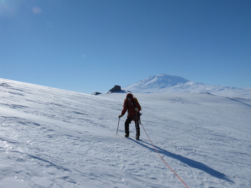
Going back to my story. After 2009, I took a year off from running in 2010 in order to thru-hike the PCT. Because of this, I failed to run any qualifiers for Western States so was not able to reapply. But, my PCT hike also gave me a closer connection to that race as I spent a few days hiking right along the Granite Chief Wilderness area near Squaw Valley (The Western States Starting Line).  I went through that area on June 30th, just 4 days after Geoff Roes battled out his first place finish (As shown in the documentary "Unbreakable").  There were still visible course markings in the snow that hadn't been removed yet.  Without my qualifier though, This meant my ticket count was reset and I went back to zero for my next application.  I didn't care though.  During my PCT thru-hike I decided that just like with Hardrock, I now had a personal connection to Western States and wanted to run them both one day.  

Thankfully, with Hardrock, a qualifier is good for two years, so I was again able to apply for the 2011 race still using my 2009 Leadville finish (unlike Western States).

As my years through graduate school progressed, so did my passion for running ridiculous and extreme distances and events.  Beginning in 2011, I managed to complete at least one significant 100-miler every subsequent year.  Each year I thus applied to both Western States and Hardrock religiously.  Both races had competitive lotteries...and both races unfortunately had yearly increases in the number of applicants.  When I applied to Hardrock in 2010, there were about 500 applicants. For reference, this year, there were 2000.  Likewise with Western States.  Back in 2010, there were about 1200 applicants.  This year, there were over 4200.

Each year around November, since 2011 I have placed my name into each of these coveted lotteries. Over the years the metrics have changed a few times, the lottery algorithms have been tweaked, but ostensibly, my odds for selection have gone up each year.  Each year as I've put my names in and eagerly await the drawings, I get excited and hopeful. Each year, I wasn't selected. I always felt moderately disappointed by the results, but I knew my odds were terrible and didn't necessarily expect to get selected.  But it's hard not to hope, when you hear of many of your friends who get selected on just the first or second try....just lucky!


Western States yearly applicant pool increase...

A picture from PCT hike along the WS course

Another picture from PCT thru-hike along the WS course.

As the year's progressed, so too did the limitations of each races' approved qualifiers. It used to perfectly fine to run an easy road 50-miler as a qualifier for Western States. Now, only 100-milers (with the exception of a few 100k events) are allowed.  For Hardrock, I always used Leadville as my qualifier, but eventually, that race was even scrapped.  Now, there are only about 15 domestic 100-milers that count as adequate qualifiers for Hardrock, with just a few being east of the Mississippi.  Still, despite these limitations, thousands of people are qualifying and applying.

Approved Hardrock Qualifiers

One of the toughest restrictions is the one placed on the Western States race.  This restriction (which I noted previously) states that you MUST apply each subsequent year, to maintain your ticket count in the "lottery hat".  For both HR and WS, the ticket counts are increased exponentially by an order of 2.  In other words each year your ticket counts double.  For example you start with 1 ticket, then 2, then 4, then 8.  As you can see, after about 5 or 6 years, your counts starting getting really high (i.e. 128 or 256...).  This algorithm means that your odds of selection increase sharply after the first few years.  But again, each year more and more people are also applying.  With the aforementioned restriction though, if you qualify for, and apply to, the WS race for 5 straight years and accrue 32 tickets you have a good chance of getting in.  However, if bad luck prevails and you don't get selected, you must run (and finish) a race that falls on the WS qualify list sometime within the next year or you forfeit all 32 of your tickets and start all the way back at 0.  This can be a very big source of anxiety for someone with several years of tickets accrued.  If you have a bad or injury year, you may not be able to run a hundred-miler...and boom, just like that you've lost 5 or 6 years worth of waiting.

For me, I have managed to qualify every year and thus keep my ticket counts accruing.  Each year however, bad luck has prevailed.  Despite increasing odds of being selected, my golden entrance lottery ticket has thus evaded me. Every year thus far I have been forced to watch  the race unfold and cheer from the sidelines.

With Hardrock, thankfully, if you miss a year of applying to the lottery, you DON'T lose your tickets. For me, I was not able to run one of the very selective races on that above qualifying list during the two years surrounding the finish of my PhD program (2014 and 2015).  I simply didn't have the time to train for, or resources to run one of these specific events (despite being able to squeeze in the necessary race to at least qualify for Western States and run many other ultras).

Last December after again coming up short on the Western States lottery after 6 years, I knew going into this year, that my odds were finally looking incredibly good. While I didn't apply to Hardrock last year due to my lack of a qualifier, I had not lost my 5 years of tickets and was determined to finally run a new qualifier.

Everything changed after last year's lottery.

I made the decision that since I was not able to yet run Hardrock (still the run I was most eager to participate in), then I could at least volunteer at it during the 2016 run.  I spoke with the volunteer coordinator and was able to secure a spot captaining an aid station.  This was fantastic because not only would I be able to help the runners, and be there during the event, but by captaining an aid station, I would accrue another "year" of lottery tickets.  (The Hardrock rewards the dedication of HR aid station captains with another year of lottery tickets).  This means that I would jump right from 5 years of applications to 7 years.  

The experience at Hardrock was magical.  I saw many of my friends and witnessed the event from start to finish.  As I sat there during the race meeting, I got goose bumps. I called home to my other half and said, "There's no doubt in my mind.  I want to be here next year running this event. I've never wanted it so badly".  I could feel it coursing through my veins.

During the race, my aid station was the finish line station, which also meant I was responsible for cooking full finish-line style meals for over 36 straight hours. I maybe slept for 2 hours during the entire event.  It was an ultramarathon in itself just keeping that station running, but it was soooo worth it and I wouldn't have traded it for a second.  It was simply an incredible experience.

I walked out to the finish line rock...literally a giant painted rock that marks the end of the run, and stared at it for a very long time. Tradition dictates that during the actual run, in order to officially finish, you must "kiss the rock".  I stared at that rock thinking of the day that I would run up to it and finish out my race with a well-deserved kiss. I walked back inside never even setting my hands on the rock.  In some way I think it would have felt unearned even touching it.

Inside I spent hours talking at length with Hardrock legends.  Often people wanted to talk Barkley, but all I wanted to hear about was Hardrock.  So much history in this event...and I wanted to hear it all. It felt like even though I only spent a few days there, that somehow slowly, I was being welcomed into the HR family.  

Within hours of the event being over, I signed up for the Grindstone 100, determined to get a qualifier and apply for what would be my 7th year.  In addition, Grindstone would act as my Western States qualifier, keeping my count for that also at 7 years.

Runners starting the 2016 Hardrock

The finish line Rock

Some bacon and potato "mish-mash" for the runners

Come October, I toed the line at the Grindstone, moderately underprepared, but ready for a finish and a qualifier. Despite never having tried Grindstone, and the reputation it had at being a fantastic course, I was honestly there really for the one reason:  To get my name in the hat again for both WS and HR. The weather was predicted to be horrible, and the forecast proved true. I spent over 24 hours slogging my way through awful rain and mud...the whole time thinking in my mind...."This is for Hardrock....this is for Western States!".  At mile 92 I went off course for almost an hour and I truly thought I was gonna get myself lost end up blowing my qualifier.  I was so morally deflated but kept pushing.  Finally, after finding my way back on the course, and after 32 long hours, I crossed the finish with the biggest smile on my face. I'd be applying to both WS and HR again!....and this time, with GREAT odds.

slogging it out at Grindstone

When the lotteries opened this year, I submitted my name on the first day for both races and then waited patiently for the odds calculations to be published. I wanted to know my chances. Unfortunately, both races again had record number of applicants.

But, I was optimistic. The odds were published first for Western States and I was elated.  I was one of only 31 applicants applying for my 7th year (6 previous applications), and I would have a 55% chance of selection.  Out of 4200 applicants, there were literally only 2 people with more tickets than me, and 30 with the same as me.  Everyone else had lower odds.  I would be at the top of the pyramid.

A few days later Hardrock odds would be published, and my elation was somewhat quelled. Despite the fact that I was one of only 10 people with 64 tickets in the lottery (with only 1 person having 128), my odds would still only be about 32% of getting selected.  The reason for such low odds is that the specific lottery for "never" applicants only selects 45 total runners. The lottery for "never" applicants is always notoriously difficult to get in through.  Once accepted to the race at least once though, you become a member of the "else" lottery for future drawings and your odds immediately increase an order of magnitude.  It truly does become easier to re-race Hardrock once you've been there. The problem is getting there that first time.

So, 
I would have a 55% chance of getting selected to WS, and
I would have a 32% chance of getting selected to HR.

This means that the probability that I'd get into AT LEAST one of the two events was (1 - (.45)(.68)) or (1 -.306) or 69.4%

I would have a 69.4% chance of getting into at least one race.  The fact that my hardrock odds were 32% didn't worry me too much because I was actually sort of fearing I might get into both events. In this case, I would HAVE to run WS.  If I didn't, I would lose all my tickets.  The problem is, mentally, I would want to run HR so much more and the two races are only a couple weeks apart.  I just didn't want to do both.  The other issue is that I REALLY want to go after the grand slam of running which includes Western States, Vermont, Leadville and Wasatch. I cannot do the grand slam AND Hardrock.  So believe it or not, my preferred outcome was to get into just one of the two races...but whatever. If I got into both, so be it!

On lottery morning, I turned off my phone, and instead chose to not stress about it. I'd wait till afternoon and learn the news.

When I finally opened up my laptop and logged in, I was shocked at the outcome. Despite dozens of my friends posting excited messages about their acceptances into WS or HR....I was again, not selected outright for EITHER event.  0 for 7 years.  0 for 14 races.

This year....this year really stung. I was admittedly very saddened and disheartened.  I felt like after 7 years, I'd finally be able to show up on one of the start lines. I thought with my time at HR last summer, that maybe somehow I had appeased the Karma gods.  But I guess it just wasn't meant to be.

What's worse is that I checked the statistics for outcomes.

For Western States, of the 2 people (out of 4200) with more tickets than me, one was selected outright and the other is #1 on the waitlist...so ostensibly they will both be on the start line.  Of the 31 of us with 6 years of past tickets, 18 were selected outright. A 19th runner is #33 on the waitlist, and then there's me.  The one silver lining in all of this is that I was drawn #39th on the waitlist.   This number is out of 50 total wait listers, and it is incredibly unlikely that the list would ever go that deep. Last year, only 25 people withdrew from WS.  If I were high on the wait list, I would simply sign up for the slam races and assume that I'd move up.  But with #39, I can't do that and risk not getting refunds from those races if I don't get in.  The other issue here is that the wait list is brand new this year so no one really knows how much it will move.  So essentially I'm in Western States limbo, but effectively just not selected.  Even if somehow I DO get selected off of the waitlist, it probably wouldn't be until VERY close to the race date...meaning I'd have to either scramble to prepare and travel, or simply decline and go into the lottery again next year (and qualify again). Assuming I'm not selected off of the waitlist (which is highly likely), I will one of a possible maximum of only 13 runners next years with 7 years of previous applications.  I will be at the absolute top of the pyramid with a selection probability over 80%.  There will probably be upwards of 5000 applicants next year as well.  It's simply incredible to think that I will be that guy who has tried for 8 attempts to run WS........but there it is.

Where I was this year (6 past applications)
18 of 31 were selected
2 of us were waitlisted (I'm #39 on the waitlist)


With Hardrock the story is truly heartbreaking.  There were 10 of us that had 64 tickets (6 past applications), with only 1 single runner with 128 tickets.  That one runner was selected, and I was extremely happy to see that he was.  Of the 10 of us with 64 tickets, all but 2 were either selected outright or waitlisted; 8 runners total. There were only 2 of those runners that were not selected at all....one of which was myself.  This means that next year, I will probably be 1 of only 2-3 runners with 128 tickets out of 2000 (depending on how the waitlist goes this year).  If I end up captaining another aid station this Summer at the race, I would actually go all the way up to 256 tickets and probably be the only one.  I would be the lone person on the top of the pyramid of 2000+ runners.

I was one of 10 applicants of 1726 with 64 tickets.
Next year I'll have at least 128, if not 256 and be all alone.

It just seems so incredible to me how improbable the odds have been for me to be 0 for 7 in both lotteries.  I spent many long hours thinking about how I've been going after both of these events for literally the entire time I was in graduate school and now beyond.  Since 2009, when I ran my first VT 100, I have been thinking about these two races.  Since my thru hikes on the CT and PCT, I've thought about running these events.  And now 8 years later, I've just turned 40 years old....and I come away from the 2017 lotteries so disheartened again.


BUT....BUT......THERE ARE A COUPLE OF SILVER LININGS TO ALL OF THIS....

I have had a long day to reflect on this and the smile on my face has returned.  First off, I have been lucky in the past with other races. In 2015 I was selected on my first try into the HURT 100...a notoriously hard lottery.  And of course....there's Barkley. I know many who've been trying to get into Barkley for years, and I am forever grateful for being selected multiple years for the experiences I've had there. The bottom line is that if my experiences at Barkley were to mean that I will never be able to run both WS or HR...then I'd be ok with that.  To me, Barkley has been more important and more transformative than any race I've ever run....or ever will run.....even Hardrock.

Also, I think of all of my friends who will toe that line at WS and HR and I am truly happy for them.  I know my time will come and there are plenty of other races to go after out there.  I eagerly look forward to the opportunity to go back to Silverton this Summer and be a part of the wonder that is Hardrock again. With a little luck and even better odds, I will be running one of these events in 2018!

Now...time to think about a 2018 Western States and HR qualifier. There's a few races I've been thinking about over the past few years that I've really wanted to have a go at.  The Plain 100, Cascade Crest 100, Fat Dog 120.....But I think I've made up my mind for what I'll go after.  Maybe see some of you out there??? 

Thursday, December 1, 2016

The Decade

Still excitedly running forward...with a smile
(pic: from the Tasmanian Trail Festival in Feb of 2016)

Ten years. Let me say that again more slowly. T e n....Y e a r s.....

Two weeks ago I celebrated my 40th birthday. I suppose a part of me should be panicking at the thought of "mid-life".  Perhaps I should be keenly aware of the associated impending "crisis" that is now assuredly coming at any moment.  Honestly though, my first though was, "Cool! I get to be a masters runner now!".

I chose this above picture to act as the cover for this post, because I thought it was just such a fitting capture of what I truly feel when I think about the past 10 years...and what may come of the next 10. I'd like to think that I'm moving ahead, with purpose, with determination, and with a whole lot of excitement and fun. It's almost as if I'm saying in the picture, "Damn this was a fun course and a I can't wait to see what's around the next turn!".

In many ways I just can't believe it's been ten years.  It seems like yesterday that I was hanging out in Cleveland, going to work everyday as a computer engineer, and dreaming of visiting faraway places of the world.  But yet, when I think of all that I've been able to do these past 10 years, it almost seems like my life in Cleveland was truly a full lifetime ago; a past life in a sense.

So much has happened in the past ten years that it's hard for me to really focus on any one thing.  I could turn this post into a very long "Decade in Review" post....but I won't.  Instead, I thought I'd keep it simple with a few words, and a few pictures. I figure for specific memories, I have my  "year-in-review" posts that I do each year that really highlight my new experiences along the way.

On my 30th birthday, 10 years ago, I had just made it through the two worst years of my entire life...barely...and was desperate for something new. On that day, it was the first time in a very very long time that I actually felt a tiny sliver of hope. I remember thinking that the dark fog had cleared a little bit that day. I wrote these words in my journal:

"Well today I celebrate two things.  First off, at 9:57 this morning, I officially became an adult.  My wild and crazy twenties....are now over.  I am a man of thirty years.  I am as old as the first Apple computer.  I was born only months after the country was celebrating its 200th birthday.  I have seen many good and many bad things in these thirty years.  These last few years, worse than any.  I am going to look forward to the next thirty with hope and excitement.  There are many accomplishments yet for me to go after, and I start tomorrow. Before I know it...I'll be 40!. Today I think I'll rest though. As far as the second celebration, and probably the more important one.  Today I mailed off all of my graduate school applications.  I made my deadline of Nov 30th. Now I sit back, and wait.  I was very surprised at the difficulty I faced doing these apps.  I really thought they'd be a breeze.  But it all doesn't matter now.  No more proof reading, no more editing, no more worrying. Now I am going to get a coffee and enjoy the rest of my birthday.  I think I've earned it dammit."

And that was it.  The next day the sun came up and I felt a little better.  I went out that night and celebrated my 30th with friends as I hosted a 3 hour acoustic set at the local bar.  I played over 30 songs, laughed for the first time in ages, and was finally able to enjoy the company of good people.

Celebrating my 30th at the local bar in Cleveland

My friends coming up to help me with a few songs

A few months later, I'd get the news that I'd been accepted to the Penn State graduate program in Geosciences, and I knew my life was on a brand new path, that would open so many new doors to me. And to say it has...would be an enormous understatement.

There's been the thru-hikes, the crazy runs, the Antarctic deployments, the traveling, the new friends, the new relationships, the new hobbies, my Barkley family, new jobs, and so much more.  Shoot, just in those 10 years, I managed to somehow make it down to Antarctica SEVEN times!

7 deployments in 10 years!

But I think of all the things I could highlight in this post that I've managed to experience over these ten years, there's really just TWO things that I come back to which I believe have made this entire new life, and the departure from my old life, all worth it.

First: In May of last year after not even being sure if I'd get a decent score on the GRE in 2006, let alone be accepted to a prestigious graduate school program like Penn State, THIS happened:

Graduating with my PhD in Geoscience

Celebrating 8 long years of hard work in graduate school

I wrote these words below in a post about my graduation and I think they really still say it best:

"One of the most anticipated, important, poignant, and memorable experiences I've had, was my graduation from graduate school. I had spent almost 8 years of my life back in school trying desperately to finish...and at many times I was honestly worried I wouldn't. Working towards a doctorate in any field takes an incredible amount out of a person, and I have a profound respect for anyone that survives it. When I started graduate school in 2007, all I had my sights set on was a Masters Degree...and even that seemed lofty. Through the many years, many classes, many hours in the lab, and countless months deployed in the field, I had somehow worked my way up through a doctoral program. I barely survived my candidacy exam, and eeked my way through my comprehensives. In August of 2014 I stood in front of my committee, friends, and family, and somehow successfully defended my dissertation. I'm pretty sure the old man was there that day too. I had countless hours of edits to work through before all of my committee would approve my work, so I missed the cut-off for a December graduation. This meant that I had to wait almost a full year to actually walk across the Penn State commencement stage, and be addressed as "Doctor" for the first time. But....it was entirely worth the wait. I will never forget, for as long as I live, that moment walking across that stage, being handed my doctorate, looking out an enormous crowd, and knowing that my 8 years of hard work was finally over. It was the hardest, longest, and most trying ultramarathon I had ever made it through....and somehow I survived. I have so many people to thank for their support, which ultimately allowed me to actually finish; mostly my family and my wonderful C. I was there with you on your day, and I will always be grateful you were there for me on my day."

Which brings me to the second most important part of the past decade. Wherever anyone's life may take them, or whatever sadness they may have experienced along the way, what makes hope possible, are the people that we meet along the way; the people we share our experiences with. I have been so incredibly fortunate to have met some really good people over these ten years, but most especially you C. Because of you, I continue to hope for the future...and I continue to head into it with a smile, and as always...with a requisite amount of "silly-ness".  Thank you for keeping my life goofy, fun, and full of surprises.  I can't wait for the next ten, and where it brings us.


I wish I had some profundities I could spew forth onto these pages, but honestly, I'm really just content in my writers block.  There will be no poetic waxing, or quoting of Thoreau.  Just a few fun pictures to leave with you highlighting a couple of other fun memories from the last decade.

Looking back at the line in my text about "Before I know it, I'll be 40!",  makes me wonder if I could go back and talk that version of me now...what that 30-year old John would ask me. I'm sure that version of me would love to ask "So how have I done?" Well 30 year-old John, this is the 40-year old version of you telling you that you did good kid. You took risks, and you came out so much more fulfilled that you could have possibly imagined.

So, Here's to another amazing 10 years...and I look forward to quoting this text on this day in 2026.

This year at South Pole....realizing I was days away from turning 40...

Some fun Glacier traversing for my birthday near McMurdo and Mt. Erebus...


And I'll leave you all with this fun walk down memory lane...

In 2006, I hiked the Quehanna Trial in Pennsylvania wearing this blue Go-Lite Shirt.
This was my first true "multi-day" hike and gear shakedown, before my AT thru-hike.

6 years later, I finished Barkley in that same shirt....

Monday, October 17, 2016

The Essays

Plodding my way through the Grindstone 100

First off, I'll briefly say that I had a successful outing at Grindstone.  I managed to plod my way along the 100-mile course to a mediocre finish of 31+ hours. It rained nearly 27 of those 31 hours, so was definitely not the most pleasant ultra I've done. Many of the climbs, while not technical, were quite notable as well. My only goal was a finish and to secure a Hardrock/WS qualifier.  I was monumentally undertrained, and went in treating it like a thru-hike...so there was lots of power hiking.  Still, I was thrilled to come away with finish and a qualifier.  I may put together a race report yet, as I did have a few bizarre experiences on this course (e.g. a very close bear encounter, and about 45 minutes of running off course).  If I do, it will end up here at some point.


On to the Essays......

Over the years, I've had many ask me about my Barkley Marathons Essays.  It has become public knowledge at this point, especially since the release of the documentary, that every applicant must submit an essay titled "Why I should be allowed to run the Barkley Marathons".  There are varying opinions by the Barkley community and veterans on what makes a "good essay", and there are many approaches people take to try to potentially woo the race director (Laz).  Often, people simply go with the "here's my awesome/impressive resume" approach, or the "I'm so tough, I never DNF, and I never quit" approach.  Sometimes, people will go for an inspirational approach, or even the more risky hubris angle of, "I'm so awesome, your course won't beat me", which has the potential to get Laz fired up to prove that applicant wrong.  It's a risky approach that can backfire horribly, but often the hubris angle does pay off.  What I've learned over the years, is that there really is no perfect equation...and a lot of it is just luck or random chance.  Maybe in some rare cases, the essay really does matter; it's hard to say, and honestly I think it's best that way. If there were a known formula, then it just wouldn't be the same.  I have no idea the reaction Laz has had to my essays.  He may have enjoyed them, maybe he hated them, or maybe he just rolled his eyes at them and said, "how many times will I read this same essay!"

Frozen Ed shared all of his essays over the years in his book, and it gives readers a tiny window into what goes through the heads of Barkley applicants from year to year.  Sometimes it really comes down to how you're feeling the day you send in your application.  Often times, you'll spend days composing the "perfect" essay, only to delete it all and write a few haphazard sentences before hitting  "send" in a blur of uncertainty.  Other than Ed's essays, I've never read any other applicant's essays, save for the occasional one that is shared online or via email.  I honestly have no idea what other people are writing...only what Ed has written, and what I have written.

I've never had a specific approach to my essays, and they have always varied from year to year.  I've also known full well, that there's a very real possibility they aren't even being truly read...but merely skimmed over in the madness that is probably several hundred submitted essays that find their way to laz during the application period.

I have never publicly shared my essays, nor really told anyone specifics about any of them. I have always regarded them as something I would keep to myself. Lately though, my thought on this has evolved.  I am dealing with the reality that I very likely won't be applying this year and it has stirred in me a desire to partially close a chapter on my own Barkley book, and publish it for the world.  I have submitted 5 separate essays now, each with their own character and personality.  When I go back and read through them now, it's almost nostalgic in a way.  I can also see how my entire mental and emotional connection to the Barkley changes each year, and how my level of respect for the course grows.  Also, I see coming through my words the realization on just how much of an outlier 2012 was, and how the cold truth is I will almost assuredly never finish Barkley again.  So many things went perfectly right that year, and even with my fun-run redemption in 2014, I doubt I will ever be able to put together the perfect year I had in 2012 again.  

So....posted below are my 5 essays spanning 2012 - 2016.  Take them for what they are...a little piece of something that has been so very important to me for the past 5 years.  These essays are incredibly personal to me.  They may just be silly words to all of you, but to me they represent some of the most difficult words I've ever had to put to paper. You'd think answering the question of "why do you want to run Barkley" would be easy.  For me it has been one of the most difficult to really answer...and arguably after 5 years may still be at least partially unanswered for me.  I wanted to share these personal memories with you all.


One parting thought.  My final essay contained this quote, "One might think that I have already come to find or discover what I was meant to at Barkley, but this is simply not true."  

Well, this year at the Barkley, I walked off of the course (thereby quitting) near the end of my 2nd loop, but, with a smile on my face.  I was in decent shape to continue...well-fed, warm, hydrated, etc.  I had simply come to the realization that after 5 years, I had finally arrived at what I was looking for on the course. I sat on the trail for over an hour just admiring the perfect stars without a care in the world.  Then, I walked down into camp with a smile and a truly earned sense of contentment.  It has been a wonderful journey over the years, and I'm honored and humbled to have been able to share it with you all...

THE ESSAYS:

2012
Laz,

Well, the time has come and I would like to formally request entry into the 2012 Barkley Marathons, aka Barkley 100, aka Barkley 100 miles-of-torture, aka The Race That Eats Its Young.
(PLEASE NOTE:  While you read this, I am very literally working at a remote field camp in West Antarctica.  My internet access is very limited here, but I assure you that I CAN still respond and send you any additional information as needed.  It just may take an extra day or two.  I am also in contact with several people back home via satellite phone if it comes to that.  I return back to the States at the end of January.)

"Why I Should Be Allowed To Run The Barkley"

Originally I had this grand plan to send you an elaborate essay where I would immediately jump into all of the reasons why I think I'm "qualified" to run the Barkley.  I was going to list all of my ultrarunning, thru-hiking, and various other accomplishments and achievements in hopes that it might convince you that I have the "drive" or "tenacity" to actually do well at the 2012 race (or at least better than the other virgin applicants).  I was going to try to relay to you my stubbornness and my ability to push through what I considered extreme situations.  I was undoubtedly going to mention that I don't have a single DNF on my record either and that when I set a goal, I complete it.   blah, blah, blah....you've heard it all before.

In all of my countless hours of internet research on the Barkley and in all of my conversations with fellow runners about it, I've learned one valuable thing:  You can be the best of the best of the best....and still fail miserably out there.  We are all scum of the earth....measly mortals when faced against the beast.  You can end up leaving the yellow gate on what looks to be an "in-the-bag" lap 5, and end up talking to imaginary friends while sitting in a mud puddle.  I've come to realize that nothing about the Barkley is "normal" for an ultrarun.  When you leave that gate, you are stepping into that proverbial boxing ring.  On one side is you...oh so tiny and insignificant, and on the other is the Barkley Course itself.  You can be completely trained, completely confident, and completely ready...but still be knocked out and beaten by the course in the first round.  Like Ed said in his book, you can spout off all you want about how you "never quit", but at the Barkley, you can still lose to the course....and lose miserably....embarrassingly. 

So, with all that said, and with all the knowledge I've been able to glean from various resources, I do still want the humbling experience of participating in the 2012 Barkley Marathons.  I want to feel what it's like to push myself to the absolute extreme point of whimpering in a corner, only to get kicked again while down.   So I ask that you give me the opportunity to be tortured and maimed...so that I may call myself a Barkley Runner.

Thank you, and I hope that you give me a shot at being one of the few 2012 Barkley virgins.  

-John Fegy, Representing Antarctica (and/or Pennsylvania)


2013
Laz,

It has taken me a long time to decide whether or not to send you this email, but ultimately, as you are now reading it, that decision was made.

"Why I Should Be Allowed To Run The Barkley.......Again."

I have thought for a long time about what I might say to you if I were to submit another application to the Barkley Marathons.  In all that time of thinking, I never did come up with any sort of array of profundities or overly-inspirational motives to spill into this email.  The honest truth as to why I should be allowed to run again in 2013, is not because of any obvious or cliche' reason as one might assume.  It's not because I feel that I "deserve" to, or because I'm "worthy", because I "earned it", or because I'm that "Antarctica guy" (or any other crap like that).  Frankly I don't think anyone truly earns it.

Quite simply the reason I'm sending this application in....is because:  I am Haunted.  Constantly.  I am haunted by disbelief. Every single day since I left Frozen Head State Park on April 2nd, I think about what happened, and my experience participating in the Barkley Marathons.  But, every day that passes, the less I actually believe it really happened.  I think back to specific memories I have of being lost on the course, getting water from a creek, picking ticks off of myself, or laughing alongside Alan...and I start to wonder if it wasn't just a dream.  I look at results listings and postings on the internet that list my name, but somehow I no longer believe it.  I email Ed Furtaw and ask him, "Did I really finish?  Was I really there?"  He assures me I did, and that I was.  I see pictures at the finish of me touching the yellow gate and it simply feels that it can't be so.  It has been tearing me up.  I've seen so many people say online that I "shouldn't have finished", that I'm not an "elite runner", or that I just got "really lucky"....and sometimes I actually start to believe them.

But then I think about how damn hard I trained.  How many God-awful hill repeats I did....over and over and over and over....    How I spent 15+ hours every weekend training on hills and trails.  how I did two-a-day workouts during the week (every week) of more hills, and how I studied that Frozen Head map for months.  I think about how I sat every single night at the dinner table down in Antarctica while others were playing cribbage and poker, and I studied race reports and scribbled down notes and compass bearings.  I tell myself that I did finish dammit...and it was because I trained hard enough, and wanted it badly enough.  But then I wake up the next day and I don't believe it again. In a way, I've tried to mentally "Earn" my Barkley finish by spending the rest of this year pounding out countless ultras.  I've run harder, and at more races this year, than during any previous year.  I thought finishing Badwater would somehow make my Barkley finish feel more real.  It didn't.  I thought perhaps finally breaking 25 hours at Leadville would make me accept my Barkley finish as non-fantasy.  It didn't.  I even thought that if I simply ran a large volume of races, I could somehow earn my Barkley finish.  After a long year of racing multiple ultras (Five 100-milers), I still fail to believe that Barkley really happened.  Why?

So, back to the question at hand.  I should be allowed to run the Barkley, because, quite simply, I need to experience it again...in person.  I need its very presence to course through my veins.  I need to stand in the park and take it in again, during a race, so that I can truly remember and be a part of it.  I want to know that it really happened, and that it wasn't a fluke of luck.  That measly ol' middle-of-the-packer me....could walk up to that gate during Fool's Weekend in 2013, and make some sort of magic happen again.   And perhaps prove to myself once and for all, that it did really happen, and that I am capable. 
...or I'll crawl back to camp whimpering like baby after 1 loop and realize that it in fact was just a dream.   A Very BAD one.

I hope to see you there Laz,
-John (Antarctica and/or Pennsylvania)

P.S.  Actually the real reason is just because I want to buy you a pack of smokes and then hide them under a rock half-way down Checkmate Hill.

OBLIGATORY HAIKU:
Not all pain is gain
Observe the march of the fools.
What were we thinking?


2014
Laz, ....a story first.....
On February 13, 1996, in Philadelphia Pennsylvania, Gary Kasparov, a legendary chess master, walked into a room and sat down to play a third game of chess against IBM's Deep Blue computer....
Three days prior, on the 10th, Kasparov was beaten by Deep Blue...marking the first time that a chess-playing computer defeated a reigning world champion chess player.  What he had originally thought in his mind would be another quick exercise in formality, demonstrating that the instincts of a human player will always better those of an artificial intelligence, was violently thrown into disarray when he was forced to resign after just 37 moves.  It suddenly dawned on him that this would not be a "walk in the park", and that he would have to earn it....to fight for it.

On the 2nd night (Feb 11th), Kasparov went in prepared.  He sat down, and began by employing a Catalan Opening technique.  The game was trying, and lasted for 73 moves, but eventually resulted in Deep Blue's resignation.  Kasparov now had his confidence back as the match was now tied 1 to 1.

So, coming back to this third night, Kasparov wanted to keep his momentum going.  This time, he began with a Sicilian Defense to which Deep Blue responded with the Alapin Variation.  After 39 moves, the game resulted in a draw with 1/2 point being awarded to each player.  It would be the same story on the fourth night as that game also ended in a draw.

On the fifth and penultimate night, Kasparov knew he needed a win to at least ensure an overall tie.  Leading with a Four Knights technique, Kasparov was quickly overpowered and it looked as though he'd lose.  He offered a draw, but Deep Blue's team refused, overconfident they'd get the win.  After just 23 moves, Kasparov had turn the tide of the game and come out on top with a victory (which was particularly embarrassing for the Deep Blue Team)

On the last night, Kasparov solidified his place as the ultimate chess master, when after 43 moves, he again came out with the victory, securing an overall score of 4 to 2 for the entire 6-game match.

Sadly...one year later, IBM challenged Kasparov to a rematch, and this time Deep Blue came out on top, besting Kasparov after 6 games by a total of 3.5 to 2.5.   After that match, Kasparov's career was destroyed because in his anger at losing, he had accused the Deep Blue team of cheating.  This accusation brought him shame in his home Russia, and he eventually faded into somewhat obscurity....

SO, on to The Barkley,
("Why I Should Be Allowed To Run The Barkley.......Again......AGAIN....")

In 2012, I came to Frozen Head as a nobody.  No one would have bet a single cent on my finishing the impossible.  Somehow, someway, I got it done.  I pulled out every ounce of will I had, and had a lot of luck on my side.  This past year (2013), I came to Frozen Head, more prepared, but was defeated rather handily.  I came shivering down from the fire tower, utterly and completely humiliated.  The Barkley had eaten me alive.  It was humbling, yet it was exhilarating and wonderful.  Later that weekend, I watched in awe as my friend Travis touched the gate for his fifth lap and it nearly brought me to tears.

I have had another full year to think about going back to Frozen Head.  As much as I loved my time playing at Vol State this summer, there is something about touching that gate at Frozen Head that can never be equaled.  The people, the mountains, the camaraderie, the climbs, the bushwacking, the compass-work, the camping, the misery, and yes....even the chicken.

I am Kasparov.  I defeated Deep Blue in 2012, and was crushed in 2 moves (loops) in 2013.  So I ask that you let me come back in 2014 to break the tie...and win the match.  I realize that space is very limited and there are so many that would love a chance to run.  2014 will be the last year of my PhD and could very well be the last year I'll be able to train and run the Barkley for a long while.  So I ask that you give me another chance to defeat the machine, before whatever post-doc life takes me over.

Here are some words I wrote to you back in my 2012 application essay:
"I've come to realize that nothing about the Barkley is "normal" for an ultrarun.  When you leave the gate, you are stepping into that proverbial boxing ring.  On one side is you...oh so tiny and insignificant, and on the other is the Barkley Course itself.  you can be completely trained, completely confident, and completely ready...but still be knocked out and beaten by the course in the first round.  Like Ed said in his book, you can spout off all you want about how you "never quit", but at the Barkley, you can still lose to the course....and lose miserably....embarrassingly."

These words were in a sense prophetic.  In 2012 Laz, I won.  I beat the course.  But in 2013, I lost miserably.....embarrassingly.  What might 2014 bring?

-john fegy (PA)

Lyrics from "Deep Blue" a song from acoustic artist Peter Mulvey,
"After all the dance was done and after all the big boys left the room...did you take the time to savor your sweet doom?   You went deep....as deep you could go....but there's a deeper blue than you."

OBLIGATORY HAIKU:
I will fight Deep Blue
Inevitable check mate
Just five easy loops


2015
Laz, ("Why I Should Be Allowed To Run The Barkley.......Again.....Again......AGAIN....")

"Although we live with the expectation that the world is fully visible and exhaustively known, we also want and need places that allow our thoughts to roam unimpeded.  The hidden and remarkable places are havens for the geographical imagination.  Map makers, cartographers, and surveyors alike play their part for modernity by eliminating doubt and attaining panoptic knowledge.  Yet modernity also gives us the self-questioning and self-doubting consciousness that permits us to understand that we lose something in its attainment.  Interest in phantom, hidden, or undiscovered geographical oddities is growing.  There are countless shifting and potentially doubtful phenomena out there, including cartographic "facts" like the shape of nations, borders, mountains, parks, rivers, and trails that will continue to disturb our geographical certainties.  The truth is, we want a world that is not totally known and that has the capacity to surprise us.  As our information sources improve and become ever more complete, the need to discover new places that are defiantly off the maps becomes more intriguing and provoking.  As new hidden places are newly discovered or uncovered, it hints at the possibility that perhaps the age of discovery is not quite over."

I came across this text (paraphrased) as I was reading a new book I picked up titled, "Unruly Places"....a book that highlights strange geographical oddities around the world and a need to explore that still exists in many of us.  Needless to say it got me thinking about Barkley again.  Last year I finished on a high note with my fun run, and certainly it could be argued that I have nothing left to prove...and that I should gracefully bow out.  But what I have come to realize over my 38 years, is that I have an unnatural fascination with exploration.  I've spent many many hours/days/years trying to understand what is at the root of this fascination within me, and after years of coming back to it, I think I've finally been able to put a small finger on it.  I think there are just some people that are born into this world that are meant to be explorers.  Thinking back to many of the classic explorers of old (Shackleton, Scott, Amundsen, etc), they all seem to have had a deep-down drive to go to uncharted places.  To see the unseen and to set foot on the un-touched ground.  The problem is in today's 21'st century, so many of the places on Earth have already been "found", leaving the explorers among us, striving to find new ways to "explore".  For me, I think perhaps I was born in the wrong century, as I  do seem to have this unexplainable desire to "set forth" and go out not just to the edges of world, but to the oddities of the world.  I want to see and appreciate places, that very few if any others have the way I do.  I want my resume of visited places to be full of superlatives, extremes, and oddities when I finally leave this world.  Many many people have asked me why the hell I would want to go to some of the places I go to, and I find it extremely difficult to explain it in words.  It's a feeling I have, and a need that I must fulfill from time to time.  It is one of the things that truly brings me a sense of contentment, and I will continue to seek out unique places for as long as I am able.  It is also part of the reason I found myself doing research for 5 seasons down in Antarctica.

One might think that I have already come to find or discover what I was meant to at Barkley, but this is simply not true.  Certainly there are the countless places I've yet to physically see within Frozen Head, but I speak more of the places that the Barkley allows me to explore within.  I have yet to find another experience that has allowed me to explore so deeply within (except for maybe my PCT thru-hike).  Each of my three years at Barkley has been immeasurably different with regards to my inner-exploration and I know I still have more to "see".  The Barkley has become my family, the course my home, and the other runners, my friends.  I'm not sure that I deserve an entry this year or not, and many might argue that I should give up a possible spot for another, but I have found that as long as my sense of discovery and adventure is alive and thriving within me, I must continue to explore.  It is at the Barkley that I may best do this.
I hope to see you fools weekend Laz,

-John Fegy   -   (representing Pennsylvania)

2015 Haiku
Unruly places
Explore Frozen Head again
Discover within


2016
Laz, (Why I should be allowed to run the Barkley Marathons)

Sitting in my dorm room in McMurdo Station Antarctica, waiting to deploy to South Pole Station, and many Barkley thoughts have been weighing heavy on my mind. There is a place here on station dedicated to the historical explorers with many famous quotes and tales of their expeditions. Many of the quotes bring me right back to my failures at Frozen Head, particularly those from Scott’s doomed quest for the pole. I’ve replaced a few words to make the quotes more relatable...

“Great God! This is an awful place and terrible enough for us to have laboured to it without the reward of priority”.

“[I] shall stick it out to the end, but [I am] getting weaker of course and the end cannot be far. It seems a pity, but I do not think I can write more…”

“Had we survived, I should have had a tale to tell of the hardihood, endurance, and courage of my companions and I which would have stirred the heart of every [runner]. These rough notes and our [broken] bodies must tell the tale.”

Last year I wrote you about Unruly Places. Places that are at the geographical and metaphorical edges of our world. Places that I long to find. I say this to you now, literally 24 hours from setting foot at the south pole of our lovely world. In just one day, I will be standing atop a place, where every direction is North, farther and more remote than anywhere. I tried to explain this desire I have in me to get to these places (both physically and mentally), but couldn’t really put my finger on it. Recently, I found myself re-reading Melville’s Moby Dick and this passage explained it better than I ever could. The Barkley is my great whale, and I am tormented by it. Someone has undoubtedly made this connection before to you, but for me, I only just discovered the incredible similarities…..

"Chief among the motives, was the overwhelming idea of the great whale himself (i.e. The Barkley). Such a portentous and mysterious monster roused all my curiosity. Then the wild and distant seas (i.e. Frozen Head) where he rolled his island bulk; the undeliverable, the nameless perils of the whale; these, with all the attending marvels of a thousand Patagonian sights and sounds, helped to sway me to my wish. With other men, perhaps, such things would not have been inducements; but as for me, I am tormented with an everlasting itch for things remote. I love to sail the forbidden seas, and land on barbarous coasts. not ignoring what is good, I am quick to perceive a horror, and could still be social with it.”

This past year, I decided the fire was not in me and I gave up my spot for another runner. This was a very difficult decision, only made harder by the fact that so many others ended up dropping as well. I attended the event, watched as Jamil, Johan, John, Rob, Heather, and others inspired with their performances. I was happy for them, but I most certainly had a part of me that was empty because of it. Watching the runners head up Bird Mountain on loop 1 was hard, not being among them.

So I ask you to let me return. Let me return and go after my great white whale once again. I know slots are even more coveted/rare this year, but I will come trained and prepared to give it another honest go.

-John Fegy (now representing Vermont)

2016 Haiku:

Wicked Great White Whale
Dear God, what an awful place
Everlasting itch

I’ll leave you with this final quote:

"We are weak, writing is difficult, but for my own sake I do not regret this journey, which has shown that we can endure hardships, help one another, and meet death with as great a fortitude as ever in the past. We took risks, we knew we took them; things have come out against us, and therefore we have no cause for complaint, but bow to the will of Providence, determined still to do our best to the last."

-Robert Falcon Scott


Remember...nothing, is impossible

See you out on the trails everyone....
and never stop exploring.

-j

Tuesday, September 13, 2016

Nunavut

View from Nunavut Canada

"[We] go out into the void spaces of the world for various reasons. Some are actuated simply by a love of adventure, some have the keen thirst for scientific knowledge, and others again are drawn away from the trodden paths by the lure of 'little voices,' the mysterious fascination of the unknown." -Sir Ernest Shackleton

Nunavut, or ᓄᓇᕗᑦ as it is written in the Canadian Inuit language of Inuktitut, is the newest official Territory of Canada. As a kid, I remember fondly looking at maps of Canada for hours. One of things I remember was that Northern Canada was always just the "Yukon" and "Northwest" Territories.

This all changed around the turn of the century however. On April 1st, 1999, the Nunavut Act and the Nunavut Land Claims Agreement Act were signed, splitting the Northwest Territories up, resulting in an entirely new Territory: Nunavut. (As a side note, in 2001, the province of Newfoundland was officially renamed/rebranded to "Newfoundland and Labrador" as well).

Some interesting wikipedia points about Nunavut: Nunavut is the largest, northernmost, and least populated of all Canadian territories. Its vast territory makes it the fifth-largest country subdivision in the world, as well as the North America's second-largest (after Greenland...if included in North America). Nunavut is one of the world's most remote, sparsely settled regions, it has a population of 31,906, mostly Inuit, spread over an area of just over 1,750,000 sq. km (680,000 sq mi), the size of Western Europe. Nunavut is also home to the world's northernmost permanently inhabited place, Alert. A weather station farther down Ellesmere Island, Eureka, has the lowest average annual temperature of any Canadian weather station.

Basic political map of Nunavut

I've spent some considerable time reading up on this wonderful new Territory of Canada, and what I've discovered, is that the entire existence of it gets very complicated...particularly when it comes to the specific ways in which the border is drawn, as well as who makes claims to various parts of the land, and/or which parts have some level of self-autonomy. At first glance of the southern border of Nunavut, one can plainly see that the new territory essentially contains all land within the Hudson, James, and Ungava Bays.

The official verbiage in the Nunavut Act states:
Establishment of Nunavut
There is hereby established a territory of Canada, to be known as Nunavut, consisting of 

1) all that part of Canada north of the sixtieth parallel of north latitude and east of the boundary described in Schedule I that is not within Quebec or Newfoundland and Labrador; and

2) the islands in Hudson Bay, James Bay and Ungava Bay that are not within Manitoba, Ontario or Quebec.

But what exactly do they mean by "not within Manitoba, Ontario, or Quebec"?

It gets weirder when you consider the Nunavut Land Claims Act which only lays Nunavut land claims to the Belcher Island group within the Hudson Bay and says nothing about the smaller islands within the James Bay. I'm not entirely clear where Google Maps gets its border information from, but I did not find any specifics to why certain parts of the border were drawn the way they were. What's more, is that I have no idea why some islands that are clearly within the James Bay, are shown as being on the Quebec side of the border if the Nunavut Act states "Islands within James Bay...", unless those specific islands were already considered "within Quebec".

Very crudely drawn southern border of Nunavut

Some interesting border anomalies of Nunavut Identified (see below)

Triple point between Nunavut, Quebec, and Newfound and Labrador

Some islands in Quebec and some in Nunavut

What seem to be arbitrary lines drawn separating Quebec and Nunavut.

Why is the border drawn like this? Shouldn't all islands be Nunavut?
Is it tide or glacial-isostasy related, maybe?

Actual areas A and B of land claimed by Nunavut. 
Notice that no islands within James Bay are identified.

To go one step further, I introduce the Cree Nation peoples of the region. Indigenous peoples in Canada exercise a certain level of autonomy. On July 7th, 2010, The Cree Nation of the Chisasibi region, signed an agreement with the Inuit peoples of Nunavut, giving the Cree land ownership/claim, stewardship, and ancestral rights to the islands within the James Bay (with a few exceptions discussed later). So from an administrative point of view, the islands are part of the Cree Nation, but territorially, they are still part of Nunavut and subject to territorial legislation. Here is a map showing the specific region and a website detailing the agreement: Cree sign Agreement for James Bay. Here is the official Government Agreement.

So in other words, the islands within James Bay ARE part of the Nunavut Territory, but not part of Nunavut Lands. Make sense? Not really...


This map shows the Nunavut islands covered by the Eeyou Marine Region Land Claims Agreement. Though they lie within the boundaries of the Nunavut territory, they do not lie within the boundaries of the Nunavut land claims settlement area. (source)

As an ardent geographile (geogrophile?), I am of course drawn like a moth to a flame to places like this. So, let's go down this rabbit hole even further. Specifically, the James Bay area of Quebec and Nunavut.

Northern Quebec is compromised of an enormous (750,000 sq. km) administrative region called Nord-du-Quebec.

Nord-du-Quebec

As of 2012, within the Nord-du-Quebec, there were three regional municipalities (or TE's).  
  • The first one was called Kativik, comprising all land north of the 55th parallel and inhabited almost entirely by Inuit. This area north of 55, is also called Nunavik (not be confused with Nunavut the Territory of course).  Nunavik is home to the Inuit peoples of Quebec, and they have even petitioned for the own territory (and even have their own flag). It is a territory, just not a Canadian legislative Territory.
  • The second one was called Jamésie and comprised most of the remaining southern portion of Nord-du-Quebec excluding small Cree village areas.
  • The third TE, was called Eeyoo Istchee, and comprised the remaining small Cree Village areas.
 

On 24 July, 2012, the Quebec government signed a new accord combining the existing Jamesie and Eeyoo Istchee regions and forming a new municipality officially titled, the "Eeyou Istchee James Bay Territory".

So, what's all this have to do with me?  

You may remember back in 2014 when I posted about my little visit the the exclave of Province Point Vermont, that I had said I wanted to visit Nunavut without flying.  I had found a blog post from a couple of guys out of Boston, where the talked about how they went on a road trip up to Chisasibi Quebec, and then pack-rafted out to one of the nearby islands.  By doing this, they were able to visit Nunavut, almost entirely by car (and without flying).  

Well, I finally came up on a weekend where this was possible to do, but wanted to make absolutely sure that I was in fact going to be visiting Nunavut.  I was concerned that I would drive 2000 miles and due to some technicality over land claims, that I never actually would be setting foot within Nunavut.  This is how I came to read so much about Nunavut and the area in general.

From everything I read, even with all the Cree/Inuit land claims agreements, and the Eeyoo Marine Region (EMR) designation, the biggest reason for so much confusion comes down to ancestral land claims. These islands are very important to both the Cree and Inuit from a land and resources perspective, and they simply wanted to clear up land claims since those islands were never actually part of the Nunavut Land Claims.  So, like I stated above, Territorially (as in Canadian Territory), yes, the islands are part of Nunavut.  BUT, they are entirely administered by either the Cree or Inuit peoples.  An analogy might be if you visited a Sioux reservation in South Dakota.  While on the reservation, you'd be on Sioux Nation lands, but still within South Dakota.  Still....that left one very confusing issue unresolved.  Why are some islands included inside the Quebec border and others not? Could it maybe be related to tides?  Perhaps at lowest tide, some of those islands are connected to the mainland? Could it be glacially-related isostatic rebound of the land? (discussed a bit more later). The guys from Boston mentioned above visited the unnamed islands just off the coast near the boat launch in Chisasibi.  I was not content with the way that border was drawn by Google, so chose to make my destination something more certain.

Within the Indigenous Land Agreement mentioned above between Nunavut and the Cree and Inuit peoples, there are many specifics about where borders are drawn.  I was interested in the area around Chisasibi as that was my intended driving destination. Within this agreement there are mentions of two specific islands which to me, give authenticity to their existence within the Governmental territory of Nunavut.  These islands are Tiny Island and Grass Island.  

Within the Cree/Inuit offshore overlapping zone, the lower boundary is defined with a reference to Tiny Island.  The reference states:

Schedule 1 - Geographic Coordinates of the Cree/Inuit Offshore Overlapping Interests Area
The Cree/Inuit Offshore Overlapping Interests Area (Overlap Area), as illustrated on Schedule 1a and Schedule 5, includes all the marine areas, islands, lands and waters within the following boundary:
- Commencing at the boundary of Québec south of Chisasibi, as illustrated on Schedule 1a and Schedule 1b, at the intersection of 53°45'31"N latitude and approximate 79°04'56"W longitude;
- thence west following 53°45'31";N latitude to a point at the intersection of 79°06'55"W longitude, south of Tiny Island and north of locally known Aahchikuyaaniminishtikw Island;

The reference to Grass Island related to an Inuit claim. Within the Cree district, the Inuit asked for claims to a few specific islands (likely due to existing huts or properties on them). One of these specific claims is to Grass Island.  The text from the agreement reads:

Schedule 6 - Lands Selected by Nunavik Inuit in the Cree Zone
As illustrated in Schedule 6a, the following lands are selected by Nunavik Inuit:
- Grass Island (Aamishkushiiunikaach) of which the center is located at approximately 53°47'50"N latitude and approximate 79°06'40"W longitude;

Cree/Inuit Offshore overlapping area of interest

Official Southern Boundary of the Cree / Inuit Offshore Overlapping Interests Area
Specifically identifying "Tiny Island".

Grass Island identified as land selected by Inuit, but within the Cree Zone.

So.....

In order to satisfy both my curiosity, and my desire to "hit all the check boxes" on my trip to Nunavut, I decided that I would aim to pack raft out to both Tiny Island and Grass Island.  This way, not only would I be visiting the Canadian Legislative Territory of Nunavut, but I would also be visiting Cree lands of the Eeyou Istchee James Bay Indigenous Territory, and Inuit lands of the Nunavik (Kativik) Indigenous Territory.  Crazy complicated...but I was content with my plan, considering my only REAL goal was to visit Nunavut.


My intended destinations: Grass Island and Tiny Island. I was worried that the border to the nearby unnamed island might actually be part of Quebec

Video animation showing where Tiny Island is

TRIP REPORT:

So finally I get to the actual trip report. The short summary of my adventure was that it was mostly a success.  I say mostly, because while I did drive up to Chisasibi, AND packraft out to Tiny Island, I did NOT make it up to Grass Island. I probably could have, and maybe should have, but the waters were just too rough in my little packraft, and it was incredibly cold.  I was completely content to spend my time enjoying Tiny Island rather than spend an additional 2 hours rafting up to Grass Island and back. I was also getting tossed around like crazy in the raft in the high winds and with the high waves (and the water was probably about 40 degrees). The waters closer to the shore were very shallow, and there were many dangerous (read: sharp) rocks that were just below the surface as well.  These made me nervous with the pack raft.  I chose to spend more time on Tiny Island, and then hit the unnamed island on the return back to the boat dock (since it was essentially "on the way").  Impending rain and storms cut my entire venture short anyway, so I was glad I did not head up to Grass Island.  The other reason I chose not to fret about hitting Grass Island is that I do still have plans to visit Northern Nunavut (specifically Iqaluit, Pangnirtung, and the Asgard Mountain Range) sometime in the future.  This region is entirely Inuit administered.

Actual Packrafting Route completed

For planning purposes, I used Google Maps to determine the most direct route.  There really are only a couple of ways to drive up to Chisasibi, and I wasn't looking to do the several-hundred kilometer gravel "North Road". I chose to go the James Bay Road route. I knew my phone wouldn't work for navigation in Canada, so I borrowed a Garmin Nuvi in order to Navigate the roads up there.  It worked beautifully and never led me astray.  As I stated above to, I relied heavily on the trip report and photos from the guys out of Boston that did this trip a few years ago.

My driving route

There were a few things I knew for sure going into this trip:
  • I wanted to keep costs to an absolute minimum.
  • I didn't want to buy a packraft
  • I didn't want to put 2000 miles on my personal car
After some investigation, I found a company the rents out Alpacka pack rafts for relatively cheap (Packraft America).  The will mail you everything the day before your trip starts, and then you simply mail it all back the day after you get back.  They only charge you for the days OF your trip.  I had them send me a Yukon raft with a free paddle and PFD to arrive on Thursday.  I had it through Monday and it cost me something like 75 bucks. For reference, to buy the Yukon, would cost about 800 dollars.  Regarding the car.  I had 2 free days accrued with National Rental car, so booked a car out of Burlington Airport for 4 days (even though I'd only need 3).  The car cost me about 50 bucks and was a little roomier inside.  This meant I could set up my sleeping bag in the back with the seats down and have a wonderful dirtbagging tent/car.  I was worried with the vehicle being an SUV-style (Nissan Rogue) that it would get horrible gas mileage, but it had an "econo" button that greatly increased the mpg.  The performance suffered a bit, but I didn't care.  It was all about saving money and maximizing my miles. The James Bay Road (if you include the 80 km side road to Chisasibi), has a stretch of 700 total km (~430 miles) that I wanted to be able to do without stopping for gas.  There is a gas station within that stretch, but I had read that it wasn't always reliable.

Packraft....all packed

I left my apartment in Vermont mid-day on Friday and was checking out my Rental car in Burlington about 2 PM (I took the day off of work).  I parked my personal car in the long-term parking at the airport (cost 30 bucks for 3 days).  Right after leaving, I crossed the border into Quebec, informing the agent I would be camping and paddling in Northern Quebec.  I was through quickly, but then hit Montreal at the start of rush hour on a Friday. For those that don't know, Montreal has some of the worst traffic of any city in North America.  I remember reading a poll once that had it listed 2nd worst behind only Los Angeles.  It took well over an hour to make it across Montreal, but once I was headed north, it was smooth sailing. By the time I passed Mont-Tremblent, it was about 6 pm and the roads were getting very quiet.  At my first stop for gas around Mont Laurier, I learned quickly that English is not really spoken north of Montreal.  I fumbled my way through some French and continued on.  
Standing at my car in Quechee VT, about to start the drive...

Things went relatively smoothly for hours as I navigated my way through the town of  Val D'Or (Valley of Gold) and up through Amos.  When I hit the town of Matagami though, my focus entirely shifted.  Matagami is the last town with any services before starting the James Bay Road (Link to a great website about the James Bay Road).  After leaving this town, you have 610 straight kilometers without anything.  As I said before, there is a small gas station somewhere in that 610 kms, but I was worried it would not be open when I drove past (turns out it was though, but I still didn't want to wake the gas attendant up at 4 in the morning to fill up my tank in the cold rain).  My goal was to do all 610 kms on one tank.  Relying on getting over 400 miles on a tank is risky, so I planned ahead.  I brought a 3 gallon fuel canister with me and filled it in Matagami while I filled my tank.  I also filled with higher octane fuel as it does yield slightly better gas mileage. At this point, I was averaging about 31 miles per gallon, and I did get about 400 miles on my last tank.  With the extra 3 gallons, I knew I'd be good to go, unless something dramatically changed in my gas mileage.  I topped off my tank as high as it would go, and left Matagami just after midnight (with 3 extra gallons of fuel sealed up in the back).  As I turned on to the James Bay Rd, I took a picture of the "Km 0" sign.

The James Bay Rd was spooky and I was utterly alone.  The gas station attendant back in Matagami told me that there were many Moose accidents on the Rd so to be extremely cautious and careful.  The last thing I needed was to be stranded hundreds of miles from civilization in a moose-busted rental car.  I drove slowly, and the miles went by even slower.  I stopped a few times to eat some food and get in some quick naps.  I made it about 400 kms at about 4 am before I finally was succumbing to tired eyes.  I pulled over at a random pullout near the turn for the Trans Taiga Road, and slept in the back of the car for a couple hours.  It was surprisingly comfortable.


Here are some fun facts about the James Bay Road and the connected Trans-Taiga Road (source):
  • THE LONGEST SERVICE-FREE STRETCH OF ROAD IN CANADA : The 381 km (236 mile) stretch of the James Bay Road that is without services is the longest service-free stretch of road in Canada, and the second longest service-free stretch of road in North America! This is second only by a hair to the Dalton Hwy in Alaska, which has a 394 km (244 mile) stretch without services. The Dempster Hwy running from the Yukon to NWT in Canada has a stretch of 363 km (225 miles) without services.
  • THE FARTHEST FROM A TOWN ON A ROAD IN NORTH AMERICA : The end of the Trans-Taiga Road is 745 km (462 miles) from the nearest town, which is the farthest you can get by road from a town anywhere in North America
  • THE FARTHEST NORTH YOU CAN DRIVE IN EASTERN NORTH AMERICA: The end of the Trans-Taiga Road is the farthest north you can drive on a road in eastern North America.
  • THE LARGEST MUNICIPALITY IN THE WORLD : The Municipality of James Bay covers an area of 350,000 square kilometres (135,136 square miles), making it by far the largest municipality in the world!
Starting the James Bay Rd.

Spooky night driving down the James Bay Rd.

As the sun rose, I woke up and pushed onward. I put the three extra gallons of fuel in the car and my "miles to empty" were showing I'd make it all the way to Chisasibi.  If it got too close, I decided I would take the short detour into Radisson earlier.  When I actually made it to the turn off for Chisasibi though, my car was still registering that I had 85 miles to empty...with about 50 miles to go.  I decided to go for it and aimed straight for Chisasibi.  My gas light came on with a "25 miles to empty" warning just as I pulled into town at around 10 am.  I learned quickly that within the town, most of the residents speak English (as well as Cree).

Overcast morning in Northern Quebec

Finally made it to Chisasibi on fumes...and the sign was in English!

I poked around town for a bit, filled up my tank, and got some coffee.  It was a pretty quiet morning there.  With not much else to do, I headed straight out for the end of the road and the boat launch area.  Once I pulled up to the little picnic pavilion near the water, I immediately recognized it from pictures.  I was super giddy and pumped to get the packraft out.  It was about 50 degrees, but the winds were gusting quite nicely.  A quick glance out to the water and I could see that I'd be in for a bumpy, wet trip.

View from the end of the road.  The Unnamed Nunavut island can be seen out in the water.

Another view of the Unnamed Nunavut island.

View to the West with Tiny Island just barely visible

Pulling up my reference map on my laptop just before heading out.

Video from the "end of the road"

Using the inflator bag (orange) to blow up the raft

All inflated and ready to go...

Even comes with an inflatable seat and backrest!

Once the boat was all inflated, I put in off of the shore near the beach, pulled out my GPS, and made my way out to Tiny Island. It was incredibly rough, very wet, and took way longer than I was expecting.  The wind and waves were moving west-to-east, so it was a hard up-wind paddle against the current.  It took over 45 minutes to get out there and I had a lot of trouble navigating around shallow areas in the water....particularly near the shore.  There were several very pointy rocks just below the surface that made me nervous. I opted to loop slightly around off course to clear some of the shallow areas.

When I did finally pull up to Tiny Island, it felt amazing.  My long journey to my remote little island had come to an end.  I stepped out of the boat, and spent the next hour exploring around the entire island.  Even more so than when I was on Beaver Island in Isle Royale National Park, I felt completely and utterly alone...as if I was truly the only person on Earth.

Before leaving, I even cooked small meal with my stove and made a portable espresso while sitting back and enjoying the solitude of my little slice of land.  

Pushing off into the James Bay (and what is actually part of the Arctic Ocean)

Here we go...

Paddling frantically...

Distant view of Tiny Island behind a closer unnamed island

Looking back to the mainland

First view from the beach on Tiny Island

About to set foot in Nunavut!

Video from first steps in Nunavut!

In Nunavut!

Another view from the beach

Beautiful glacially sculpted gneiss

View South

View from top...some short taiga grass was sparsely growing on the island.

View West (you can just make out the small rock peninsula at the end of the island that was noticeably larger due to the low tide)

View looking out West

Some video reflection while on Tiny Island

Standing at the West end on the small rock peninsula looking back East

A decaying Polar Bear pelt was on the island...crazy!

View from the top of the island where there was a small pool of fresh water

Another beautiful view of the colorful gneiss

And another...

Probably one of the coolest panoramas I've ever taken

Another shot looking back East (packraft in view)

Probably my favorite photo from the island
(at southern point, packraft in view at top)

Official documentation part 1

Official documentation part 2

Enjoying a nice handpresso coffee on Tiny Island.
Good times. Good times indeed.

Video evidence of aforementioned espresso endeavor

After about an hour on the island, I noticed that the clouds were starting to look less than welcoming. This is when I made the command decision to abort my attempt up to Grass Island.  I knew it would easily take another hour at least to get up there, and then probably 2 to get back, so I just wasn't ready to be stuck way out in the bay with a huge rain storm possibly coming.  Honestly, I was also just cold and hungry too.  When I got in the raft to head back to the mainland, I instead decided to pop over quickly to the Unnamed Island since it was essentially "on the way" and the waters were much calmer within the little embayment cove (even if I was still unsure as to whether or not that Island was truly in Nunavut or actually in Quebec).  If the rains did come, I'd be a quick paddle away from my boat luanch area.  I guess I sort of thought of it as a little tribute to the Boston guys too, since it was their trip report that really pushed me over the edge to do this trip.  

Route taken during packrafting adventure
GPS Track: https://connect.garmin.com/modern/activity/1355422280

Heading over to the Unnamed island after leaving Tiny Island

Parked on the Unnamed Island


For reference, here is that same photo with Tiny Island identified to show scale of distances.

View over to the boat dock area

View from the other end of the Unnamed Island

More incredible geology.  Banded gneiss

And more...

And more....

Awesome glacial groove

Foot for scale....

On both islands, the Geology was simply amazing. The exposed bedrock was not only visibly smoothed over and covered with striae from the last glaciation, but the rock itself was ancient Canadian shield gneiss...upwards of 3-4 billion years old.  Honestly, these rocks are some of the oldest exposed bedrock on the planet.  I was like a kid in a candy store.  I walked around looking at the different rocks for over another hour, simply trying to identify them.  Some people love sedimentary geology like what you see at the Grand Canyon. For me, nothing gets me more excited than seeing exposed rock representing truly deep time.  Precambrian rock from billions of years ago when the Earth was at its youngest. The exposed rock on Tiny Island is definitely Archean in age, so between 2.5 and 4 billion years old.  Here is an awesome document detailing the geology of the area. From what I can tell, the units I was mostly seeing on the islands were monzonites and tonalitic gneisses. 

Beautiful (and complicated) geologic map of Quebec

Some samples from Tiny Island (Banded Gneiss)

I made it back to the mainland at about 4 o'clock local time and decided to go see if I could get a ferry ride over to Fort George Island.  I drove down the small access road and when I got to the "Ferry" dock, no one was around.  I came to find out later, that there is no longer a public ferry, but if you can find a local who has a boat, for a small "fee", they'll take you over.  I decided to move on and not pursue it.  I could have pack rafted over, but just wasn't feeling it. I went back in to town, and explored a little more, but decided it was simply time to start heading home.  I wanted to give myself time so that I had extra time for sleep on the drive back. I also wanted to try and drive up to Longue Pointe.  The Longue Pointe road is an extension from the Chisasibi road that takes you up a little further north to a very remote peninsula.  I was on the fence about whether or not I wanted to drive the extra 2 hours to get up there and back, but went to at least scope out the road.  The primitive gravel road was not labeled on my GPS and I couldn't remember exactly where it started, I only knew that it was associated with one of the dam roads.  When I got to what I thought was the dam road, there was a sign in clear French stating, "l'accès du public interdit"....in other words...public access prohibited.  I had assumed that the Longue Pointe road was no longer open to access other than the local Cree and the dam workers.  I was bummed, but decided to simply start heading home.  I came to find out after I got home that I was actually at the wrong road entrance for Longue Pointe and that instead I was trying to access the dam maintenance entrance. D'oh!  The road to Longue Pointe IS open to the public.  In retrospect, I wish I would have brought better directions or at least made a screen capture of the road intersection before leaving the US.  This was my only real mistake on this trip.  It would have been cool to hit the true "End of the road".

Still, I did get to hit the end of the James Bay Road though.  Upon arriving at the intersection with the road (50 miles out from Chisasibi), I turned North and headed into Radisson.  This way I knew I'd have a completely full tank AND my full 3 gallon spare canister.  I made sure to drive all the way to the very end of the road at KM 620, just before the gated section leading to the power plant area.  I zipped up the short 5km road over to Radisson from there and stocked up on gas and food at the service station.  

From there, I began the long ride home following the same route as the way up.  Not much to say about the return trip other than I had to stop three times for sleep breaks. The back of the Rogue was surprisingly comfortable with my air pad and sleeping bag fully laid out.  It rained for over 8 hours through the night along the James Bay Road making it a very slow slog.  There were many spots where the road had large puddles which wreaked havoc on the car at 60 mph.  It was constant vigilance all the way to Matagami...which is probably why I was so tired.  I did manage to make it the entire way without fueling again, but did have to use my 3 gallon reserve.  I arrived at the Matagami station with about 50 miles to empty.  Other than to sleep, I only stopped two other times on the James Bay Road.  Once to take some pictures of the Opinaca River, and once to say high to a very large Black Bear.

Rainy view of the Opinaca River

Very large black bear out for a stroll

The 3 gallon canister that made my trip so much easier

...and that pretty much ends this very long post.  I guess as a way to close it all out, I'll repost a response I gave to an inquiry about this trip.  Earlier, I posted to a reddit group related to strange and remote places, and weird border anomalies.  I was asked if I had any pointers/tips for a trip like this...and this was my reply in case you may also be thinking of doing it:

I guess I would say a few things about this trip. First off, it was totally worth it! I've been wanting to do this for over 3 years. I live up in New England, so the drive was about 1100 miles one way, but very straight forward.
  • Traffic through montreal was horrendous both ways. I was glad I had a car GPS that worked in Canada, as I didn't have a Canadian data plan on my iphone. 
  • I brought a small ~3 gallon fuel canister. By filling up completely in Matagami, I was actually able make it all the way to Chisasibi without having to fill up...but I DID have to pour in the 3 gallons extra. When I got to Chisasibi, my fuel gauge told me I had 30 miles to empty. The gas station in Chisasibi is only open like 9-5 and is full service. I tipped the guy like 10 bucks. There is a much larger station with groceries in Raddison if you don't want to risk making it all the way to Chisasibi, but going to Radisson is about 10 miles in the wrong direction (20 miles round trip)
  • I opted to rent a car instead of drive my own (From Burlington Airport). It cost like 70 bucks to rent a car for the weekend, and I got one that averaged over 30 mpg. The border agent coming back into the USA did ask to see the rental agreement, so have it handy.
  • Areas in the south of Quebec do speak English, but once you get up into the North country, it can help to know at least basic "gas station" French. Meaning, "hellos", "thank yous", "fill up on pump 3", "no, this is everything I want, thank you", or "any moose on the roads tonight?" etc. Once in Chisasibi, the Cree inhabitants speak English. I took years of French in high school and lived on-and-off in Montreal while my partner was doing a post-doc at McGill...so knew enough French to get by.
  • Rather than buy a 700 dollar packraft, I rented one from Packraft America. They ship it to you with everything and you just ship it back when you're done. It was like 60 bucks and worked out great.
  • Regarding my choice of destination. Here is my GPS track from my packrafting itself: https://connect.garmin.com/modern/activity/1355422280 You may notice there is actually an island closer to the end of the road that google maps places in Nunavut that I did also go to. I find that the border between James Bay (Nunavut) and Quebec seems a bit arbitrary. Some islands near the shore are labeled as part of Quebec, and some part of Nunavut. The closer island is unnamed, and the border loops around quite dramatically to include this island in Nunavut. It's because of this that I chose to raft out a little further to the first "named" island in the bay. There is actually an island called "Tiny Island" that's not only listed on Google Maps, but even identified by name in a Cree document on-line discussing land access to the islands. Interestingly enough, the Cree signed a treaty with the Nunavut government stating that while the islands along the Eastern coast of the James Bay are territorially Nunavut, that the Cree Nation will administer them and have land "ownership" to them. So it is a little bit of a grey area. 
  • Not sure I recommend doing the trip in a long weekend like I did, although if you are as into Geographical oddities and borderporn as I am, I know that many of you just might anyway. I literally started driving on Friday about 2 PM, and drove straight through the night and arrived in Chisasibi at 10 am Saturday morning. I slept maybe an hour in my car. On the drive back, I slept a bit more, but was pretty wrecked when I got home.
  • In retrospect, I wish I would have gone up to Longue Point. I had identified the access road incorrectly and instead thought the road was restricted to dam personnel only...so I skipped going up there. Turns out I had actually passed up the real road. It would have been cool to go up to the very "end-of-the-road" at Longue Point.
  • Lastly, I had been juggling various ideas on how to do this when I stumbled across these guys trip report. Turns out they did the same thing back in 2013 and it sealed the deal for me. I essentially went with a very similar approach to the trip as these guys did with the exception of rafting all the way out to Tiny Island and NOT driving the longer gravel road back home.  http://18.187.0.192/gallery/main.php?g2_itemId=410470

That's it...I hoped you enjoyed reading about my little trip to Nunavut as much as I enjoyed going there.  Here is my updated visited map for North America.  All that remains is Saskatchewan, Manitoba, and Northwest Territories (A territory I was within 100 miles of when I drove up to Alaska back in 2003...yet didn't visit, D'oh!).


There is one last thing I'll leave you to ponder...

Since the retreat of the large Laurentide Ice sheet (from the last Ice Age) in Canada over 10,000 years ago, the area around James Bay has been uplifting significantly due to the disappearance of all the extra ice weight.  This area has been documented to be rising over 10 mm PER YEAR....yes you read that right.  So, in as little as a few hundred years, many of the islands will rise up several meters.  This is known as post-glacial isostatic adjustment (or rebound).  Several papers have been written about it, and most show that the area around James Bay is experiencing the largest rebound of any area in Canada. In one paper (found here), several scientist have actually modeled how much the land will uplift into the future.  Incidentally, within the next several hundred years, the James Bay will lift up so much, that many of the close islands like Tiny and Grass Islands, will no longer be islands at all, but rather land-bridged and connected right to the mainland.  So, does this mean they will then become part of Quebec?  Perhaps I didn't permanently visit Nunavut, but rather got a temporary Visa which will expire in ~500 years. Ponder that for a while...


Glacial rebound uplift rates in Canada
(source Sella et al., 2007)

Heat map showing the uplift rates.  Notice the James Bay area is over 10 mm/yr

Another map of GPS measurements showing the Chisasibi area with the largest uplift rates
(source Sella et al., 2007)