Friday, November 30, 2018

A San Juan Survey

View of El Diente from Mt. Wilson

This past July I spent over two wonderful weeks in southwestern Colorado. During that time, C and I toured around the San Juans, hiked a few 14ers, and lived out of a camper van. It was a fantastic way to spend a vacation. To top it off, I capped the trip off with a long overdue loop around the Hardrock 100 course. See my posts here for more detail:  


Despite all of this time spent in one of my favorite states, I had the opportunity to return just one month later in order to take care of a few loose ends related to my research projects at work. On this research trip, I had two primary objectives. 

For the first objective, I had to make a quick visit to the National Ice Core Facility outside of Denver in order to cut 53 separate samples of ice from the recent South Pole Ice core. After cutting these samples, I would ship back to my lab for analyses. There is an instrument at my lab called a micro-CT, which can measure the internal structure and properties of various materials. A micro-CT is actually an instrument designed for hospitals in order to scan bone and tissue through the use of high-energy x-rays. Our scanner is this same kind scanner...only we keep it in a freezer, and use it to measure the internals structure ice and snow.

I spent two full days at the Ice Core Facility outside of Denver, working very long hours to pull all 53 ice cores from the archives, and then cut/prep each of my small samples. The dimensions of each sample I prepared were approximately 2cm x 2cm x 8cm...or very roughly about the size of a roll of pennies (only with square edges). After cutting each sample, I then had to carefully pack them all, and ship them back to my lab in special cold containers. This was a lot of work to cram into just two days, but I managed to get it all done thanks to very long hours, and only slightly frost-bitten fingers.

In the Ice Core archives pulling my 53 tubes.

At the Ice Core Facility ready to start cutting

Cutting my "sticks" of ice off of the larger archive piece.

The micro-CT scanner shown with a cylindrical snow sample

3D image showing all bubbles measured in an ice-core sample


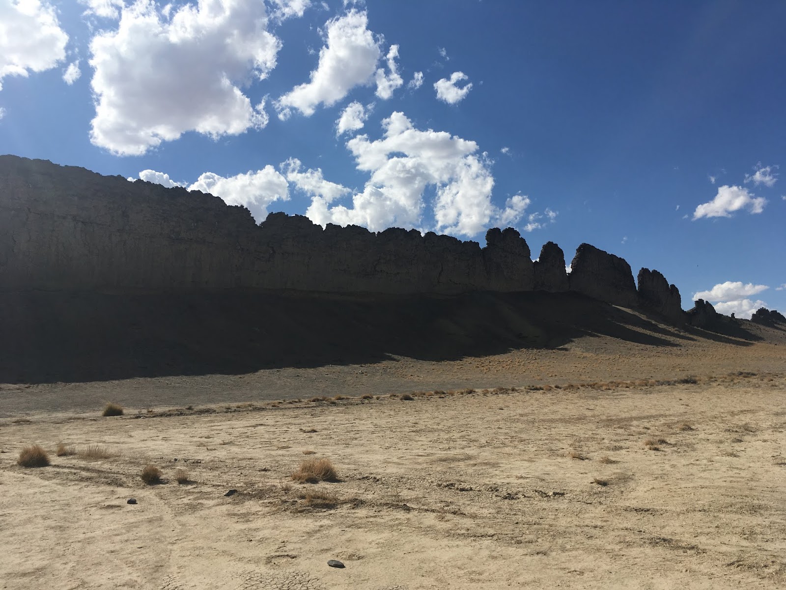
The second objective of this trip to Colorado was to collect a series of soil samples related to a dust-transport project. Recently, large dust episodes have been observed within the snowpack in and around the San Juans of Colorado. These dust events have been increasing in frequency in recent years and are starting to have a measurable effect on the snowpack and how fast it melts. The overarching purpose of the project being carried out at my lab (which is all under the greater umbrella of the NASA SnowEx project, is to try to better pin down the provenance, or source, of the dust. 

One way we can do that is to first go back and look at relevant meteorological data from various weather stations in the area. Using those data, we can run trajectory models based on the days the dust appeared, to model where it was most likely to have originated from. Then, identify and select physical sites in those projected areas for sample collection.

It turns out that almost all "dust", has a very unique microbiological signature. Quite simply, different  families of micro-organisms grow in different patches of dirt. So, once we collected our various samples, we can run DNA sequencing on the various micro-organisms in those samples, and compare the results to the actual dust we sampled from the snowpack. Then, if we find a match, we can go back and compare it to what the trajectory model predicted to see if it was accurate. Ultimately we are trying to determine if the increase in dust events is due to environmental changes in the source region of that dust. For example, is a dry/dusty area near the San Juan Mountains...getting dryer and dustier? And if so, why?

We were able to definitively identify and sample 3 specific dust layers within the snow pack,  at multiple sites around the Senator Beck Basin area of the San Juan Mountains. Senator Beck Basin is actually just up the road from Silverton near Red Mountain Pass. These collected snow-dust samples had already been sent back to the lab and tested several months ago. My job on this trip after leaving the Ice Core Facility, was to run the trajectory models, and then determine probable candidate source sites from which to collect soil samples. I analyzed the three dust events, and based on the days they appeared on the snow surface, I was able to run back-trajectories and determine two very-likely source areas:

1. Southwest of the San Juan Mountains, right over the "4-Corners" area of CO/NM/AZ/UT

2. South of the San Juan Mountains, along the CO/NM border near the town of Redmesa

I pulled up satellite imagery for Southwest Colorado, and created a candidate source map for collection based on apparent "dusty" areas, as well as where public land was available. Much of the land in that part of the 4-corners region is also on Indian Reservation land, so also requires written permission for sample collection.

A cut snow-pit wall exposing two prominent dust layers


Trajectory probability model showing both the Silverton area (upper red dot),
 as well as the likely dust source area over 4-Corners (central red star)


Trajectory probability model showing both the Silverton area (upper red dot),
 as well as the likely dust source area over 4-Corners (central red star)


Trajectory probability model showing both the Silverton area (upper red dot),
 as well as the likely dust source area over CO/NM border (central red star)

Map showing the sites I collected samples from

Dusty/dry sampling area near the iconic "Shiprock"

Sampling near a prominent volcanic rock dyke 

Another large dusty/dry area for sampling

Once back in Silverton, I had one more official task to complete before I could sneak away for some play time. Three of the weather stations we used for meteorological data collection related to the dust project are located near Red Mountain Pass. I was tasked with hiking in to these stations in order to perform some basic maintenance on them. One of the stations was right up from the highway, but the other two required significant off=trail hiking. I had an absolute blast free hiking with just my GPS to guide me.

I managed to locate all stations without any trouble, and was able to service them all before the nasty weather came in. I also took some additional soil samples at the base of each station.

Track showing hike up to stations 1 and 2.

Station #1 - "Swamp Angel"

Soil temperature probe station

Swapping out the data card

The second station after a several mile hike up to the Senator Beck basin

Station 2

Hike up to Station 3, "Putney"

Station #3, "Putney"


Having completed my primary objectives in the San Juans, I still had a couple days to kill. Let me back up for a second....

Back in July during my vacation and Hardrock preparation, I managed to knock out several more 14ers in my quest to summit all 58. Prior to this second trip, I had 11 remaining peaks to bag before I could declare my quest completed. One of my last climbs I had a rather unpleasant scare in the Chicago Basin as I took a nasty fall on my descent from Sunlight Peak. It spooked me quite a bit and I wasn't sure when I'd be comfortable attempting my next climb. I spent quite a bit of time debating whether or not to attempt another hike on this trip, and ultimately decided I'd at least start at a trail head to see how I felt. If I wasn't ready, I would simply turn around. 

Of the 11 peaks still to summit on my 14er list, 7 are in the Elk Range. I wasn't anywhere near that range so those were out of the question. 2 other peaks are over in the Crestone range in the Sangre de Cristos; also really far out of the way. The last 2 though, were in the San Juans. These were also the only two that I still had to do in that grouping. These two peaks were Mt. Wilson, and El Diente. I had previously done the nearby Wilson Peak, back in 2017, but never did get these other two done.  With time to kill on this trip, and the proximity to the peaks, I decided to head to the Kilpacker trailhead and give it a whirl. If successful, I could finish out the San Juan 14ers completely.

To save time, I had this grand plan of driving up and over Ophir pass in my rental SUV, rather than driving all the way around via Ouray, Ridgway, and Placerville. I had driven up to the pass the previous evening to scope it out, and had no trouble, so figured going down the other side wouldn't be a big deal. I googled a bit about it and it seemed like the general consensus was that it wasn't too bad. I figured even if it was slow, it would still be way faster than driving all the way around. Well...I was in for a really big shock the next morning when I started descending from the pass in the wee hours of the morning.  Thankfully my little rental SUV had moderate clearance because there is no way I would have ever made the descent in a car. The descent was terrifying and extremely narrow and loose. I honestly feared that I was going to careen off of the mountain side. It was absolutely nerve wracking and I descended very gingerly, holding the steering wheel with a death grip the entire time. I thought for sure, even if I did make the descent, that I would most certainly damage the undercarriage of the car or get a flat tire. Somehow though, I managed to navigate all of the tricky spots good enough to make it through. I definitely bottomed out several times though and only hope that the rental company never figured it out. For anyone reading this, please take notice. The Ophir pass road is really only suited for high-clearance 4x4's.  Anything less, and you are in for some stressful miles without any real options for turning around.

Here's a video of someone driving UP the bad side of Ophir Pass that I went down.

The long (safe) way around from Silverton

The Ophir Pass (stressful) route

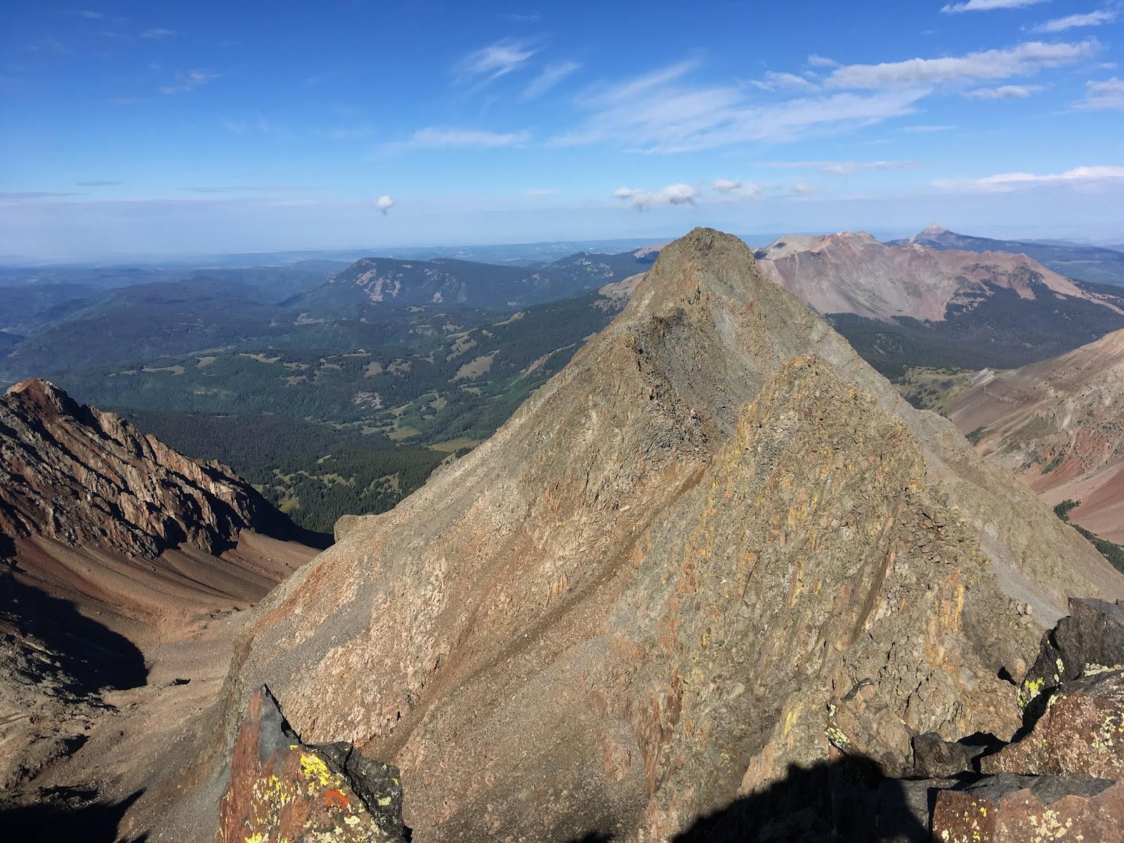
Once down on the other side I was over to the Kilpacker trailhead in under 30 minutes. I started my hike at about 5:30 am and was making quick work of the easier trail section down low. In just over an hour, I had already made it past 3 miles and was beginning the more technical climbing above tree line. I was still fine to continue, so happily pushed on. At 2 hours exactly, I made it into the upper basin and the primary decision point turn off. At this spot the trail splits, with one trail going up to Mt. Wilson, and the other turning left and going up to El Diente. It's possible to go up to either and then traverse across the ridgeline to the other, but I was not going to attempt this class 5 maneuver. If I were going to do both summits, it would mean summiting one, and then dropping back down to the junction, and summiting the second peak separately. I opted to shoot for Mt. Wilson first as it was the longer climb, and higher summit. I figured if I had to come back and just do El Diente on a different day, then it would be quicker overall.

The climb up after the junction began to get very loose and scrambly. My pace reduced notably, but I was still feeling great and was not spooked at all. I could tell I was moving very slowly, but pushed on. My goal was to summit in under 3 hours. The last pitch is the crux of the route, and does have some exposure. I took it very slowly and had no trouble. At this point I just had one final short pitch to the summit, so continued up. I hit the top in just under 3 hours and felt great. The actual summit was quite small and was fairly exposed. I took a few quick pictures of the El Diente traverse as well as views over to Gladstone and Wilson Peaks, before quickly descending back down.

I purposely descended a bit slower than usual because I was still a little shaken from my fall coming down Sunlight the previous month. After about 10 minutes of descent, I looked up towards El Diente and realized that if I started contouring around, I could meet the El Diente trail part-way up, and would save myself several hundred feet of descent/climb. I peeled off of the route I was on and began to contour over on an open off-trail route. It was slow going, but effective. at 3hrs 15minutes clock time, I was already over to the El Diente trail. I figured from here, it would be a super quick up and down, and I'd be back to the car in no time. 

But...things never work out just the way you want in the mountains. My pace was slowing considerably, and the weather was starting to turn. I was only a few hundred feet below the summit, but didn't want to turn back. I kept pushing up to the ridgeline, and just before topping out, it started sleeting. I was only a few minutes from the summit, but the rocks were getting extremely slippery. I took a long look at the sky and opted to just quickly go for it. I hustled over to the summit in the freezing rain, tagged it quickly, took a couple photos, and immediately began descending. I was slipping on a lot on the rocks, but was making progress. I made it down from the ridge line and began spotting cairns for the trail. I hit the main trail junction in just under 4 hours total time, and felt relieved to be nearly back on soft trail. I just had to hike about a mile on rocky exposed trail before hitting treeline, so figured I was in the clear. I sauntered along without a care, when about 5 minutes later I was greeted with a sky crushing boom of thunder and lightning. It was close! I quite literally began running as fast as I could along the trail, just praying to make it to treeline in time. I didn't even  stop to put on my rain gear. I just ran. The lightning was getting closer, and what's worse, was that I wasn't alone on the trail. I passed a few others also trying to descend. Everyone was running scared.

I did make it to tree line safely, albeit with soaked clothes. By the time I was deep into the woods at lower altitude, the rains had stopped and the thunder and lightning seemed to be isolated near the peaks. Looks like I would live to hike another day. The trail down low had turned into a river so when I did make it back to my car, I was caked in mud up to my knees. Somehow, my car still had four full tires as well, so my little adventure over Ophir pass didn't seem to damage anything. I called it a successful, although lucky, day.

With this little adventure, I was able to complete the San Juan 14ers, leaving me with just 9 peaks remaining: The Elks, and the two primary Crestone Peaks.

Strava track for Wilson and El Diente:

Route showing my full hike.

Mt. Wilson summit

El Diente seen from Mt. Wilson (and the class 5 ridge traverse)

Wilson Peak (left) and Gladstone Peak (right)

Mt. Wilson summit shot with El Diente in background

El Diente summit, looking east to Mt. Wilson summit

On El Diente, with the sleet falling

El Diente Summit with Wilson Peak (left), Gladstone (center), and Mt. Wilson (right) in view

Looking along the class 5 traverse to Mt. Wilson

Back near my car at the end of the hike. El Diente is visible (left rear peak)

After my fun hike, I drove down to Durango so that I could catch my flight out the following day. While there I had the incredible good fortune to catch up with some very old friends.

Quick rewind....

Back in 2007 during my Appalachian Trail thru-hike, I met and hiked with quite a few people. With that said though, there weren't too many that I stayed in contact with following the hike. There was one couple I met on my third night just before hitting the North Carolina border with trailnames: Stitch and Figgy. Apparently Stitch liked to sew his own hiking gear, and Figgy really liked figs. I remember really hitting it off with these two, but the next morning I hiked on ahead, and never saw them again.  Months after finishing my thru-hike, Stitch found me on-line and reached out. We've been internet corresponding on and off ever since. They live in Durango now with their three kids, and in July, during my running at Hardrock, they had both driven up to Silverton hoping to see my finish. I was not aware of this and only found out because they had left me a note on the public message board. Ultimately, they had to leave before my finish, but I did manage to write their phone number down just in case I was ever in the area again.

Well....after my Wilson/El Diente hike, I was headed for Durango. I sent a quick text to Stitch, and just like that I was at their house just a short bit later, enjoying some great company and stories. One of the things I love about thru-hiking, is that you can spend an evening talking with friends that you met on your third day of hiking....that you haven’t seen in 11 years....and it feels like you just saw them yesterday. 

Thanks for a fun evening in Durango, Stitch and Figgy. -Lakewood

Stitch and Figgy in 2007 on the AT

Stitch and Figgy in 2018 in Durango

Tuesday, November 20, 2018

Worsley

Henry Worsley arriving at South Pole station

Last night I was making my weekly drive back up to Vermont from Boston. I managed to somehow time it just right so that I was navigating up Highway 3 North during the worst of the weather. I suppose I'm not always the most prudent when it comes to checking forecasts.

As I was white-knuckling the slick, and ice-covered roads (sans snow tires I might add, because I'm an idiot), I had NPR tuned on the radio. On any given Monday night in Boston, the show "On Point" airs at 8:00 pm on WBUR. Normally I don't pay too much attention, but when I heard the program's introduction, I immediately took notice.

The show's topic: Henry Worsley and his solo Trans-Antarctic expedition. The show featured author David Grann discussing his new book on Henry's traverse, as well as interviews and discussions revolving around two men who are currently attempting the same traverse. Listening to the program brought back some powerful memories and emotions.  I'll explain...

Let me back up for a second and start this story with Sir Ernest Shackleton. A good portion of the general population has at least heard of the story of Shackleton. Books have been written about him, documentaries have been made, and the overall magnitude and heroism of his story will likely live on in history as one of the greatest feats of endurance and perseverance. For those of you that maybe don't know the whole story, or who just need a reminder, here's the 2-minute elevator version:

Shackleton set out to be the first to the South Pole. In 1907-1909, he set out on his Nimrod expedition to undertake this endeavor. He set up camp at Cape Royds (a place I visited in person a several years ago), and then began the long trek. After battling horrible conditions, Shackleton and his team of Adams, Marshall, and Wild, made the difficult decision to turn back just 97.5 nautical miles from the geographic pole. This decision was driven by not just the conditions and deteriorating health of the crew, but because they had determined that there simply wasn't enough food remaining to make it to Pole, and return back to Cape Royds. A famous photo was taken at the moment they turned around. I wrote a little more about this (as well as my trip to Cape Royds) on an old elementary school educational outreach blog I had up many years ago, here: 


Shackelton and crew 97.5 miles from Pole (1909)

Shackleton's Cape Royds Hut

Just a few years later, Roald Amundsen would take the honor of the first to the pole, beating out Robert Falcon Scott by just a month. Again, there are famous photos from these expeditions. 

Coincidentally, during my 2015-16 field work at South Pole Station, some colleagues and I participated in a photography project meant to re-create some of these these famous pictures....


Amundsen's Party at Pole

Our re-creation

Scott's Party at Pole

Our re-creation.

When Shackleton learned the news that Pole had been conquered, he set his sights on a new quest: Being the first to transect the continent of Antarctica on foot (well...on ski, but you get the idea). His plan, was to land on the Weddell Sea side of Antarctica, traverse up to Pole, and then back down the Ross Ice Shelf side ending back on Ross Island (near present day McMurdo Station). This is where the famous story of the "Endurance" comes into the picture. Shackleton's main party never even got started as his vessel became locked in sea ice and drifted around the Weddell Sea. Eventually, Shackleton and his crew made it to the remote and inhospitable, Elephant Island, where they were marooned after their primary ship, The Endurance, sank. Some time later, and in a desperate attempt to save his ailing crew, Shackleton selected a handful of his crew and traversed over 800 miles of rough seas in the tiny James Caird lifeboat....to eventually make it to the island of South Georgia. From there he was able to finally rally up assistance and organize a rescue. Many months later, he did return to Elephant island to recover his entire crew. Miraculously, not a single member of the expedition that was on Elephant island perished. It is important to note however, that Shackleton had an advance team marching to Pole from the opposite side of the continent, laying supply caches. Three members of that Ross Sea party, did perish.

Shackleton's famous journey to South Georgia

The James Caird pushing off of Elephant Island

The part of this story that brings it all back full circle to the story I was listening to on NPR, is this: One of the members of Shackleton's crew that was on board the lifeboat, the James Caird, was a Kiwi navigator named Frank Worsley, a possible distant relative of Henry Worsley. I say possible, because while Henry had claimed he was a distant relative, I don't know that it was ever actually proven. Regardless, Henry's eventual Trans-Antarctic expedition, would end up being modeled directly after the route and expedition planned by Sir Ernest Shackleton himself, which included Frank Worsley.

Despite Shackleton's attempt being over a century prior, and with many since completing the same journey, no one had yet to complete it 100% solo and self-supported. What I mean, is that no one had yet crossed the entirety of Antarctica, pulling 100% of the supplies they'd need from day 1, and using no pre-dropped supply caches. This was Henry's ultimate goal: To follow the route of his distant relative Frank (which was never actually carried out at the time), and to do it completely self-supported, and under human-power only (i.e. no kites)

Henry's proposed route...an homage to Sir Ernest Shackleton.

I knew nothing of Henry Worsley or his expedition in late 2015. All I knew was that after 6 Antarctic deployments, I was finally going to be headed to South Pole station. I had been wanting to make it to Pole ever since first setting foot on the Continent. I came close back in 2011 during a deployment to Union Glacier. Our flight out back to McMurdo needed to stop for fuel and it was between either the WAIS Divide field camp, or South Pole. 9 out of 10 times that decision would be South Pole...but this one time, it was decided that WAIS was the better call, so I thought for sure my one true chance at getting to pole was lost.

But, just a few short years later, I would be invited to participate on the new South Pole ice coring project and managed to finally get set up for a 2 month deployment at 90S. Needless to say, I was ecstatic.

Something a lot of people don't realize about South Pole is that there are actually two "poles" there. When the new elevated station was being built over an 8 year period at South Pole (Starting in 1999-2000), the famous "Barber Pole" style marker was placed at the actual 90S geographical pole, directly in front of the station. Surrounding this marker were placed the flags of several nations who also all participate in Antarctic research. 

BUT...the ice at pole is not stationary. Like any smaller glacier, the massive ice sheets also move and deform under their own weight. My advisor like to always say, "Imagine an ice sheet is just a really big pancake. It's going to flow and spread out". Well, the surface ice at South Pole moves about 10 meters year.  What this means of course is that every year, the actual 90S Geographical South Pole marker, moves 10 more meters away from the station. Of course what is really happening is that the pole isn't moving at all, it is the station that is moving 10 meters a year away from the actual pole. By the time I arrived at the station in the Winter of 2015 (Austral Summer), the Geographical Pole was already over 100 meters away from the Ceremonial "Barber Pole".

Aerial view of South Pole Station and the "Poles"

Another view of the two "Poles"

Related to the actual pole of course is the incredible desire by many to actually visit it. I find it absolutely incredible that for so many years, entire crews of explorers set out to make it there. Many died, and most never made it to the pole. The stories of Shackleton, Amundsen, and Scott, still manage to stir something in us all, and capture the imagination. Yet, almost exactly 100 years later, I landed safely near the pole via plane, stepped outside of my heated dorm room just minutes later wearing running shoes and Carhart pants, and celebrated arriving at the same Geographical South Pole. It seemed unfair.

While stationed at Pole, I noticed several tourist groups that came through to visit the pole that weren't associated in any way with the station. I was curious how this worked, and came to find out that a small company called Antarctic Logistics and Expeditions (ALE) operates a very small (bare bones) camp about 1 km away from the primary research station. They contract with Ken Borek air transport for a small ski-equipped plane which takes tourists to and from the station a couple times a week from their main camp at Union Glacier. Anyone can pay for one of these trips....it'll cost you about $50,000 though.

One of the things that absolutely blew my mind regarding these visits was just how short they were. The small DC3 would land on the skiway and taxi right over to the ALE camp. Within minutes the tourists were unloaded and given a short briefing. Then, they'd skidoo quickly up to the Pole and take pictures. After less than an hour, and as fast they appeared, they'd be loading back on the plane and flying away again. There were usually a couple that stayed behind as they had requested to "spend the night" at Pole, but most left after they took their pictures. 

Here's the absolutely ridiculous part though. I'd sit in the galley, watching these tourists out the windows of the research station. I'd often wonder what they were thinking, how far they'd traveled, and just how far up on their bucket lists visiting the pole was. For many of these folks, they were undoubtedly cashing in a large part of their retirement just for this once-in-a-lifetime experience....

....BUT...without fail, every time I watched these tourists skidoo up to the pole, they'd always end up going to up to the "Ceremonial" Barber Pole, and not the ACTUAL 90S Geographical Pole. I'd watch as dozens of high-paying tourists posed for 30 minutes in the -35C temperatures, in order to take hundreds of pictures huddled around the recognizable spiral pole and the circling national flags. They'd take serious shots, funny shots, upside-down shots....you name it.  All with huge grins on their faces. Then almost every time, the entire crew would skidoo back away to the plane and never actually take the 100m walk over to the TRUE 90S South Pole. In other words, these tourists were paying over 50,000 dollars for a once in a lifetime opportunity to visit the actual South Pole, and never actually visit it. They'd only ever make it to within 100 meters of it, without truly ever setting foot at the Pole itself. It absolutely blew my mind. Even the wikipedia page on the South Pole is pretty clear on this. Without question, the first place I wanted to visit upon touching down at South Pole station was the 90S marker. I barely even got my gear to my dorm room before running out to see the marker. I honestly didn't care at all about the Ceremonial Pole. But I suppose to most people, getting within 100 meters is close enough maybe? For someone like me, who's so geeked out on geographical oddities and superlatives, I wasn't content until I was standing on the actual surveyed spot, and my GPS read 90S. Heck, I even walked 100+ meters both in the up and down ice-flow directions of the marked pole, just to be sure I was actually hitting the true 90S. I guess I'm a bit particular like that. I figured for me, this was likely the only time I'd ever be there, I'd better make it count!

At any rate.....back to real story here....

Finally made it to South Pole Station after 39 years!

The nearby "Ceremonial South Pole" in front of the station.

The top of the Ceremonial Pole (with flags in background)

My Garmin GPS registering 90S exactly

Location of the ALE Camp before being set up for the year
(~1 Km from South Pole Station)

While stationed at pole, I worked on a team that was responsible for drilling and logging a new ice core down to a depth of 1700 meters (and over 50,000 years old). We worked non-stop, 6 days a week, on three shifts. It was a tough schedule, and resulted in only one day off a week. These days were precious. I often took them to write postcards, catch up on some overdue reading, or research. Usually though, I was out skiing or running outside in the frigid temps.

The South Pole Ice Coring Team (minus 2)

Recovered core

Me examining a core for defects and ash layers

On one particular Saturday night, our ice-coring group received a rather unique invitation. While enjoying our one evening off  during the week, the two camp managers for the ALE camp stopped over to socialize a bit, and share a few drinks. Their camp had emptied out and so they were all alone for a couple days until the next tourist group came in. They asked us if we wanted to take the 1 km walk over to the camp after lunch on Sunday to get a "tour". This was somewhat of a silly thought since their camp only had a couple of small collapsible buildings, but still, we graciously accepted the invitation. Normally, the ALE camp is completely off-limits to NSF staff, personnel, or researchers.

After lunch on Sunday, a group of us made the 10 minute walk down to the ALE camp from the primary research station. There wasn't much at the ALE camp except two collapsible operations buildings not much bigger than large tents, and then a grouping of smaller camp tents for the tourists that opt to "spend the night" at pole (for an extra fee of course). 

I remember distinctly that the walk over to the ALE camp was slightly more difficult than normal due to what is often referred to as "flat light". What this means is simply that the sky is completely overcast, creating almost zero contrast or shadows on the surface of the snow/ice. Because of this, it is almost impossible to "see" any surface features on the ground. It is very unsettling and can really create a sense of vertigo. It can feel like you are walking on void space, with no discernible interface or boundary between the sky and the ground.  It often results in tripping over your own feet quite a bit. On a skidoo, it can lead to serious wipe outs as well, especially if you don't see big bumps in the surface, or small elongated snow "dunes", (also known as "sastrugi"). I've seen many a colleague launch into the air on a skidoo because they didn't see the sastrugi.

Flat light day in Antarctica. Where's the ground? Where's the sky?

So finally coming full circle....and back to Worsley...

We sat there in the small heated tent of the ALE camp, and the camp manager told us some rather ridiculous stories from some of their tourist guests. We traded stories back all about our science objectives and how the ice coring project was progressing. As we were all trading these stories, the other camp manager came inside and told us all something remarkable. 

He said, "So hey guys, it is your lucky day. Henry called us a short bit ago on the Satellite phone, and he should be pulling up to camp some time in the next 10 minutes or so."

No one in our group knew who Henry was, so we listened intently for the next 10 minutes as they told us about his expedition, and what he was trying to accomplish. He had been out on his own for over 40 days, marching his way up to the Pole on the polar plateau. Because he was self-supported, he would not be taking any aid at Pole, but ALE was nice enough to let him set up his tent in the cluster of tourist tents nearby. Both of the managers told us specifically to not offer him any aid, but that we were certainly allowed to talk to him and listen to whatever stories he wanted to tell us. I couldn't believe it. 

I thought to myself...There's no way we're going to just walk out the back door of this small camp tent, and see some random guy skiing up out of the void pulling a 200 pound sled. It just seemed so impossible. There's just no way. Of all the places on Earth, there's no way that this specific person is just going to appear.

But then, I stood up, walked out the back door, just about 10 minutes after they first told us about Henry. I peered off into flat white void, in the rough direction he'd likely be coming from. As I stared, absolutely sure I'd see nothing but the emptiness....I saw it. I saw a faint, and almost ghost-like phantom, slowly materialize out of the void, right in the place I was staring. I could not believe it. There's no way that this man, who has been solo skiing for over 40 days, just appeared out of the nothingness, exactly at the moment I was looking for him. But that is exactly what happened. I took a quick photo with my camera just to capture that moment, and immediately burst back into the tent to tell the others that I saw Henry coming. Everyone rushed out quickly and my disbelief was put to rest as others too agreed they saw him coming in.

My first sighting of Henry arriving at the ALE camp at South Pole

Within just a few minutes he was up to the camp, and had disconnected himself from his sled at what would end up being his camp site for the night. He talked for short bit with the camp manager and then walked slowly over the group of us ~10 eager scientists.

Henry stopping for the day

I'll never forget what he said to us as he first walked up. He said,

"I've been alone for quite some time. You are all the first people I've seen in over 40 days, and is so good to talk to you all. It is so good to talk to anyone."

He went on to tell us that that the conditions up to Pole were very difficult. The sastrugi were much bumpier than anticipated, and the weather much nastier....which all meant for slow and exhausting days. Henry was a few days behind schedule, but visibly happy that most of the rest of the journey would be ostensibly "down hill". Other than a very slight rise up to Titan Dome the next few days out of Pole, the remainder of his journey would eventually lead back down from almost 10,000 feet, back to sea level. He looked visibly tired and battered, but overall in decent shape. Something about the way he talked though, definitely carried a heavy weight of weariness. 

We all asked him dozens of questions and he was eager to answer, and quite simply, to talk. I felt genuine happiness for him as it was clear that he had been missing the company of others. Seeing his eyes light up as he came up to us told me just how much it meant for him to simply see other people.  Here was a man who has done many traverses in Antarctica, but yet seeing other people and being able to smile and laugh amongst us for even a short time, made him into a new man. After some time, we eventually had to part ways to head back to the research station. We all shook his hand and thanked him for the fantastic stories, and for inspiring us all. We wished him well for the rest of his journey and I took one final photo of him before leaving the ALE camp. As we started the walk back, Henry went back to his sled and set up his tent for the evening. I remember thinking how kind it was of him to spend so much time answering all of our questions, when he could have been resting.

The next morning when I woke for my work shift at the ice-coring facility, I learned that Henry had already left a few hours prior. I remember thinking what an incredible story I would have to tell friends and family about back home. I could tell them I got to meet the man who was the first to transect Antarctica...in the middle of his journey. And what an inspirational and incredible man he was.

But sadly....this was not the eventual story I would tell...

Henry telling us the stories of his journey
(fellow ice-core driller/friend on the left)

A few weeks later at camp, our crew was wrapping up drilling for the season. We were again celebrating on a final Saturday night when the word came into camp...

Henry had made it to within 100 miles of his final destination, but due to physical complications, had to end his journey short, and call for an emergency medical evacuation. His designated flight crew managed to pick him up safely at his location, and bring him back to their primary camp at Union Glacier.  During the final few days however, Henry had developed an infection in his peritoneum. He was eventually flown back to Chile and admitted into a Hospital. But by that time however, the infection had become septic and he ultimately succumbed to it. Henry, the incredibly inspiring explorer that I had met just a few weeks prior, was gone.  

The news of Henry's passing was quite heavy for the entire South Pole station. We were all affected by it deeply and thought a lot about the day we all had the honor of meeting him just those few short weeks earlier. 


I will never forget that day Henry. I'll never forget the day that I listened to you recount the incredible details of your journey, and then thought to myself.....Explorers really do still exist. So keep exploring Henry, and may our paths cross again somehow. Oh the stories we might tell.