In the high country at Western States
As I sit here, calmly enjoying an early summer day, I am filled with both a sense of satisfied contentment for what I have just accomplished, but also a sense of palpable trepidation for what is to come. This past weekend, I successfully navigated my way through the mountains and canyons of northern California along the Western States 100 course to again cross the finish line in the town of Auburn...and thus complete my 99th official ultramarathon. This was my second running of this event, and this year, I bested my previous time by almost 50 minutes. The snow conditions in the early miles were quite similar to those in 2017, however the overall temperatures during the mid-day, were much more forgiving this year. As a result, I was able to move well, and move consistently all day...and nibble away at my previous time. The ultimate result was a successful day, with no major blowouts, injury scares, or other issues. I sit here today, just 4 days later, feeling quite well and ready to run again.
If the story ended there, then it would be a worthy of a celebratory drink on the back porch, with feet elevated, and accompanied by well-earned sense of achievement. But, the story doesn't end there.
In just over two weeks, I'll be again lining up for another 100-mile jaunt through the wilderness...but this time well over 9000 feet, and with almost twice the amount of elevation gain. I will be lining up in Silverton Colorado, for the annual running of the Hardrock Hundred Endurance Run. The good news is that I have run Hardrock before, so I have an idea of what to expect out there. The bad news is that this year, I will be going in the other (and arguably harder) direction....and there will be significant amounts of snow still on the course (when I ran the course in 2018, there was almost no snow at all).
So, I could fret. I could worry. I could panic. But instead I choose to breathe in the cool air, and be grateful for what I have been able to do in California, and what I have the honor and privilege to be a part of in Colorado. I know it will be difficult and challenging. I know it will require an enormous effort. I know it will take everything I have to reach the "rock" (finish line). So....I will show up ready and willing to head forth into the wilderness bearing a smile, an eager spirit of adventure, and of course, my trekking poles.
A Brief Race Recap
I arrived in Tahoe City on Wednesday, giving me two full days to relax and take care of race logistics. One thing that was noticeably different from my past running at Western States, was that upon arrival, I already knew that I was in the starting field. There would be no nervous nail biting as I wait to hear if I might come off of a wait list. This made the entire experience quite different from what I had in 2017. I could enjoy the pre-race festivities, check out the gear store, and otherwise let my mind relax. I spent most of the day Thursday, mulling around the Olympic Village, and shopping for WS gear...and then on Friday, I took care of my drop bags. At 2:00 PM on Friday, I attended the runner briefing and learned that we should expect a lot of snow up top in the high country, but much cooler temps in the canyons as compared to normal. I wasn't too worried about the snow, but I knew if I had to contend with temps like I had in 2017, it was going to be a rough day. Hearing that the expected highs (even in the canyons) wasn't supposed to top 85 degrees, was very welcome news.
Another thing that made this year's running different was that was I sharing a rental condo with some friends from back east (one of which was also running). In addition, I had a planned pacer that I would be picking up at mile 62. This pacer, Deb, works in the same department at the University and had offered to pace when I first learned I'd be running (last December). Typically, I don't use pacers much anymore, but I knew that having one for Western States is really beneficial. I've run with Deb many times back home on training runs, so knew that she would be excellent company in the wee hours of the night as well.
After the runner briefing, and having dropped off all of my gear, I headed back to my airbnb, ate a healthy serving of pasta, and went to bed as early as I could. Alarms set for 3:30 am.
One quick important note: Just four weeks prior to the race, I had run about 50 miles of the Western States course with my friend from back east, Melissa, as part of the "Training Camp". We had a grand ol' time, but the snow was definitely still quite expansive in places. I had heard that in the 4 weeks leading up to the race, the temps had been high and much of that snow had melted. But, from just looking up at the high peaks towards and the first 4 miles of the course that lay ahead, I knew we were still in for quite a bit of the white stuff. Melissa, was also in the starting field for the race this year.
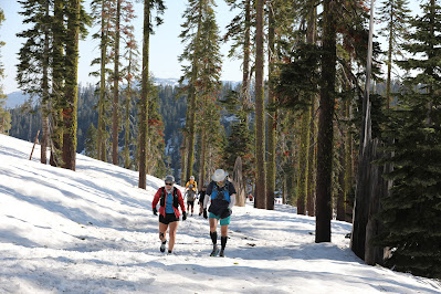
Western States Training camp with Melissa (Late-May)
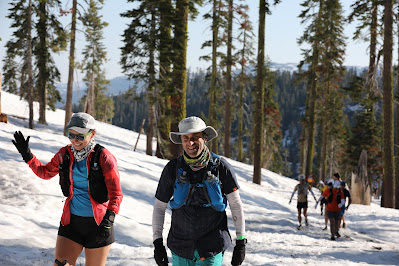
Western States Training camp with Melissa (Late-May)
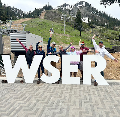
Hanging out with the gang near the start line
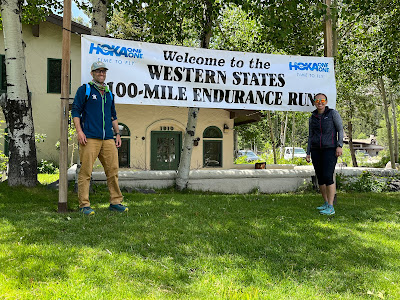
Melissa and I getting the quintessential "welcome" shot

The new start line (moved a few hundred meters)
Pre-race photo at the start with Melissa
Pre-race photo at the start with Deb
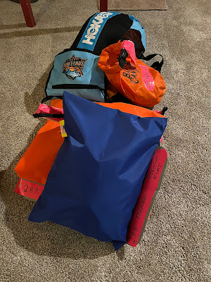
Drop bags packed and ready
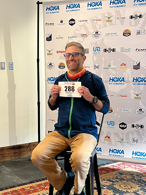
Getting my official race photo
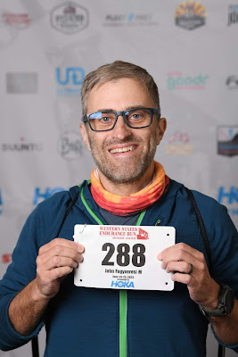
2023 official entrant photo
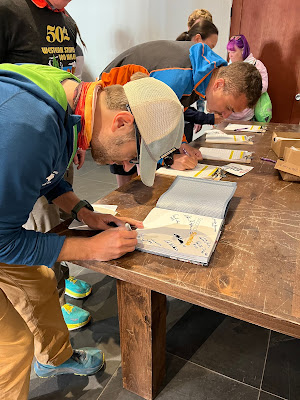
Signing the runner book and other paperwork
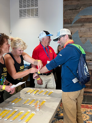
Getting my wristband...it's official!
Race morning starting about 3:00 am when we all woke with the pre-race jitters. I put down a healthy bowl of muesli and drank two full bottles of water (I was trying to be super proactive with respect to hydration this year). We all headed over to the village about 4:00 and had an hour to kill until the gun went off. About 5 minutes before the start, I said "see you later" to Deb, and headed to the start with Melissa. A look up at the snow levels on the peaks revealed an almost identical amount of snow that we had in 2017. I went back after the race and compared photos from both years, and it's frankly remarkable how similar the snow levels actually were.
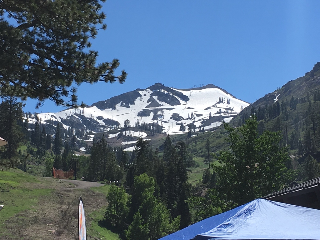
Snowy peaks at the start in 2017

Snowy peaks at the start this year (nearly identical)
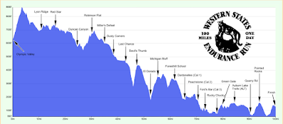
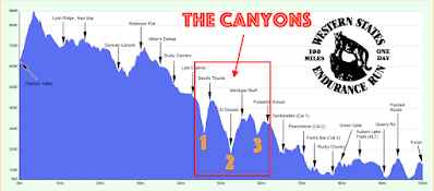
Western States Elevation Profile
I shared a few last minute words with Melissa, wishing her luck and then...promptly at 5:00 am, we were off! I trotted my way up the approach road making use of the snow-free terrain while it lasted. About 2 miles up the climb though, we left the comfort of the road, and headed straight up the snow fields towards the escarpment (the highest point on the course). I didn't have my split times from 2017, but knew I had hit the top a little over an hour into the run. Similarly, I hit it just a few minutes past the hour this year. I made sure to stop again at the top, turn around and admire the beautiful sunrise. I looked down briefly to see if I could spot Melissa behind me, and caught a quick glance of her not too far behind.
As expected, on the backside of the climb, the trail was clear for about 1/4-mile, but then immediately turned into a snowy wonderland almost exactly like what I went through in 2017. For the next 10 miles, all the way to the first aid station at Lyon Ridge, we had almost continuous snow. Every once in a while, we'd get a few hundred feet of trail, but we were almost exclusively slipping and sliding along snowy drifts. I manage ok on snow (given all of my experience back on the PCT), and kept a steady pace. I monitored my heart rate carefully to make sure I didn't get carried away though. It's easy to push a bit hard and burn too many "matches" if you're not careful. Dealing with snow can sap a lot of energy if you just try to plow through with reckless abandon. When my heart rate started to climb, I eased back, all the while not worrying about how I was passing, or who was passing me. There was a lot of race left.
The first aid station took a while to reach given the conditions, but once there, I topped off my bottles, grabbed some snacks, and was out rather quickly. For the next 6 miles to the Red Star station, the trail continued to be heavily covered with snow, but significant gaps were starting to open up. The staggered nature of the snow made it hard to settle into a rhythm though. When I hit Red Star, I really had to use the porta-potty, but it was in use when I arrived. I decided it was worth it to wait, so lost about 5 minutes at this aid station. In retrospect, those 5 minutes would end up being the difference between a sub-27 hour finish...but so it goes with races I suppose. I guess I could have just used "the woods" for my bathroom break. ¯\_(ツ)_/¯
Cruising along some clear single-track in the high country (snow visible in back)


Climbing Cougar Rock
Heading out of Red Star, we began the slow descent down to Duncan Canyon. We were told two things about this stretch by the race director. First, once we began descending, it would be mostly snow-free. Second, the creek crossing at the bottom was "waist high". The descent was the first time I felt like I could open up a bit and it felt great. Coming into the Duncan Canyon aid station around mile 25, I was feeling good, floating along, and optimistic that most of the snow was behind me.

Nearing Duncan Canyon Aid Station

Nearing Duncan Canyon Aid Station (and moving well)

Coming into Duncan Canyon Aid Station (and moving well)
I left Duncan Canyon for the river crossing, and was feeling good. On the many descents in this section, I was moving somewhat conservatively and getting passed a lot, but I was doing really well on the climbs (passing just as many). Part of the reason I was a bit timid and somewhat "afraid" to open up too fast, was that during the training camp just a few weeks prior, I took a really nasty fall. I was going a bit too fast, and clipped my toe on a rock and went hard into the ground. This fall nearly de-railed my entire "Double" and I was actually worried I wasn't going to be able to run. I had fallen monumentally hard on my right knee, and had to take a week off from training while I recovered. Thankfully it did heal in time, but it really spooked me, and had me constantly reminding myself to "watch the trail", and "keep the pace easy". As as consequence of my spill, I ran the race with leather biking gloves in case I did fall again.
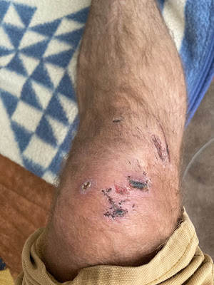
My right knee just two weeks before the race
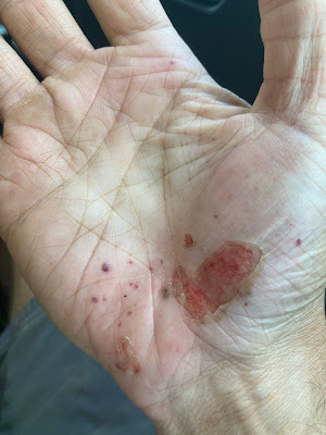
My right hand before the race
When I got to the Duncan Creek crossing, a rope had been set up to help runners get across. When I stepped in, the water immediately went up to my stomach and it was a bit of a surprise. The water was also incredibly cold and took the air right out of me. Once on the other side, it took me a few minutes to catch my breath again.
The climb up out of Duncan Canyon to Robinson Flat was the first significant climb on the course after the big haul up to the escarpment at mile 3. I pushed through it consistently and strongly and in less than an hour, I could hear the people cheering at Robinson Flat. This would be the first aid station where'd I'd see Deb and Melissa's crew. I planned to sit briefly, to assess my gear, and then move on in under 4 minutes. About a half-mile before the aid station, I had navigate one last section of full snow before hitting the road. I was shocked to see how clear Robinson Flat was of the white stuff, given just 4 weeks prior the drifts were over 8 feet tall.
I rolled up to all of my friends, sat down and immediately asked, "How far back is Melissa?" I was then told by her crew, that based on her live tracking, she was in danger of missing the time cutoffs. I knew Melissa was worried about the snow slowing her down (as well as the altitude), but I also knew that if she could get through it, she'd easily make up time after Robinson Flat when the snow was supposedly all gone. I told her crew that I was rooting for her, and then filled my bottles and rolled out. As I made my way down the road, I had fond memories of starting this stretch with Melissa just a month prior during the training camp.
For the next ~13 miles, the Western States course presents runners with probably the most beautiful and runable stretches on the entire course. At one point a volunteer was directing runners at a junction and he told me, "get ready for about 5 miles of pure awesomeness". He wasn't lying. I had a smile on my face for the entire stretch...just soaking it in. I ran most of it, and tried not to look at my watch too much. This section was recently burned in an expansive wildfire, so there were considerable exposed areas, but the temps were still behaving. In the back of my mind, I was starting to get nervous about the looming canyons.
Starting around mile 44, the Western States course presents runners with what I believe is the most difficult stretch of the entire race: The dreaded Canyons. The "Canyons" consists of three significant down-and-ups in a row. Each canyon involves anywhere from 1600 feet, up to 2000 feet of descent....followed immediately by an equivalent climb. In 2017, the canyons absolutely kicked my ass. Of course it was also over 100 degrees at the bottom of each, so I simply got sapped by the "oven-effect". This year, we were presented with much more modest mid-80s.
As I dove down into the first canyon, I quickly recalled the short and steep switchbacks. They always seem to go on forever and the river at the bottom never seems to come. I firmly believe that the first canyon is the worst of the three despite not being the most elevation loss/gain. The climb out up to Devil's Thumb is steep, and soul-crushing. In 2017, I nearly quit the race at the top after being completely drained on the climb. This year, though, I moved steadily, and consistently and was frankly shocked at my progress moving up to the Thumb. I probably passed a dozen people on that climb and once on top, I was already running smoothly again. I only spent a few moments at the aid station was on my way to the second canyon (El Dorado) quickly. The descent and climb out of the second canyon does lose/gain more total feet, but the gradients are noticeably less. This means the climb is longer, but I think much more forgiving. I put my music on in my earbuds, put my head down, and plowed my way through the second canyon as quickly as I could.
The dreaded three "Canyons"
At the top of the second canyon, runners are welcomed at the Michigan Bluff aid station. This stop is quite lively and was a really nice welcome. I spent a few minutes there re-hydrating and putting down some more substantial solid food. As I left the station, I knew I had just one final canyon remaining, and the easiest of the three. Then, in less than 6 miles, I'd be at Foresthill and picking up my pacer, Deb. Once runners pass Foresthill, the entire feel of the Western States course changes. There are very few big climbs left, and the entire course becomes noticeably more run-able and subdued. I was hoping to really try to run a lot of the final 40 miles this year (as opposed to 2017 when I walked a fair amount of those miles)
The final canyon went quickly and I noticed that sun was starting to get quite low in they sky. I remembered in 2017 I had reached Foresthill just as I needed a headlamp, and was hoping to make it there this year a little sooner. My watch told me that sunset was about 8:40 pm, so was aiming to come in under that if I could. I didn't know my exact time from 2017, but guess it was probably about 9:00 pm.
I descended quickly down to the creek crossing of the final canyon and had to again get my feet wet, but then the climb up to Foresthill went incredibly quickly. In what seemed like just a few minutes I was already on the paved "Bath Road" that leads up to town and feeling surprisingly good. I topped out on the climb about 1/2-mile from the aid station and picked it up a little to a nice running pace. As I approached the station, I looked at my watch and it read 8:38! I had made it before dark!
I immediately spotted Deb and got pumped for the company. But then...I also caught something unexpected out of the corner of my eye. My sister-in-law and her partner had driven up from their home outside Sacramento to cheer me on! It was so great to see them and I eagerly hugged them both. I also learned from Deb that Melissa had missed the cutoffs and her entire crew had left to assist her. This news definitely saddened me, but there wasn't much I could do about it. I told myself that I would keep Melissa in my thoughts over the next 40 miles and try my best to "bring her along with me".
Deb and I geared up quickly, restocked our fuel and waters, and then headed out of town and into the night. I said goodbye to my family, switched on my headlamp, and began the steep descent down the first of the "Cal Street" aid stations.
"Rocking Out" while arriving at Cal Street aid station
Over the next 16 miles, Deb and I shuffled along the river, at much lower elevations, trading good stories. I was able to run most of this stretch and it felt so good to have some company to chat with. We began ticking off aid stations one by one, and within just a few hours, we were approaching the famous Rucky Chucky river crossing. In 2017, I hit this crossing feeling like absolute death. This year, the two of us were feeling good, and I was over 20 minutes ahead of my time from 2017. We hit up the aid station at the crossing, and then hopped in the boat for the quick assist across the river. Once on the other side, I quickly flipped through my drop bag, and then we began the climb up to Green Gate.

2017 crossing...feeling awful

This year...feeling so much better!
At green gate I was flooded with the unpleasant memories of my fall 4 weeks prior. During the training camp, I had fallen just above the gate, and then waddled my way over 5 miles down the trail to the Auburn Lakes Aid station in order to get a ride out. I was in really bad shape, and convinced that I had ruined my race. Needless to say, I was having some awful conversations with myself during those training camp miles. But...now, now I was feeling good, my knee was behaving, and Deb and I crushed through this section making up another 10 minutes on my 2017 time. It was during this stretch though that we noticed that we were both getting a bit sleepy. While the 2-3 am window of a 100-miler is my favorite, it is also the sleepiest.
We pushed through Auburn Lakes and on to Quarry Rd where we were welcomed by Scott Jurek manning the station. It was an unexpected surprise for sure. As we left Quarry Rd, we noticed it starting to get light out. We had made it through the night! It was somewhere in this stretch that I saw the 24-hour time pass by and smiled to myself thinking about the last of the silver bucklers finishing (sub-24).
We made our way up the climb to Pointed Rocks and Deb took a few nice sunrise photos
Mile 91-ish
Mile 91-ish
When we arrived at the top of the climb at Pointed Rocks, we took one last mini-break to refuel, rehydrate, and use the facilities. I told Deb that once we left, I had no plans to stop in the final ~5 miles. When we headed out, the sun was starting to warm us up, and my pace quickened. Over the next 2.5 miles to the No-Hands Bridge I ran fairly quickly, and felt simply fantastic. I again passed several other runners in this stretch. When I hit the bridge, it felt magical. Deb and I ran across, all while hootin' and hollerin'. I was shocked at how much better I felt at this point than I did in 2017.
As I made my way up to Robie Point on the last climb of the course, I was monitoring my watch obsessively. I tried to convince myself that I could make it to the finish under 27 hours, but also knew to do that, it would require an almost impossible effort. As I did the math, I realized that I was going to need to run two 8-minute miles, all while climbing over 1200 feet, and with 100-miles on my legs. By the time we made it to the top of the climb and back on the paved road about a mile from the finish, I knew a sub-27 was out of reach (it would have required a sub-6 minute mile). Rather than fret about it, I settled into an easy-paced run alongside Deb, and we cruised down the road on our way to the high school with smiles on our faces.
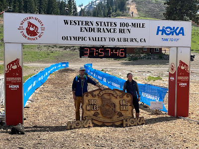
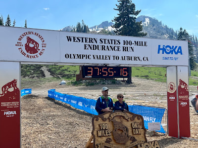
When I arrived at the final track, we ran around it together soaking it all in, and just before the finish....Deb pulled away off the course. I crossed the line in 27:04:56, almost 50 minutes faster than in 2017. I had made up an additional 25 minutes over the last 10 miles.
I walked over to the grass, promptly laid down, and took a well-deserved rest. Deb grabbed my drop bag, and I changed into more comfortable clothes. For the next few hours I cheered on additional finishers and watched as the last of the runners came in during the golden hour.

The finish....still feeling good.
Accepting my award
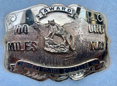
The "Prize" - the Western States Buckle
The biggest takeaway from my run this year is that I truly paced myself correctly. I knew that I had Hardrock coming in just a few weeks, so intentionally wanted to be conservative. Yet, I was still able to reach the finish almost 50 minutes faster than in 2017. Certainly some of this was due to the cooler temps, but I also think that by taking it a bit easier earlier on, I effectively "banked" some much needed energy for later in the race. I was able to keep moving well through the night, and into the second morning. I was able to have good conversations with Deb and not feel like absolute death over the last 20 miles. By Monday, just two days after the run, my legs already felt almost completely normal.
So now...I look ahead to the next tempest: The Hardrock 100. I look ahead with anticipation, but with an enormous amount of humility and respect. I know just how difficult Hardrock is, especially with tired legs. My mission these next two weeks is to go easy on myself, don't push things, and try to recover as much as possible.
....onward!