
Visiting Neel's Gap....7 years later.
I decided it was time to post something a little more whimsical as all of my entries as-of-late have been very heavy into the running/ultrarunning. An opportunity presented itself a few weeks ago for me to partake in a very abridged road-trip. My mom was making her Spring trip back North from Florida, but had one too many cars to deal with. I volunteered to fly one-way down to Orlando with my other-half for a quick visit, and then drive the car back for my mom....allowing her to leave a few days later and the car would already be in NY waiting for her when she arrived. I figured it would be a fun way to drive up the spine of the Appalachians, hitting a few fun quick stops along the way.
Those of you that have read along in the past know that I am still pretty keen on road-trips, especially if those trips allow me to hit up new "unvisited" States. Unfortunately when it comes to this aspect of my travel, I am somewhat limited as I have already now visited 49 of the 50 states and North Dakota would not be anywhere near my driving route this time around. The good news is just as I have a secret love for visiting all of the States, I also have a love of hitting State High Points of which I've accrued 17 now. With the tentative route we had planned, I knew it would give us the opportunity to hit a few new high points as well as a few other fun spots of interest along the way. In all honesty though, I was truly hoping to wing it. We only had 3 days for this trip, so any visits had to be quick and we wanted as much spontaneity as possible.
First stop: NEEL's GAP
7 years ago, almost to the day, I made my way into the famous Neel's Gap store after my first 31 miles on the Appalachian Trail. It was there that I first laid eyes on the wall map of the entire AT, and knew just how much further I had to go. Having pushed out a solid 31, I quickly realized that it was barely 1% of the trail. You could say that Neel's Gap is where reality first set in. I've often wondered what it would be like to go back there...back to a place that represents a setting so early in my hiking infancy. Spend a day re-remembering what it was like to be a nascent thru-hiker. It was literally only the night before I hiked into Neel's Gap, while camped at Slaughter Creek roughly 23 miles into my thru-hike, that I had decided on the trailname that would still be with me now 7 years later. I have often laughed when thinking back to how much I thought I knew at that point, and how little I actually did. It truly seems like a different lifetime ago. And yet, here on this road trip I knew I'd be driving right by again, AND that there'd likely be thru-hikers there. I had to stop. It didn't disappoint....
As I got out of the car and walked around, all the memories came rushing back as if I had just been there yesterday. I can remember where I sat down to adjust my shoelaces, where'd I'd talked to other hikers, and even where I ate my first pint of ice cream. One thing I didn't remember though was signing my first log book. Half out of jest, I decided to poke through the logs and see if I could find the 2007 book. After some digging I pulled it out almost 100% sure I wouldn't find my name. Looks like I would have lost that bet...

Neel's Gap...The first true oasis on the AT

Just like old times

Finding my name from 7 years prior in the log-book.

I even walked up the trail a bit for old time's sake

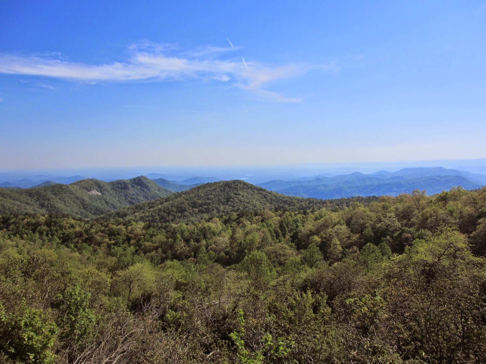
Some beautiful Georgia AT
Next Up: Brasstown Bald
I left Neel's Gap with a big smile and we happily drove further up the road to visit Brasstown Bald...Georgia's highest point. The Appalachian Trail doesn't actually take you over the mountain and I had never been back to that area of North Georgia to knock out the highpoint since. Here was my chance. Brasstown Bald is easily accessible by car. A quick drive up the approach road leaves you at the visitor store about 1/2 mile from the summit (which is accessed by a very nice paved walking path). At the top is a beautiful lookout tower that you can climb, which provides incredible views of the surrounding North Georgia and Carolina mountains. We had a perfect day for it to.
I got permission from a Park Ranger to get a photo at the physical USGS benchmark which is actually located behind a locked door. I was quite grateful for this as touching the USGS benchmark on a highpoint is the way I personally mark my summits (I know it's a bit OCD, but it always gives me something fun to look for on summits....if there is an actual benchmark of course).

Brasstown's first marker (4784')

Atop the lookout tower on Brasstown Bald

At the actual USGS highpoint benchmark behind a locked door
Next Up: Sassafras Mt.
After leaving Brasstown, there was still plenty of day left to make a quick hop over to South Carolina's highpoint - Sassafras Mountain (Which sits right on the border between North and South Carolina). The drive over and up to approach road was very quiet and when we started the drive up the mountain, we were in fact the only car on the road....and in the eventual gravel parking area near the top. We spent over an hour playing around the summit, hiking some nearby trails, and taking pictures of the many vistas before tagging the summit and heading out. It was a magnificent evening.

Back in the SC

Cooling off in the Chattooga River on the border between GA and SC

Perfect evening atop Sassafras (3553')
View from the near the summit

The official USGS Summit Marker
Next Up: Mt. Mitchell
After leaving, there was still enough time in the day to make our way through the fun/hip town of Asheville, North Carolina and hopefully catch the summit of Mt. Mitchell (North Carolina's high point, and the highest point East of the Mississippi) just in time for sunset...it would be close though. After playing around Asheville for an hour and getting some spectacular Japanese food to go, we bolted towards Mitchell. The access road is long, and has a fairly low speed limit and it ended up taking much longer than expected to the summit. The sun was slowly setting off on the horizon, and the summit was still a few miles off. When we hit the parking area, we were the only car in it. We jumped out of the car and ran up the access path to the observation deck and literally caught the last 30 seconds of the sun setting. It was perfect timing. After some pictures, we ate our dinners and drove on ahead for another hour so as to set ourselves up for a morning hike up Mt. Rogers (Virginia).


After leaving, there was still enough time in the day to make our way through the fun/hip town of Asheville, North Carolina and hopefully catch the summit of Mt. Mitchell (North Carolina's high point, and the highest point East of the Mississippi) just in time for sunset...it would be close though. After playing around Asheville for an hour and getting some spectacular Japanese food to go, we bolted towards Mitchell. The access road is long, and has a fairly low speed limit and it ended up taking much longer than expected to the summit. The sun was slowly setting off on the horizon, and the summit was still a few miles off. When we hit the parking area, we were the only car in it. We jumped out of the car and ran up the access path to the observation deck and literally caught the last 30 seconds of the sun setting. It was perfect timing. After some pictures, we ate our dinners and drove on ahead for another hour so as to set ourselves up for a morning hike up Mt. Rogers (Virginia).
Moments after the sun finished setting on Mt. Mitchell
Summit Marker (6684')
Panorama taken from the observation platform
For this brief moment, every person East of the Mississippi was below me!
The sign and observation platform at sunset
The Mt. Mitchell Parking lot...with our car the only vehicle.
We had the entire mountain to ourselves
Next Up: Mt. Rogers
As we left, we made our way up towards the Virginia border. While hiking the AT back in '07, the trail took me over Mt. Rogers, but never up to the summit. I'm not sure why at the time I didn't make the 2 mile side-trip to the top, but needless to say, I had yet to truly summit Rogers. Unfortunately there's no easy access, and the shortest hiking route requires an 8-mile roundtrip hike. We figured if we set ourselves up for an early start, we could be back down by lunch and on our way Northward to NY. We arrived at the Massie trailhead the following morning, again the only car there, and had a wonderful hike up to the summit. We enjoyed perfect blue skies, idyllic scenery, and the bucolic Grayson Highlands. We saw many wild horses roaming the highlands and enjoyed the only Frasier Fir forest still standing East of the Mississippi near the Roger's summit. At the top, again all alone, we took a long break at the marker (which was all tree-covered), and then headed back to the car. Most of the trip was on the AT so I got to reminisce a bit...even passing one of the Shelters that I had slept in while on my thru-hike. Good stuff!
On the climb up to Mt. Rogers
Some cattle roaming the highlands
Part of the trail goes through this slot
Wild ponies!
More wild ponies!
Mt. Rogers Summit
Last Stop: Skyline Drive / Shenandoah
Once back at the car we began the long drive up the spine of Virginia en route to PA and eventually NY. We decided on one last detour however when we made it to Waynseboro. With plenty of daylight left, we decided to drive the 107 miles of Skyline Drive through the Shenandoah's. There was almost no traffic and we made great time winding along the spine of the beautiful north VA mountains. We even stopped at many of the scenic vistas, AT crossings, and at a Wayside for Blackberry ice cream. It was a lot of fun and quite scenic. I was truly surprised at how few people we saw in total, not just on the drive, but on all the peaks and trails we visited over the course of the 3 days. It was a great mini road trip that really allowed us both to unwind and destress...even if for only a couple days.

A quick visit to "Foam-henge" along I-81 in Virginia
(A foam replica of stonehenge)

Skyline Drive

View from one of the many vistas

And of course another high point!
That's it. I thought I'd keep this post simple and to-the-point. Make sure to keep getting out there and enjoying this wonderful world any way you can.
hike on my friends,
-j
1 comment:
Nice post. I enjoyed reading this as I'm thinking about doing a thru hike.
Post a Comment