
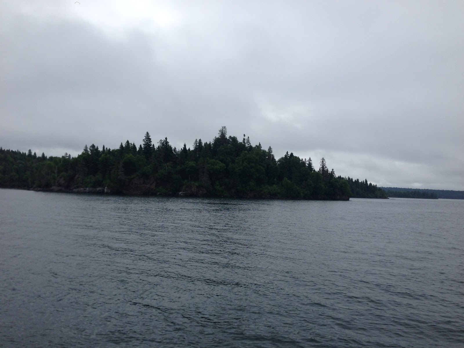
Canoeing near Isle Royale in Lake Superior
On somewhat of a whim, I decided that when my time was up in Colorado, rather than hop on my scheduled flight home, that I would instead drive my rental car all the way back to Boston. I still have a hidden passion for road trips, and I essentially had figured it would really only take me a "long weekend" to pull it off. I spent a few days trying to decide on what route I would take, but knew that I wanted to see parts of the country I hadn't yet seen...as well as maybe try to hit a few more fun (and perhaps goofy) geographical oddities along the way.
In the end, I decided upon a route that would take me through Minnesota and the Upper Peninsula of Michigan, before cutting across Canada and heading back through NY to Boston. I toyed around with taking a more southerly route, but by going the "northern route", I would be able see Lake Superior, and possibly hit a few more high points too. It's important to note however, that most of my route was decided during the drive and not beforehand...and that I only really settled on the "northern route" whilst sitting in my car somewhere in Iowa.
In the end it was definitely a satisfying road trip, however it was way too many hours sitting on my butt in a car. I probably should have budgeted for a couple more days so that I wouldn't be doing so many miles per day, but I also really wanted to get home too. It was a delicate balance of trying to enjoy a fun road trip and see new places, but also not spend too much time so that I could still get home with several days to relax and catch up on work before starting back at my job on Monday.
My route basically took me Northeast up to Lake Superior, and then in a generally Eastward direction back home. I drove 3100 miles total and spent 4.5 days in the car. Other than a half-day excursion to Isle Royale, and a few brief stops along the way, most of my time was in fact in the car. Still, I was able to knock out 4 more high points, see a few unique and remote places, and visit some spots I've been curious about since I was a little kid. So, here is the quick rundown of my trip...

My route home
CO/KS/NE Tri-State Point:
First stop along the way was the Colorado/Kansas/Nebraska tri-state point. Someone at the lab had told me that it was a unique tri-state point in that there were actually two separate monuments...and that it was relatively accessible by car. Seeing as though it was somewhat "along the way", I figured it would make a good first stop on my epic journey. I had no issues getting to the point, and when I did pull my car up to the monument, sure enough, there was a secondary monument a few hundred meters down the fence-line that marked a previously surveyed point. Of course I visited both spots.
I particularly liked how the primary monument was completely boxed inside a tiny 10x10 fenced-enclosure. It was rather quaint...

The first leg of my trip out of Denver to the tri-state point

The small fenced-in enclosure that housed the USGS marker and the plaque

tri-state plaque

USGS Benchmark

USGS Benchmark

Secondary tri-state marker a few hundred meters from the modern
marker. My car is visible in the picture by the modern marker.
Geographical Centers:
I wrote rather extensively in the previous post about "Geographical Centers", and just how complicated the issue of their definitions can be. In Kansas alone, there are at least 4 separate Geographical centers for the US depending on your proper definition. Since my route would have me basically heading due East across Kansas, I figured it set me up for visiting as many of the centers as I could. My plan was to hit these specifically defined centers in this order:
- Centroid Calculated Geographical Center of the Contiguous US (lower 48): 39.8355 N, 99.0909 W (Agra, KS) This center is defined using a newer "Centroid" technique defined as being, " derived by minimizing the sum of squared great circle distances from all points of land in a state or country (including islands, but not coastal waters, following the earlier practice of the USGS). The geographic center of the contiguous United States, determined in this way, is at (39.8355 N, 99.0909 W); this is 5.3 miles from Agra, Kansas, 5.5 miles from Kensington, Kansas, and 29.5 great circle miles west of the longstanding designated center of Lebanon, KS. See here: https://en.wikipedia.org/wiki/Geographic_centers_of_the_United_States
- Classical Geographical Center of the Contiguous US (lower 48): 39°50′N 98°35′W, Outside Lebanon, KS. This is the officially-defined contiguous center about a mile north of Lebanon, KS. Technically here, there is a monument indicating the center, which lies about a half mile from the exact coordinates...which actually lie within a random adjacent cornfield.
- Meades Ranch: Geodetic Geographical Center of the Contiguous US: 39°13'26.71218" 98°32'31.74604. This is a rather unique "center" in that it's not really a geographical center per se, but rather the geodetic center as defined by the American Surveying and Engineering Assocication. There is a unique history to this special place. Jerry, whom I talked about in the previous post, wrote a great article about Meades Ranch which can be accessed here: http://www.amerisurv.com/PDF/TheAmericanSurveyor_Penry-MeadesRanch_June2015.pdf
The short story here with all of these plans, was that I was indeed successfully able to visit each of these unique places. I found myself several times literally walking into a random field and taking a picture with my GPS unit. Honestly, it was a bit silly as in several of these cases there really wasn't any indication of my "centerness" other than a beeping GPS unit telling me I was at the specific coordinates. Still, it was definitely satisfying to be standing at the exact spots as they are defined. Call me goofy, but I certainly got a kick out of it. Here are the pics from each adventure....

Route from the tri-state mark to the centroid-center outside Agra, KS

Zoomed-in view of the myriad corn fields...

An even closer view of the Centroid Center,
pinpointed right in someone's random field...

GPS Track showing my walk in from the car. I looked around for a farm house,
but didn't see any nearby. I figured a quick in-and-out hike for a photo wouldn't bother anyone. I saw no one and no cars in the 10 minutes it took me to hike out and back.

GPS coordinates just a few feet north of the exact spot:
39.8355 N, 99.0909 W

Picture at the exact spot: 39.8355 N, 99.0909 W

View from the Centroid Geographic Center of the Contiguous US
(not very exciting....)
I scampered back to my car and headed about 20 miles East to Lebanon to get some photos at the Classically-defined Geographic Center.

Route from Centroid Center to Lebanon KS

Approaching Lebanon, signage starts to appear indicating the significance

Geographical Center Park

At the Center Park, there is copious signage indicating the significance.

Small pavilion and chapel at the park

More signage...

Official obelisk marking the center

At the obelisk....

Close up of plaque on obelisk
To any normal person, a visit to the observed monument would suffice. Of course for me, I needed to see if I could get to the actual coordinates. It was only about 1/2 mile away, and just across the field nearby, so why not try...no? Here is a quick map for reference...

Map of true center vs monument
I ended up just walking down the dirt road, and then following along between the edge of head-high corn and a small cluster of trees for a few hundred meters. Then at the very end, I hiked about 50 meters into the corn itself until my GPS told me I was at the exact coordinates: 39°50′N 98°35′W.

My GPS Track of my hike over to the actual center
39°50′N 98°35′W

Hiking along the corn to the exact center

My GPS beeped indicating I was there!

Right in the middle of head-high corn...

View from the true geographic center of the contiguous US
(not too exciting....)

Here was my phone GPS dot recorded at the Center
Last but most definitely not least, I made my way about 50 miles south in order to visit the Geodetic Center at Meades Ranch. It was getting late and I knew if I didn't hurry it would start getting dark before I could get up from the road. Thankfully, I made it there quickly and was able to get up to the marker and back down to my car before dusk set in. The hike up was through some open ranch land, and I did not see anyone during my entire hike that I could talk to about my plans. At the top, the benchmark was literally marked with a small orange stake and a concrete dome in the ground. It was all very anti-climactic, but still very satisfying. Again, I just made sure to be really quick and not disturb anything or anyone. I made it up to the marker in about 10 minutes, took a few pics, and then hurriedly scampered back down. No harm done.

Road route down to Meades Ranch from Lebanon, KS

Historical signage near the marker

My hiking GPS route up to the marker from the road...

Nearing the marker...

At the top, the benchmark was marked with single orange survey marker
(you can see a 2nd reference benchmark in the foreground)

You can just make out the concrete marker and primary USGS Benchmark
to the left of the survey marker under the overgrown grass

At the Marker along with some fresh cow patties

With signage and GPS readout

Sunset at the Geodetic Center of the US

My GPS point at the marker

Panorama at the Geodetic Center

Hiking back to car after visiting the center,
and ready to head on to my next adventure...
Of course all of these "Center" visits leaves out probably the most imporant: The Center of North America. Unfortunately, because of its location in North-Central North Dakota (near Rugby), it would have to wait until another trip. For me, I was happy to move on to my next point of interest....the Iowa High Point.
Iowa's High Point (Hawkeye Point)...and the IA/SD/MN Tri-State Point:
As I began my long drive towards Northern Iowa, something completely unexpected occurred...and rather serendipitously I might add. As I was nearing Omaha Nebraska, I realized I needed to pop off for a gas fill up. As I exited the highway, I somehow got caught in a weird loop of exit ramps. I punched up "Gas" in google maps, and it was leading me to a small station in "Carter Lake" back across the river. As I excited exited the highway from the Eastern Side of the river (The Iowa side), I saw the sign welcoming me back into Nebraska. But then, as I drove down the road, I noticed another sign re-welcoming me back in Iowa!? What the heck? I kind of felt like maybe I had entered some weird geographer's twilight zone...but then I googled Carter Lake. Turns out, and completely by accident, I had stumbled up on an honest-to-God exclave of Iowa. Years ago, one of the Missouri River's meander bends had cut off forming an oxbow lake. This cut-off occurred after the border of Iowa and Nebraska had already been established though. This thereby left the small town of Carter Lake Iowa separated from the rest of the state. Somehow, on my road trip of geographical oddities, I had stumbled across this little gem completely by accident! How did I not know about this place!? At any rate, I gleefully filled my gas up in the tiny exclave of Carter Lake, and even saved the receipt as evidence. Then...I finally pushed on for a hotel in Sioux City.


A screen grab of my route right after I noticed the welcome to Iowa Sign.
...and a screen grab of my dot at the gas station.

Here is a blow up of the Iowa Exclave known as Carter Lake

Welcome Sign

My gas receipt from Carter Lake IA
Moving on....
The next morning I left Sioux City at the crack of dawn and as I drove north towards Hawkeye Point, I noticed that the tri-state point for SD/MN/IA was only a few miles West. I made the short detour amidst some horrific thunderstorms and tagged the marker before finally heading to the high point.

SD/MN/IA Tri-State Point

The USGS Benchmark...which someone had filed down

Tri-State Marker

A quick picture before the rains and lightning opened up
A short 40 minute drive East and I was finally at my first high point of the trip. Number 29 of 50 for me. This point was one of the easier ones to deal with and literally can be driven right up to. The monument is essentially on private property, but the owners allow visitors to enjoy it any time (although they do request that you visit in the day light hours). I drove up quickly, spent about 30 minutes just relaxing at the point, taking several pictures, and then continued on. I was at a critical decision point in my journey. From Hawkeye Point, I could head East, catching 80/90 and bee-lining it for Boston. Instead, I decided to continue North and stick with my plan to see the Northern parts of Minnesota and Michigan that I had never seen (and tag a few more high points!).

Route from the Geodetic Center to Hawkeye Point, IA

Signage as you drive into the high point area

Really nice welcoming Rock at the point.

Full view of the high point

At the marker ( 1670 feet elevation)

The secondary Marker. There was no official USGS benchmark that I could find.

View from up on the Observation Deck overlooking the point
I left Hawkeye Point and headed North towards Minneapolis and into the heart of a torrential storm. Getting to the city was a bit surreal. I had been spending hours driving across very open country roads with almost no traffic, and suddenly I found myself in the heart of Minneapolis, during a bad storm. Traffic was insane. I had no idea Minneapolis was so large, but I was stuck in bumper-to-bumper traffic for a few hours before I got north of the city. My goal for the night was to make it somewhere up along the shores of Lake Superior. I had decided at some point along my drive that not only would I try to hike Eagle Mountain (MN's high point), but that I wanted to stay the night somewhere along the coast, to possibly set myself up for a quick trip over to Isle Royale. I hadn't really thought about Isle Royale along my drive, but when I saw how close it would be to Eagle Mountain, and knowing that I'd always wanted to visit it, I decided it was at least worth investigating. I knew that after hiking Eagle Mountain, it would be near dusk anyway, and time to find a cheap motel or campground for the night too.
Eagle Mountain (MN High Point) and a Grand Marais Sunset:
I made it up to Duluth around 3 PM and pushed onward towards the MN high point. I had a lovely drive along the beautiful coast of Lake Superior for over an hour before turning up a 26-mile long dirt road to the Eagle Mtn. Trailhead. I started the Hike around 5:30 Central Time and moved fairly quickly. It was a rugged trail with lots of rocks, but more importantly.....LOTS OF MOSQUITOS. Any time I tried to stop for photos, I was instantly attacked by swarms of the little blood suckers. Thankfully I had some DEET on, but it didn't really seem to matter. These were the worst mosquitos I've experienced since I was hiking in Oregon on the PCT. I had some trouble actually finding the marked summit, as the trail became a little vague on the top of the mountain. I couldn't remember if there was any sort of plaque or not, but thankfully I found it and was able to get back down to my car before it got dark. Here was my hike track: https://www.strava.com/activities/651271017. After the 7-mile round-trip hike (which took just under 2 hours), I drove back down to Grand Marais, and stayed in small motel by the water. It was quite lovely. I even took a hike out to the rock pier and enjoyed the beautiful sunset before calling it a day....

Welcome to MN

Driving route north from Duluth

Heading down the 26-mile dirt road to the Eagle Mtn trailhead.

Signage at Trailhead showing the 7-mile route (round trip)

Trailhead for Eagle Mtn

Beautiful Whale Lake MN (at mile 3 of trail)

The trail splits just before the final 300' climb up to the summit

View from near the summit

Is this the summit rock?

Am I at the summit? maybe?

Yay! Found it! (just around the corner from previous photo)
In this photo, I'm getting swarmed by skeeters.

Benchmark (2301 feet)

Eagle Mountain, MN: 2301'
It's always nice to see a plaque that highlights geology!

Hiking track


Screencap from the summit (surprised my phone's GPS still worked)

Remote view of Zoo and Shrike Lakes from the summit

Back in Grand Marais, I enjoyed a lovely sunset on the Lake

View from the pier

On concrete jetty extending from the rock pier,
admiring the orange sky

The view North to the adjacent lighthouse


My vantage point during the sunset....
Isle Royale National Park and some Canoeing:
After my incredibly successful and fun-filled day in Minnesota, I awoke the next morning with a mission: To try and get over to Isle Royale for a short day visit. I made the 35-minute drive up to Grant Portage (just south of the Canadian Border) and then through the National Monument there (I had no idea it even existed), until I found myself at the boat dock for Isle Royale. A quick payment later and I was signed up for a 6 hour visit to the island. Perfect! Just enough to explore a little and maybe see a moose or two. Incidentally, Isle Royale is THE least-visited National Park in the entire contiguous United States. The only National Parks in the US system that see fewer visitors are Gates of the Arctic park in Alaska, and the National Park on American Samoa (Isle Royale is 57 of 59). (http://www.pleacher.com/np/visits/visitors.html)
The ferry ride over was eerily spooky. The fog was thick and we couldn't see but 20 feet off of our bow. I felt like I was ferrying into Stephen King's "The Mist".
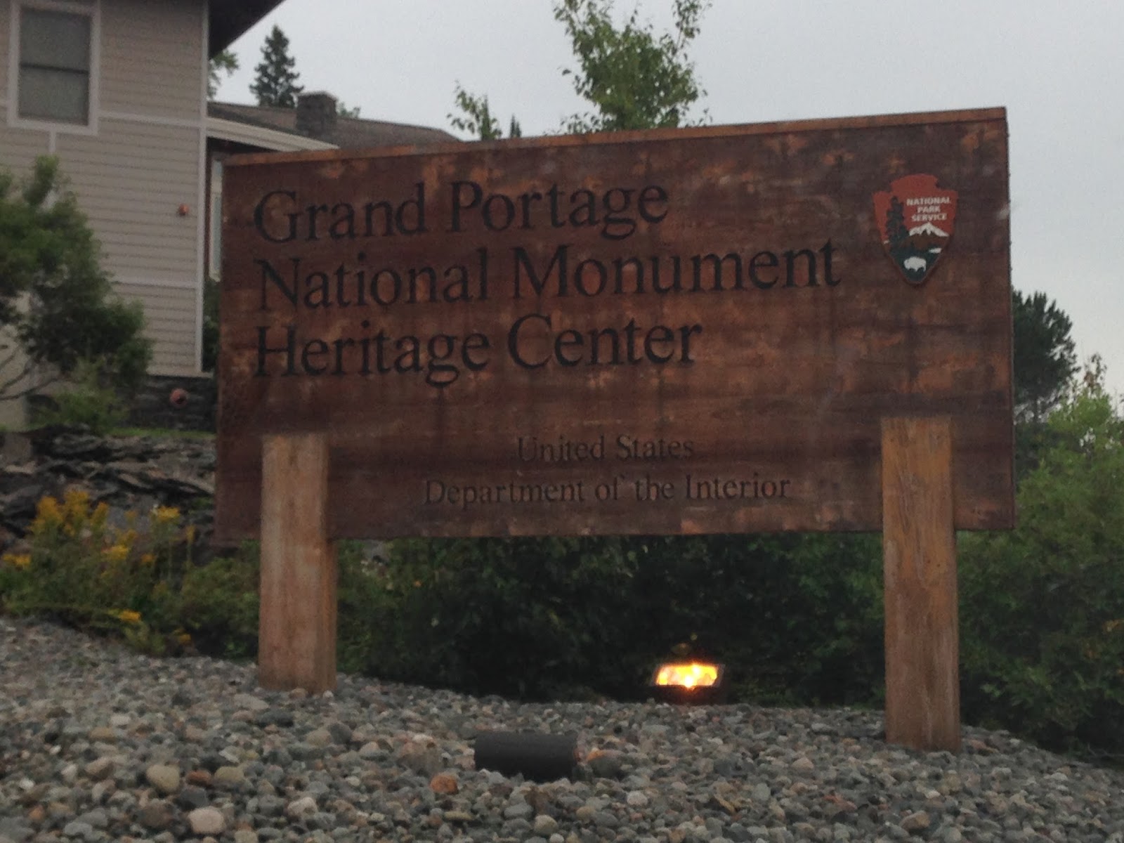
Grand Portage NM

My transportation over to Isle Royale

Early Morning fog

A lovely daisy near the boat dock

And we're off....

A quick stop to see the "Witch Tree". This tree is several hundred years old
and has had major significance to the local natives for centuries.
See here: https://en.wikipedia.org/wiki/Witch_Tree

More fog as we crossed the MN/MI border...

MN/MI maritime border within Lake Superior

Nothing but spooky grey
As we approached Isle Royale, the captain of our ferry took us on a short detour to show us the sunken remains of the SS America. This ship was a passenger/cargo vessel that was active around the turn of the 20th century. In 1928, it hit a small reef as it was leaving the harbor and ran aground. It eventually sank completely, but there were no fatalities. The wreck still sits at the bottom of the harbor today and can be seen just below the surface. More information can be found here:
Approaching the SS America Wreck

Site of the SS America on google maps

You can actually see the hull below the surface in google maps
We arrived at the Windigo Visitor's center, got a brief orientation, and then were let loose to do whatever. I considered taking a several hour hike out of the center to explore the deep woods and isolation of Isle Royale (and maybe see some moose), but instead had a different, and rather unorthodox idea. I decided to rent a Canoe and paddle my way out to the small island in the harbor (Beaver Island). I saw on a map that there was an established camp there, and thought it'd be a neat place to see. Plus, I hadn't canoed since I was I a freshman in college....so what the hell right?

Welcome to THE LEAST-visited National Park in the lower 48

Canoeing out into the harbor. Thankfully the waves were mild.

The fog/mist was still all around, making my canoeing trip even more memorable

Docked at Beaver Island

Signage on the island.
When I got out to the island, I walked around on it and realized quickly that I was the only soul on the entire island. It was a bit surreal and was certainly one of the most remote places I had ever been. It honestly felt like I was the only person on Earth (particularly with the fog too).

View from the boat dock

One of the camping shelters on the island
There wasn't much to do on the island, as there were only 4 camping shelters and a few short trails connecting them, so I decided to improvise and bushwack my way up to the high point of the island. Topographically, there is a distinct high point on Beaver Island, so I thought why not check out the view up there. The hike went very quickly and once on the top, I felt even more alone. I savored it for a bit, and then hiked back down to my Canoe to continue on.

Beaver Island (with Windigo visitors center over to the right)
Video from Beaver Island

View form the top of Beaver Island
Video from top of Beaver Island (after hike)


My weak GPS dot while on Beaver Islands high point...

My hiking route on the island...
After my little hike around the island, I thought about what else I could do with the 45 minutes I still had the canoe for. I looked quickly at the map and noticed something that piqued my interest. Off the coast of Beaver Island, I noticed a small rock, just poking it's head up through the water. Well obviously, I had to go investigate. Turns out, the Park Rangers have a name for this rock, "Jesus Rock". So dubbed, because often the water in the harbor is just high enough to submerge the rock, and many boats will hit it...declaring "Jesus!". Thus, it's eponymous name.
Well...I made it out to the rock, despite the winds picking up and the canoe getting a bit tipsy. I parked for about 15 minutes on the rock, got out and ate lunch on it...and then quickly paddled back to the visitors center. It was a cool little side trip to a remote patch of rock.

What is this rock over here?

Parked along side the "Jesus" Rock.

Resting for a short lunch break on the rock.
(looking back at Beaver island and its high point)
After getting back to Windigo, I took a short hike over to the Washington Creek Campground, spent a little time in the visitors center, and then sat in on a Park Ranger's talk on how the island became a National Park. And then....at about 2 pm, I hopped back on the boat, and headed back to Minnesota. Other than a quick border visit to Michigan back in 2012, visiting Isle Royale was really the first thing I have ever done in Michigan. Sort of a weird place to start I guess.

My Isle Royale Adventure!
(Red : Canoe, Yellow : Island hike, Purple : Windigo Hike)

Model replica of the SS America wreck

Leaving the Isle Royale, the sun came out, and the winds picked up.
(pictured: Salt Island, Isle Royale NP)
Timms Hill, Wisconsin:
Leaving Isle Royale, I was starting to think about how to get home as quickly as possible, while still hitting a few more fun little side trips. I knew I wanted to skirt along the upper peninsula of Michigan, but wasn't sure what I might be able to hit along the way. It took me several hours to get back to Duluth after the ferry ride before I could finally enter Wisconsin and start making plans. By this point it was also after 6 pm. After a quick glance at a map, I decided it was worth the 2 hour detour to swing down and hit Timm's Hill (WI high point) before heading up to the Upper Peninsula. I drove as quickly as legally possible, and managed to eek myself into Timm's Hill County Park right at sunset. Technically, the signage indicated the park closed after dark, but all the gates were open, and I wasn't going to camp in my car overnight to wait. The hike up from the car park is only about a 1/3 of a mile and took about 5 minutes. At the summit is a newly-built observation tower that you can easily climb for the views. Next to this tower is an even taller fire tower that is much older and much more sketchy to climb. The ladder to ascend that tower is a vertical ladder that goes up probably 10 stories and does not look entirely safe. Seeing as though the benchmark on the ground marks the highest "natural elevation", I was fine with tagging the mark, climbing the newer tower, and moving on. I was up on the summit taking the obligatory photos, tagging the benchmark, and heading on to my next point of interest all within a matter of minutes.: Mt. Arvon.

Route to Timm's Hill from the Duluth area.

Signage at the trailhead

Highpointers club mailbox near the summit

Signage on the observation tower

Timm's Hill Summit Benchmark (1951.5 feet)

A quick nighttime visit to Wisconsin's high point

The older fire tower
(The vertical ladder climbs the left side)

Summit photo!
Summit Video!

GPS tag at Summit
Mt. Arvon and the Upper Peninsula:
It was now sufficiently late, but I decided to push on and see if I could get up near the Michigan high point before the wee hours of the morning. Then, I figured I would just sleep in my car or camp somewhere. This is where my failure to read up on the conditions surrounding a high point came back to bite me in a big way. I knew from a cursory glance on highpointers and summitpost, that Mt. Arvon (the MI highpoint) was somewhat remote and required some navigating down old logging roads. What I didn't realize was just HOW remote it was, and how some of those roads are less-than-ideal for a low clearance rental car. Here is an exact quote taken from summitpost's website (http://www.summitpost.org/mount-arvon/151786):
"Not long ago Mt. Arvon had the reputation of being one of the most diffucult state highpoints to reach. Not due to a technical climb but due to remoteness and the maze of logging roads in the area. In the past few years however many improvements have been made. The road is now well-graded and numerous blue signs along the way help keep you on the right track on your way up. The road still is steep and rocky in a few sections, mainly within the last 2 miles, but can be driven with care by most vehicles (I wouldn't recommend taking your new Caddie or BMW up it, however!!)."
Here is an additional quote from someone who recently visited the summit which can be found in the comments section of the summitpost link:
"My wife and I drove to Mount Arvon this weekend (6/5/16). The directions from Summitpost.com were perfect! It is very well marked with those great blue signs. However, at the very last turn the road had washed out. A beaver dam that abuts the road had overflowed and the road has large ruts in it. I do a lot of off-roading, and I would not attempt this wash-out except in a serious, high-clearance 4WD vehicle. The wash-out is approximately 1 mile from the summit. The road is not steep and is very obvious. It is a lovely(!) walk and well worth it. So don't turn around at the wash-out. Park your vehicle and do this wonderful walk."
Well, let's just say, it was a ridiculous adventure getting to the summit. I finally found a place where my phone GPS would not update, but thankfully had my handheld Garmin unit to record my track. Just getting to the dirt roads took some effort and was very far out of the way. By the time I was even starting down the more primitive dirt roads 20 miles from the summit, it was already well past midnight. I drove for hours without seeing a single other car. The upper peninsula of Michigan is remote....and driving around on its remote roads in the middle of the night really gives you a taste of that remoteness. It was eerie. I had no idea hitting Mt. Arvon would be such a ridiculous undertaking, but once I made it to the dirt roads, I started to learn really fast what I was in for.

Route from Timm's Hill up to Mt. Arvon

Zoomed-in view of the dirt roads once you leave L'anse and Skanee
The dirt roads slowly ramp up in difficulty and primitiveness. The first few miles you cruise along at 30 mph kicking up gravel. Then for about 5-10 miles you make your way down true forest roads. These roads are totally navigable in a passenger car, but there are definitely a few spots were you are on dual track road with a few small washouts and rocks you need to work around. None of this was enough to get my nerves going though.
...But then you hit the last few miles and it all gets crazy. There had been recent rains in Michigan so the road got really loose, and there were many large ruts and washouts. It was painstakingly slow navigating around the obstacles in my little toyota camry but I was making progress. I turned a corner about a mile from where the road was supposed to end and was faced with a steep climb on very loose ground. I punched it and did make it up, but it was not pretty. At the top, I deciced that I would find a place to park and hoof the last bit by foot. I didn't want an incident with the rental car, especially considering if I were to get a flat or have trouble, it could be hours before I'd get any help. Up ahead I saw a small pull off and was ready to park when I noticed that it was actually the parking area for the trailhead. I had made it to the end in one piece....thank God. I got out, admired the stars for several long minutes, took in my remote setting, and walked the 250 feet down the small feeder trail to the summit clearing. For the amount of effort it took to drive to the trailhead, it had to be one of the most disappointing hikes to a summit ever. I literally rounded a single bend in the trail and into my headlamp view came a small picnic table, mailbox and sign. I was already there....

My actual GPS track driving to the summit.

Highpointers club mailbox Register

Summit USGS Benchmark

Mt. Arvon : 1979.238 feet

Dedicated Highpointers plaque

At the summit

This is what the summit looks like during the day
(Photo from wikipedia, credit: Yinan Chen)
From this point, I thought I would have an uneventful trip around a few more dirt roads, and connect in with Highway 41 to the South. Well....it didn't quite work out that way. The way that Google had routed me was on roads that were actually 4-wheeler roads, and not even suitable for Jeeps. There was no way I was going to get all the way around the loop it was setting up for me, so was faced with the unpleasant reality that I had to go back the exact way I came in. Ugh. Over an hour later, I was finally back out on the main road up by Skanee, and would have to drive back south through L'Anse and Alberta, before finally connecting with route 41. The entire detour added over 2 hours to my drive, but I was very grateful that I was not stranded on some dual-track dirt road in the middle of the remote Michigan woods. Making it back down the primitive roads near the Mt. Arvon Summit was a little easier in the reverse direction, so I didn't have any real trouble getting out. I was relieved to be on solid pavement again. Soon after making it around on to Highway 41, I finally stopped at a pull off and slept for several hours. Turns out the back seat of my rental car could fold down and I was able to sleep fully extended on the cushion of the back seat (With my feet extending into the trunk space). It was surprisingly comfortable...


The route Google wanted me to go....that was simply not possible

Google's proposed route East...

Actual route that I took East...Ugh
Mackinac Island and the Final Leg Home:
I was finally on the last leg of my journey. I would head across the Upper Peninsula, down into central Michigan, and then across Canada towards Buffalo NY. From there, it would be a straight shot on I-90 all the way to Boston. I was done with new high points, and really couldn't think of anything else I'd stop to see. I grabbed an amazing cup of coffee in the college town of Marquette (Dead River Coffee Co - Highly recommended!), and began heading towards the Mackinac Bridge (where the UP meets the rest of Michigan).
As I neared Mackinac, I began to remember having long discussions about the island with my family years ago....about how there are no cars on the island, and everyone must either bike, or take horses. I figured it would probably be impossible for me to get over there, but that I'd at least check into it. I didn't want to spend more than a few hours on any detours, but it was on the way and worth investigating.
I arrived in the town of St. Ignace, just north of the bridge, inquired at a local spot, and sure enough, for 20 bucks, I could ferry over to Mackinac Island (pronounced MackinAW, not MackinAC btw...I know, it's weird). I bought a quick ticket, was on the next ferry just 10 minutes later, and after a short 15 minute ride, I was walking around on the island. I spent about 1 hour traipsing around in total. I hiked up to Ft. Holmes, which sits on the highest point of the island, took a few pictures, and hung out eating ice cream in town for a bit. Then, as if nothing happened, I headed back to the boat, zipped over and was back on the road all within 2 hours of first stopping my car. It was a much needed respite from the car, and I got to see one last place on my list of "places yet to see"...plus, in a sense, it allowed me to visit one more "high point". Good times.

My full route over on the ferry and including my hiking on the island
(here's the track: https://www.strava.com/activities/654208963)

People getting around town on Mackinac Island

Post office

Fort Holmes, the island's high point

One last "high point" of the trip.

My GPS dot at Ft. Holmes

My Ride back to the main land
...and that pretty much sums it up. A lot of unique places visited in a short 4 days. After getting back into Michigan, I was really starting to get homesick, so I essentially beelined it home. I zipped down through Michigan, cut over through Canada and into Buffalo, took another short sleep at a rest stop on I90, and then finished out the drive in Boston. I did not have my Passport, so was a bit nervous about going into Canada. Thankfully, I had my EDL drivers license and had no issues at all. Glad I got to test it out! The last 400 miles were really tough and I was desperate to get home, but the adventure up to that point was quite special. I was incredibly fortunate to be able to experience the wonderful places that I was able to visit (as quirky as most of them were), and will look back upon the trip fondly. This is one that I'll remember for quite some time.

My Final route home across Canada, and along I90 in NY and MA
I thought what better way to finish out this post, then with my trip map (again), and my current high point map:

Road Trip 2016 Route

State High Point Map (32 total)
that's it....
always keep exploring,
always keep adventuring,
-j
1 comment:
I found your blog via /r/BorderPorn and as someone who collects counties and highways and occasionally dips into highpoints, I'm loving it!
The Hurons around Mt. Arvon are definitely an area where you want to ask a local and not trust your GPS. I've attempted that southern route starting from US 41 and gotten lost. There is a more direct route from L'Anse (I've done it in a sedan) and an eastern route that spits you out near Big Bay north of Marquette. Neither is much of a time-saver, though.
If you ever find yourself in the Upper Peninsula again, Jacob Emerick's blog (https://blog.jacobemerick.com/) is a good resource, or at least an entertaining read.
Post a Comment